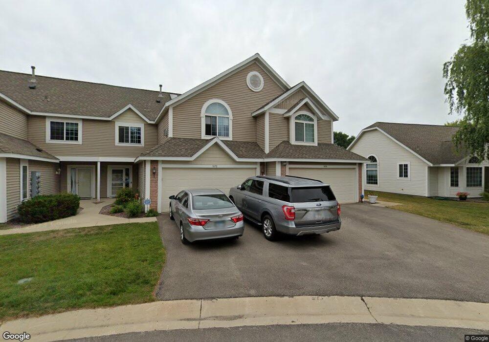
1878 Topaz Pointe Ln SW Rochester, MN 55902
Estimated Value: $281,000 - $353,000
2
Beds
2
Baths
1,565
Sq Ft
$203/Sq Ft
Est. Value
About This Home
This home is located at 1878 Topaz Pointe Ln SW, Rochester, MN 55902 and is currently estimated at $318,471, approximately $203 per square foot. 1878 Topaz Pointe Ln SW is a home located in Olmsted County with nearby schools including Bamber Valley Elementary School, John Adams Middle School, and Mayo Senior High School.
Ownership History
Date
Name
Owned For
Owner Type
Purchase Details
Closed on
Mar 26, 2014
Sold by
Kuhle Carol L
Bought by
Kuhle Carol L and Carol L Kuhle Revocable Trust
Current Estimated Value
Purchase Details
Closed on
Jun 27, 2011
Sold by
Aoun Paul
Bought by
Kuhle Carol L
Home Financials for this Owner
Home Financials are based on the most recent Mortgage that was taken out on this home.
Original Mortgage
$118,500
Interest Rate
4.56%
Mortgage Type
New Conventional
Purchase Details
Closed on
May 29, 2008
Sold by
Armour Dorothy A and Armour Revocable Liv Dorothy A
Bought by
Aoun Paul
Home Financials for this Owner
Home Financials are based on the most recent Mortgage that was taken out on this home.
Original Mortgage
$194,500
Interest Rate
6.09%
Mortgage Type
New Conventional
Purchase Details
Closed on
Feb 22, 2008
Sold by
Armour Dorothy A
Bought by
Liv Armour Dorothy A and Liv Dorothy A Armour Revocable
Create a Home Valuation Report for This Property
The Home Valuation Report is an in-depth analysis detailing your home's value as well as a comparison with similar homes in the area
Home Values in the Area
Average Home Value in this Area
Purchase History
| Date | Buyer | Sale Price | Title Company |
|---|---|---|---|
| Kuhle Carol L | -- | None Available | |
| Kuhle Carol L | $183,500 | Rochester Title | |
| Aoun Paul | $194,500 | Edina Realty Title Inc | |
| Liv Armour Dorothy A | -- | None Available |
Source: Public Records
Mortgage History
| Date | Status | Borrower | Loan Amount |
|---|---|---|---|
| Closed | Kuhle Carol L | $118,500 | |
| Previous Owner | Aoun Paul | $194,500 |
Source: Public Records
Tax History Compared to Growth
Tax History
| Year | Tax Paid | Tax Assessment Tax Assessment Total Assessment is a certain percentage of the fair market value that is determined by local assessors to be the total taxable value of land and additions on the property. | Land | Improvement |
|---|---|---|---|---|
| 2024 | $3,660 | $259,400 | $40,000 | $219,400 |
| 2023 | $3,240 | $257,300 | $40,000 | $217,300 |
| 2022 | $2,990 | $242,400 | $40,000 | $202,400 |
| 2021 | $2,724 | $217,400 | $40,000 | $177,400 |
| 2020 | $2,656 | $197,700 | $30,000 | $167,700 |
| 2019 | $2,606 | $184,900 | $30,000 | $154,900 |
| 2018 | $2,369 | $182,400 | $30,000 | $152,400 |
| 2017 | $2,326 | $173,100 | $23,600 | $149,500 |
| 2016 | $2,342 | $159,500 | $23,600 | $135,900 |
| 2015 | $2,226 | $157,000 | $23,600 | $133,400 |
| 2014 | $2,154 | $158,500 | $23,600 | $134,900 |
| 2012 | -- | $156,700 | $23,600 | $133,100 |
Source: Public Records
Map
Nearby Homes
- 1941 Waterford Place SW
- 3125 Glenwood Rd SW
- 2961 Glenwood Rd SW
- 3177 Glenwood Rd SW
- 1814 Mayowood Rd SW
- 1810 Mayowood Rd SW
- 1568 Salem Ct SW
- 1911 Greenfield Ln SW Unit E
- 2449 Salem Heights Ln SW
- 1747 Mayowood Rd SW
- 1704 Lakeview Dr SW
- 2114 Ponderosa Dr SW
- 2229 Ponderosa Dr SW
- 2236 Ponderosa Dr SW
- 3018 Mayowood Common Cir SW
- 2308 Baihly Hills Dr SW
- 1726 Mayowood Rd SW
- 1758 Mayowood Rd SW
- 1750 Mayowood Rd SW
- 1710 Mayowood Ct SW
- 1878 Topaz Point Ln SW
- 1876 Topaz Pointe Ln SW
- 1876 Topaz Point Ln SW
- 1902 Topaz Point Ln SW
- 1874 Topaz Pointe Ln SW
- 1874 Topaz Point Ln SW
- 1904 Topaz Point Ln SW
- 1872 Topaz Pointe Ln SW
- 1872 Topaz Point Ln SW
- 1910 Topaz Point Ln SW
- 1871 Topaz Point Ln SW
- 1873 Topaz Pointe Ln SW
- 1873 Topaz Point Ln SW
- 1932 Topaz Point Ln SW
- 1912 Topaz Point Ln SW
- 1875 Topaz Point Ln SW
- 1912 Topaz Pointe Ln SW
- 1875 Topaz Pointe Ln SW
- 1930 Topaz Point Ln SW
- 1930 Topaz Pointe Ln SW