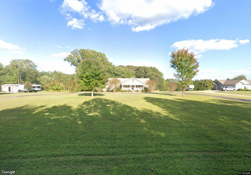
1878 Wayside Rd Stuart, VA 24171
Estimated Value: $276,000 - $347,000
Studio
--
Bath
--
Sq Ft
2.1
Acres
About This Home
This home is located at 1878 Wayside Rd, Stuart, VA 24171 and is currently estimated at $303,567. 1878 Wayside Rd is a home located in Patrick County with nearby schools including Patrick County High School.
Ownership History
Date
Name
Owned For
Owner Type
Purchase Details
Closed on
Aug 20, 2021
Sold by
Handy Rentals Inc
Bought by
Deese Bunny Llc
Current Estimated Value
Home Financials for this Owner
Home Financials are based on the most recent Mortgage that was taken out on this home.
Original Mortgage
$150,000
Outstanding Balance
$136,396
Interest Rate
2.9%
Mortgage Type
New Conventional
Estimated Equity
$167,171
Create a Home Valuation Report for This Property
The Home Valuation Report is an in-depth analysis detailing your home's value as well as a comparison with similar homes in the area
Purchase History
| Date | Buyer | Sale Price | Title Company |
|---|---|---|---|
| Deese Bunny Llc | $195,000 | None Listed On Document |
Source: Public Records
Mortgage History
| Date | Status | Borrower | Loan Amount |
|---|---|---|---|
| Open | Deese Bunny Llc | $150,000 |
Source: Public Records
Tax History
| Year | Tax Paid | Tax Assessment Tax Assessment Total Assessment is a certain percentage of the fair market value that is determined by local assessors to be the total taxable value of land and additions on the property. | Land | Improvement |
|---|---|---|---|---|
| 2025 | $1,351 | $185,000 | $19,000 | $166,000 |
| 2024 | $1,351 | $185,000 | $19,000 | $166,000 |
| 2023 | $1,351 | $185,000 | $19,000 | $166,000 |
| 2022 | $1,351 | $185,000 | $19,000 | $166,000 |
| 2021 | $1,258 | $185,000 | $19,000 | $166,000 |
| 2020 | $1,116 | $164,100 | $19,000 | $145,100 |
| 2019 | $1,116 | $164,100 | $19,000 | $145,100 |
| 2018 | $935 | $164,100 | $19,000 | $145,100 |
| 2017 | -- | $164,100 | $19,000 | $145,100 |
| 2016 | -- | $164,100 | $19,000 | $145,100 |
| 2015 | -- | $164,100 | $19,000 | $145,100 |
| 2014 | -- | $172,300 | $22,700 | $149,600 |
Source: Public Records
Map
Nearby Homes
- 367 Hazelwood Dr
- 1463 Wayside Rd
- 8153 Salem Hwy
- 3310 Creasey Chapel Rd
- 3374 Salem Hwy
- 174 Developmental Rd
- 0 Ashby Dr
- 107 Carters View Ct
- 2872 Salem Hwy
- 358 Twin Ford Loop
- 2351 Mountain View Loop
- 3865 Ayers Orchard Rd
- 22132 Jeb Stuart Hwy
- 610 Mayo Ct
- 201 W Blue Ridge St
- 133 Pine View St
- 281 Providence Dr
- 209 Pine St
- 130 Riverside Dr
- lot 31 Pine Knoll Farms Loop
- 1912 Wayside Rd
- 1834 Wayside Rd
- 1936 Wayside Rd
- 1952 Wayside Rd
- 1772 Wayside Rd
- 1776 Wayside Rd
- 1774 Wayside Rd
- 1988 Wayside Rd
- 1988 Wayside Rd
- 1988 Wayside Rd
- 1988 Wayside Rd
- 336 Wayside Park Rd
- 1722 Wayside Rd
- 1722 Wayside Rd
- 1721 Wayside Rd
- 2095 Wayside Rd
- 2095 Wayside Rd
- 2094 Wayside Rd
- 1630 Wayside Rd
- 2165 Wayside Rd
Your Personal Tour Guide
Ask me questions while you tour the home.