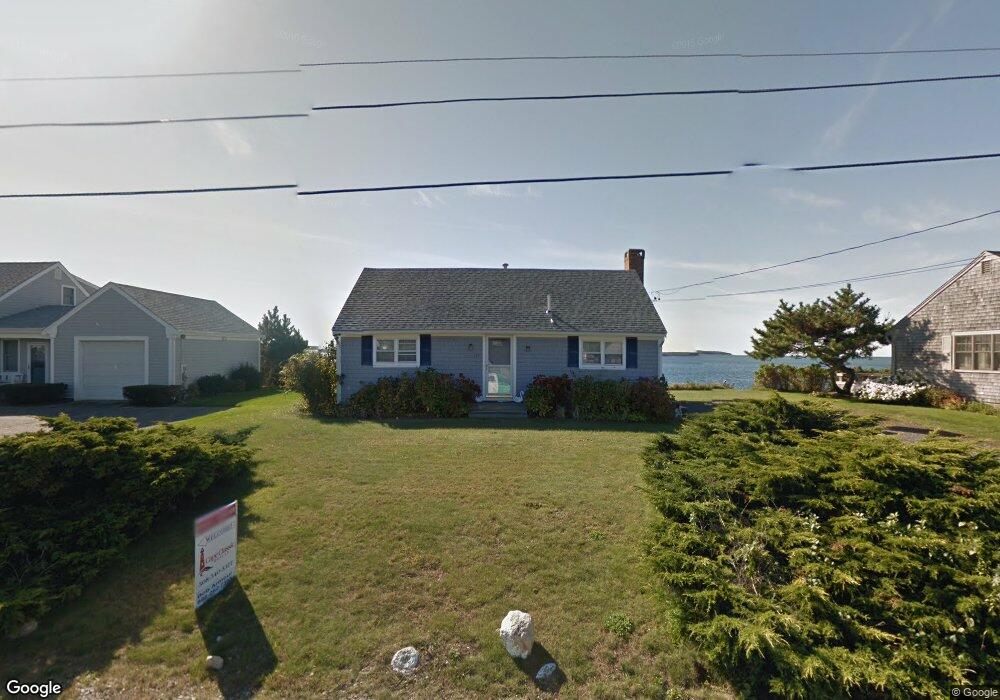
188 Captains Row Bourne, MA 2532
Estimated Value: $1,114,000 - $1,317,470
1
Bed
2
Baths
864
Sq Ft
$1,424/Sq Ft
Est. Value
About This Home
This home is located at 188 Captains Row, Bourne, MA 2532 and is currently estimated at $1,230,368, approximately $1,424 per square foot. 188 Captains Row is a home located in Barnstable County with nearby schools including Bourne High School.
Ownership History
Date
Name
Owned For
Owner Type
Purchase Details
Closed on
Jul 28, 2017
Sold by
Folan Francis M and Folan Kevin
Bought by
Santos Honorato M
Current Estimated Value
Home Financials for this Owner
Home Financials are based on the most recent Mortgage that was taken out on this home.
Original Mortgage
$300,000
Outstanding Balance
$243,217
Interest Rate
3.13%
Mortgage Type
New Conventional
Estimated Equity
$987,151
Create a Home Valuation Report for This Property
The Home Valuation Report is an in-depth analysis detailing your home's value as well as a comparison with similar homes in the area
Purchase History
| Date | Buyer | Sale Price | Title Company |
|---|---|---|---|
| Santos Honorato M | $600,000 | -- | |
| Santos Honorato M | $600,000 | -- |
Source: Public Records
Mortgage History
| Date | Status | Borrower | Loan Amount |
|---|---|---|---|
| Open | Santos Honorato M | $300,000 | |
| Closed | Santos Honorato M | $300,000 |
Source: Public Records
Tax History
| Year | Tax Paid | Tax Assessment Tax Assessment Total Assessment is a certain percentage of the fair market value that is determined by local assessors to be the total taxable value of land and additions on the property. | Land | Improvement |
|---|---|---|---|---|
| 2025 | $9,612 | $1,230,700 | $1,006,400 | $224,300 |
| 2024 | $9,168 | $1,143,100 | $958,400 | $184,700 |
| 2023 | $8,639 | $980,600 | $848,200 | $132,400 |
| 2022 | $8,551 | $847,500 | $750,600 | $96,900 |
| 2021 | $8,307 | $771,300 | $683,100 | $88,200 |
| 2020 | $3,070 | $760,100 | $676,600 | $83,500 |
| 2019 | $3,144 | $756,500 | $676,600 | $79,900 |
| 2018 | $2,920 | $716,800 | $644,500 | $72,300 |
| 2017 | $7,374 | $715,900 | $638,400 | $77,500 |
| 2016 | $7,500 | $738,200 | $673,800 | $64,400 |
| 2015 | $7,472 | $742,000 | $673,800 | $68,200 |
Source: Public Records
Map
Nearby Homes
- 566 Shore Rd
- 248 Great Neck Rd
- 14 Navajo Rd
- 35 Benedict Rd
- 254 Barlows Landing Rd
- 203 County Rd
- 200 Great Neck Rd
- 60 Bourne Neck Dr
- 709 County Rd
- 16 Michael Rd
- 36B Starboard Dr Unit 36E
- 36B Starboard Dr Unit 36G
- 36B Starboard Dr Unit 36C
- 36B Starboard Dr Unit 36A
- 36B Starboard Dr Unit 36D
- 36B Starboard Dr Unit 36B
- 36B Starboard Dr Unit 36F
- 36B Starboard Dr Unit 36H
- 23 Starboard Dr Unit Lot 50
- 3 Carleton St Unit 3
- 188 Captains Row
- 189-A Captains Row
- 189-B Captains Row
- 189A Captains Row
- 187 Captains Row
- 186 Captains Row
- 186 Captains Row
- 185 Captains Row
- 189B Captains Row
- 210 Clipper Rd
- 210 Clipper Rd
- 184 Captains Row
- 183 Clipper Rd
- 208 Clipper Rd
- 0 Leeward Rd Unit 71227280
- 153 Captains Row
- 153 Captains Row
- 182 Leeward Rd
- 181 Clipper Rd
- 206 Clipper Rd
Your Personal Tour Guide
Ask me questions while you tour the home.