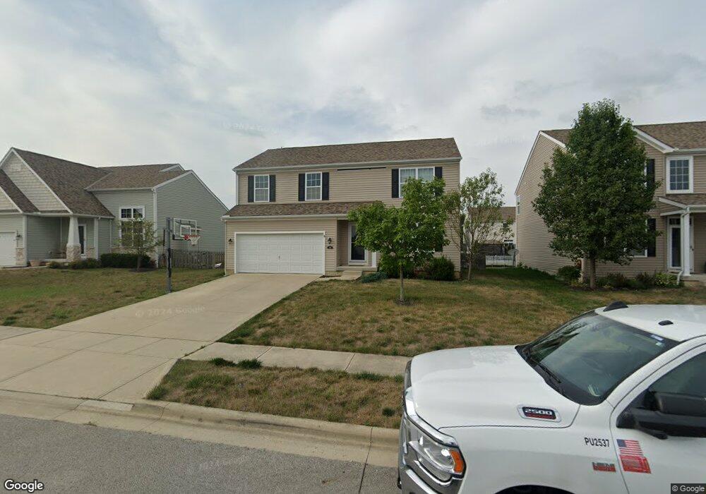
188 Honey Locust Ln Commercial Point, OH 43116
Estimated Value: $357,410 - $422,000
3
Beds
2
Baths
2,080
Sq Ft
$187/Sq Ft
Est. Value
About This Home
This home is located at 188 Honey Locust Ln, Commercial Point, OH 43116 and is currently estimated at $388,853, approximately $186 per square foot. 188 Honey Locust Ln is a home.
Ownership History
Date
Name
Owned For
Owner Type
Purchase Details
Closed on
Sep 3, 2025
Sold by
Maynard Michael D and Maynard Chelsea B
Bought by
Maynard Chelsea B
Current Estimated Value
Home Financials for this Owner
Home Financials are based on the most recent Mortgage that was taken out on this home.
Original Mortgage
$138,600
Outstanding Balance
$138,600
Interest Rate
6.72%
Mortgage Type
New Conventional
Estimated Equity
$250,253
Purchase Details
Closed on
Jun 27, 2014
Sold by
Westport Homes Inc
Bought by
Maynard Ii Michael D and Maynard Chelsea B
Home Financials for this Owner
Home Financials are based on the most recent Mortgage that was taken out on this home.
Original Mortgage
$189,617
Interest Rate
4.11%
Mortgage Type
New Conventional
Purchase Details
Closed on
Jan 28, 2014
Sold by
Saddlebrook Development Llc
Bought by
Westport Homes Inc
Create a Home Valuation Report for This Property
The Home Valuation Report is an in-depth analysis detailing your home's value as well as a comparison with similar homes in the area
Home Values in the Area
Average Home Value in this Area
Purchase History
| Date | Buyer | Sale Price | Title Company |
|---|---|---|---|
| Maynard Chelsea B | -- | Westcor Land Title | |
| Maynard Ii Michael D | $185,900 | Talon Title | |
| Westport Homes Inc | $124,000 | Talon Group |
Source: Public Records
Mortgage History
| Date | Status | Borrower | Loan Amount |
|---|---|---|---|
| Open | Maynard Chelsea B | $138,600 | |
| Previous Owner | Maynard Ii Michael D | $189,617 |
Source: Public Records
Tax History Compared to Growth
Tax History
| Year | Tax Paid | Tax Assessment Tax Assessment Total Assessment is a certain percentage of the fair market value that is determined by local assessors to be the total taxable value of land and additions on the property. | Land | Improvement |
|---|---|---|---|---|
| 2024 | -- | $105,730 | $12,570 | $93,160 |
| 2023 | $3,977 | $105,730 | $12,570 | $93,160 |
| 2022 | $3,426 | $83,680 | $10,480 | $73,200 |
| 2021 | $3,437 | $83,680 | $10,480 | $73,200 |
| 2020 | $3,437 | $83,680 | $10,480 | $73,200 |
| 2019 | $2,651 | $68,170 | $10,480 | $57,690 |
| 2018 | $2,657 | $68,170 | $10,480 | $57,690 |
| 2017 | $2,726 | $68,170 | $10,480 | $57,690 |
| 2016 | $2,418 | $60,330 | $8,000 | $52,330 |
| 2015 | $2,419 | $60,330 | $8,000 | $52,330 |
| 2014 | $265 | $6,410 | $6,410 | $0 |
Source: Public Records
Map
Nearby Homes
- 182 Honey Locust Ln
- 11044 Coontz Rd
- 161 Chestnut Estates Dr
- 186 Red Oak Ct
- 169 Chestnut Commons Dr
- 166 Rosewood Loop SE
- 7789 State Route 762
- 56 Chambers Bay Rd
- 294 Shady Hollow Dr
- 47 Front St
- 66 Genoa Cir
- 62 Genoa Cir
- 55 Genoa Cir
- The Siebert Plan at Genoa Crossing
- The Hollandia B Plan at Genoa Crossing
- The Rainier Plan at Genoa Crossing
- The Petoskey Plan at Genoa Crossing
- 310 Genoa Rd
- 45 Genoa Cir
- 428 Lockbay Rd
- 185 Honey Locust Ln
- 186 Honey Locust Ln
- 190 Honey Locust Ln Unit 197
- 183 Honey Locust Ln
- 187 Honey Locust Ln
- 189 Honey Locust Ln
- 192 Honey Locust Ln
- 184 Honey Locust Ln
- 181 Honey Locust Ln
- 161 Cottonwood Place
- 161 Cottonwood Place Unit 161
- 194 Honey Locust Ln
- 191 Honey Locust Ln
- 165 Cottonwood Place
- 179 Honey Locust Ln Unit 174
- 163 Cottonwood Place
- 163 Cottonwood Place Unit 160
- 157 Cottonwood Place
- 196 Honey Locust Ln Unit 194
- 196 Honey Locust Ln