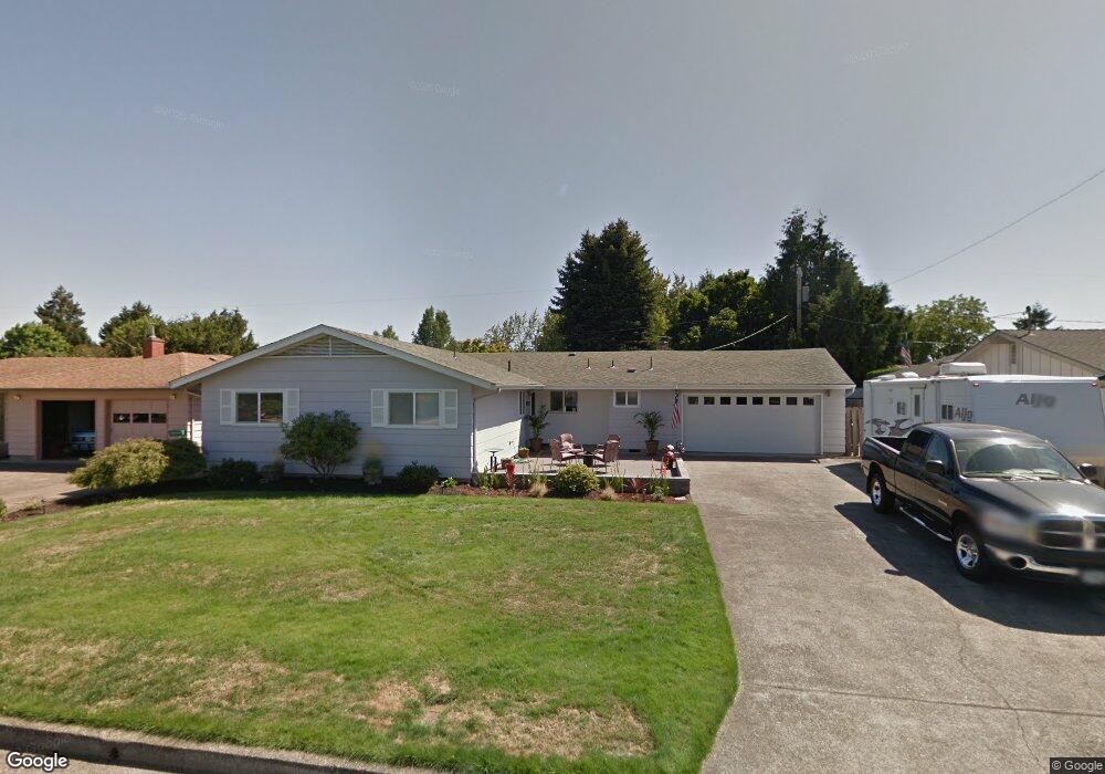
188 Knight Ave Eugene, OR 97404
Santa Clara NeighborhoodEstimated Value: $447,000 - $481,000
4
Beds
2
Baths
1,600
Sq Ft
$288/Sq Ft
Est. Value
About This Home
This home is located at 188 Knight Ave, Eugene, OR 97404 and is currently estimated at $460,592, approximately $287 per square foot. 188 Knight Ave is a home located in Lane County with nearby schools including Spring Creek Elementary School, Madison Middle School, and North Eugene High School.
Ownership History
Date
Name
Owned For
Owner Type
Purchase Details
Closed on
Apr 28, 2022
Sold by
Brown David R
Bought by
Brown Joint Trust
Current Estimated Value
Purchase Details
Closed on
Jun 6, 2007
Sold by
Chittenden Robert L and Chittenden Bonnie J
Bought by
Brown David R and Brown Keri J
Home Financials for this Owner
Home Financials are based on the most recent Mortgage that was taken out on this home.
Original Mortgage
$25,900
Interest Rate
5.85%
Mortgage Type
Credit Line Revolving
Create a Home Valuation Report for This Property
The Home Valuation Report is an in-depth analysis detailing your home's value as well as a comparison with similar homes in the area
Home Values in the Area
Average Home Value in this Area
Purchase History
| Date | Buyer | Sale Price | Title Company |
|---|---|---|---|
| Brown Joint Trust | -- | None Listed On Document | |
| Brown David R | $259,000 | First American Title |
Source: Public Records
Mortgage History
| Date | Status | Borrower | Loan Amount |
|---|---|---|---|
| Previous Owner | Brown David R | $25,900 | |
| Previous Owner | Brown David R | $207,200 |
Source: Public Records
Tax History
| Year | Tax Paid | Tax Assessment Tax Assessment Total Assessment is a certain percentage of the fair market value that is determined by local assessors to be the total taxable value of land and additions on the property. | Land | Improvement |
|---|---|---|---|---|
| 2025 | $3,484 | $272,214 | -- | -- |
| 2024 | $3,466 | $264,286 | -- | -- |
| 2023 | $3,466 | $256,589 | $0 | $0 |
| 2022 | $3,258 | $249,116 | $0 | $0 |
| 2021 | $2,969 | $241,861 | $0 | $0 |
| 2020 | $2,897 | $234,817 | $0 | $0 |
| 2019 | $2,751 | $227,978 | $0 | $0 |
| 2018 | $2,492 | $214,891 | $0 | $0 |
| 2017 | $2,297 | $214,891 | $0 | $0 |
| 2016 | $2,152 | $208,632 | $0 | $0 |
| 2015 | $2,112 | $202,555 | $0 | $0 |
| 2014 | $1,993 | $196,655 | $0 | $0 |
Source: Public Records
Map
Nearby Homes
- 51 Grizzly Ave
- 374 Blackfoot Ave
- 3256 Marvin Dr
- 346 River Loop 1
- 190 River Loop 1
- 329 Dean Ave
- 504 Dean Ave
- 3698 Revell St
- 349 Irving Rd
- 355 River Loop 2
- 591 Argon Ave
- 141 Cortland Ln
- 2721 La Darrah St
- 709 Tyson Ln
- 2612 Sage St
- 215 Jonquil Ave
- 190 Hunsaker Ln
- 4130 Scenic Dr
- 2690 Carbona St
- 193 Santa Clara Ave
- 166 Knight Ave
- 210 Knight Ave
- 191 Blazer Ave
- 169 Blazer Ave
- 213 Blazer Ave
- 173 Knight Ave
- 144 Knight Ave
- 232 Knight Ave
- 197 Knight Ave
- 149 Knight Ave
- 235 Blazer Ave
- 147 Blazer Ave
- 229 Knight Ave
- 240 Knight Ave
- 125 Knight Ave
- 122 Knight Ave
- 176 Blackfoot Ave
- 257 Blazer Ave
- 154 Blackfoot Ave
- 198 Blackfoot Ave
Your Personal Tour Guide
Ask me questions while you tour the home.