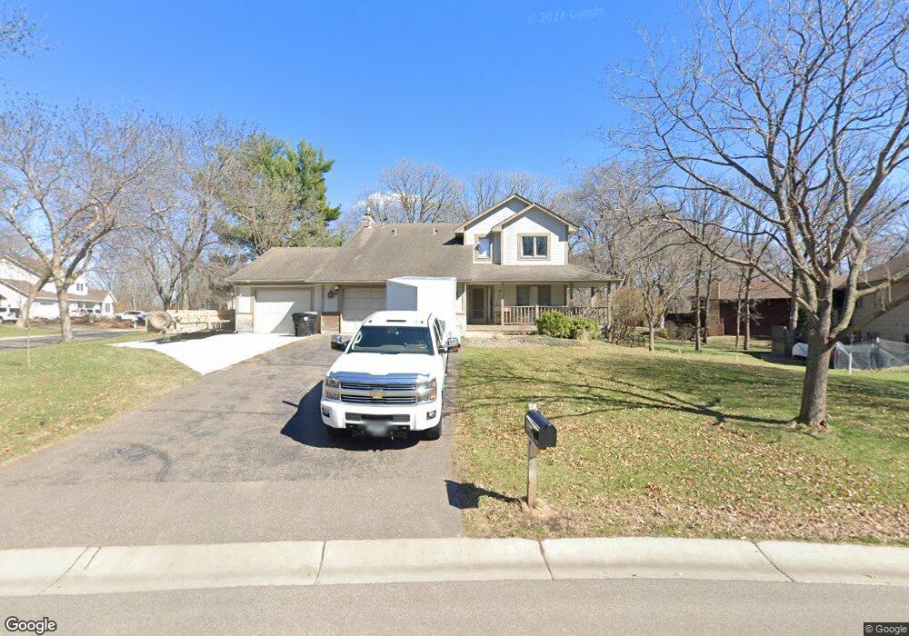
1880 128th Ave NW Coon Rapids, MN 55448
Estimated Value: $380,193 - $432,000
4
Beds
4
Baths
1,834
Sq Ft
$225/Sq Ft
Est. Value
About This Home
This home is located at 1880 128th Ave NW, Coon Rapids, MN 55448 and is currently estimated at $412,298, approximately $224 per square foot. 1880 128th Ave NW is a home located in Anoka County with nearby schools including Lucile Bruner Elementary School, Morris Bye Elementary School, and Laughlin Junior/Senior High School.
Ownership History
Date
Name
Owned For
Owner Type
Purchase Details
Closed on
Jun 28, 2016
Sold by
Johnson Franklin D and Johnson Sandra J
Bought by
Wolfe Leo D
Current Estimated Value
Home Financials for this Owner
Home Financials are based on the most recent Mortgage that was taken out on this home.
Original Mortgage
$265,109
Outstanding Balance
$209,356
Interest Rate
3.25%
Mortgage Type
FHA
Estimated Equity
$202,942
Create a Home Valuation Report for This Property
The Home Valuation Report is an in-depth analysis detailing your home's value as well as a comparison with similar homes in the area
Home Values in the Area
Average Home Value in this Area
Purchase History
| Date | Buyer | Sale Price | Title Company |
|---|---|---|---|
| Wolfe Leo D | $270,000 | Burnet Title |
Source: Public Records
Mortgage History
| Date | Status | Borrower | Loan Amount |
|---|---|---|---|
| Open | Wolfe Leo D | $265,109 |
Source: Public Records
Tax History Compared to Growth
Tax History
| Year | Tax Paid | Tax Assessment Tax Assessment Total Assessment is a certain percentage of the fair market value that is determined by local assessors to be the total taxable value of land and additions on the property. | Land | Improvement |
|---|---|---|---|---|
| 2025 | $3,285 | $304,900 | $90,000 | $214,900 |
| 2024 | $3,285 | $295,600 | $87,000 | $208,600 |
| 2023 | $4,091 | $381,700 | $72,000 | $309,700 |
| 2022 | $3,716 | $389,000 | $72,000 | $317,000 |
| 2021 | $3,382 | $314,800 | $56,000 | $258,800 |
| 2020 | $3,548 | $300,500 | $56,000 | $244,500 |
| 2019 | $3,478 | $301,500 | $56,000 | $245,500 |
| 2018 | $3,409 | $287,600 | $0 | $0 |
| 2017 | $3,147 | $273,800 | $0 | $0 |
| 2016 | $3,194 | $248,100 | $0 | $0 |
| 2015 | -- | $248,100 | $50,000 | $198,100 |
| 2014 | -- | $208,900 | $35,400 | $173,500 |
Source: Public Records
Map
Nearby Homes
- 1930 127th Cir NW
- 1687 131st Ln NW
- 1776 133rd Ave NW
- 1520 129th Ave NW
- 12554 Grouse St NW
- 12760 Raven St NW
- 1593 126th Ln NW
- 12796 Bluebird St NW
- 2147 125th Ln NW
- 1450 126th Ln NW
- 12365 Jay St NW
- 13416 Swallow St NW
- 2068 124th Ln NW
- 1625 124th Ave NW
- 13519 Partridge Cir NW
- 1234 128th Cir NW
- 12463 Drake St NW
- 13182 Zion St NW
- 1727 121st Ln NW
- 2675 128th Ave NW
- 1912 128th Ave NW
- 1864 128th Ave NW
- 1914 128th Ave NW
- 1909 128th Ave NW
- 1883 128th Ave NW
- 1848 128th Ave NW
- 12830 Linnet St NW
- 1917 128th Ave NW
- 1863 128th Ave NW
- 1832 128th Ave NW
- 12850 Linnet St NW
- 1925 128th Ave NW
- 1916 128th Ave NW
- 1922 128th Ave NW
- 12925 Linnet St NW
- 12900 Linnet St NW
- 1918 128th Ave NW
- 1847 128th Ave NW
- 1816 128th Ave NW
- 1933 128th Ave NW