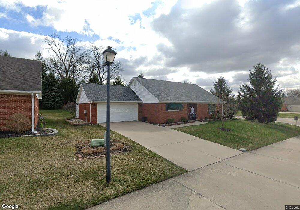
1880 Pinehurst Dr Unit 1 Springfield, OH 45502
Estimated Value: $248,000 - $267,000
2
Beds
2
Baths
1,625
Sq Ft
$157/Sq Ft
Est. Value
About This Home
This home is located at 1880 Pinehurst Dr Unit 1, Springfield, OH 45502 and is currently estimated at $254,431, approximately $156 per square foot. 1880 Pinehurst Dr Unit 1 is a home located in Clark County with nearby schools including Northridge Elementary School, Kenton Ridge Middle & High School, and Emmanuel Christian Academy.
Ownership History
Date
Name
Owned For
Owner Type
Purchase Details
Closed on
Oct 26, 2000
Sold by
Wrenwood Development Corp
Bought by
Ulliman Michael A and Ulliman Kathleen A
Current Estimated Value
Home Financials for this Owner
Home Financials are based on the most recent Mortgage that was taken out on this home.
Original Mortgage
$99,450
Interest Rate
7.9%
Create a Home Valuation Report for This Property
The Home Valuation Report is an in-depth analysis detailing your home's value as well as a comparison with similar homes in the area
Home Values in the Area
Average Home Value in this Area
Purchase History
| Date | Buyer | Sale Price | Title Company |
|---|---|---|---|
| Ulliman Michael A | $124,000 | -- |
Source: Public Records
Mortgage History
| Date | Status | Borrower | Loan Amount |
|---|---|---|---|
| Closed | Ulliman Michael A | $99,450 |
Source: Public Records
Tax History
| Year | Tax Paid | Tax Assessment Tax Assessment Total Assessment is a certain percentage of the fair market value that is determined by local assessors to be the total taxable value of land and additions on the property. | Land | Improvement |
|---|---|---|---|---|
| 2025 | $2,197 | $84,390 | $12,250 | $72,140 |
| 2024 | $2,149 | $61,600 | $10,850 | $50,750 |
| 2023 | $2,149 | $61,600 | $10,850 | $50,750 |
| 2022 | $2,174 | $61,600 | $10,850 | $50,750 |
| 2021 | $1,893 | $48,240 | $8,750 | $39,490 |
| 2020 | $1,895 | $48,240 | $8,750 | $39,490 |
| 2019 | $1,933 | $48,240 | $8,750 | $39,490 |
| 2018 | $1,798 | $44,270 | $8,750 | $35,520 |
| 2017 | $1,528 | $46,571 | $8,750 | $37,821 |
| 2016 | $1,517 | $46,571 | $8,750 | $37,821 |
| 2015 | $1,579 | $46,571 | $8,750 | $37,821 |
| 2014 | $1,579 | $46,571 | $8,750 | $37,821 |
| 2013 | $1,575 | $46,571 | $8,750 | $37,821 |
Source: Public Records
Map
Nearby Homes
- 1811 Saint Andrews Ct
- 1507 Kingsgate Rd
- 1505 Kingsgate Rd
- 1503 Kingsgate Rd
- 1500 Kingsgate Rd Unit 19430
- 1502 Kingsgate Rd Unit 19432
- 1500 Kingsgate Rd
- 1502 Kingsgate Rd
- 3631 Kingsgate Ln
- 3126 Lakeview Ct Unit 3126
- 4028 Ryland Dr Unit 4028
- 1644 Delmar Dr
- 1922 Wedgewood Cir
- 1415 Montego Dr
- 1201 Kingsgate Rd
- 2022 Westboro Ave
- 3052 Brixton Dr E
- 1162 Kingsgate Rd
- 4256 Midfield St Unit 9
- 2332 Villa Rd
- 1870 Pinehurst Dr Unit 2
- 1881 Pinehurst Dr Unit 40
- 1871 Pinehurst Dr Unit 39
- 1860 Pinehurst Dr
- 1861 Pinehurst Dr Unit 38
- 1861 Pinehurst Dr
- 1820 Saint Andrews Ct Unit 32
- 1820 Saint Andrews Ct
- 1820 Saint Andrews Ct
- 1850 Pinehurst Dr Unit 4
- 1863 Golfview Dr Unit 1
- 1821 Saint Andrews Ct Unit 31
- 1862 Golfview Dr Unit 54
- 1810 Saint Andrews Ct Unit 33
- 1810 Saint Andrews Ct
- 1861 Golfview Dr Unit 2
- 1840 Pinehurst Dr Unit 5
- 1840 Pinehurst Dr
- 1860 Golfview Dr Unit 53
- 1821 Pinehurst Dr
Your Personal Tour Guide
Ask me questions while you tour the home.