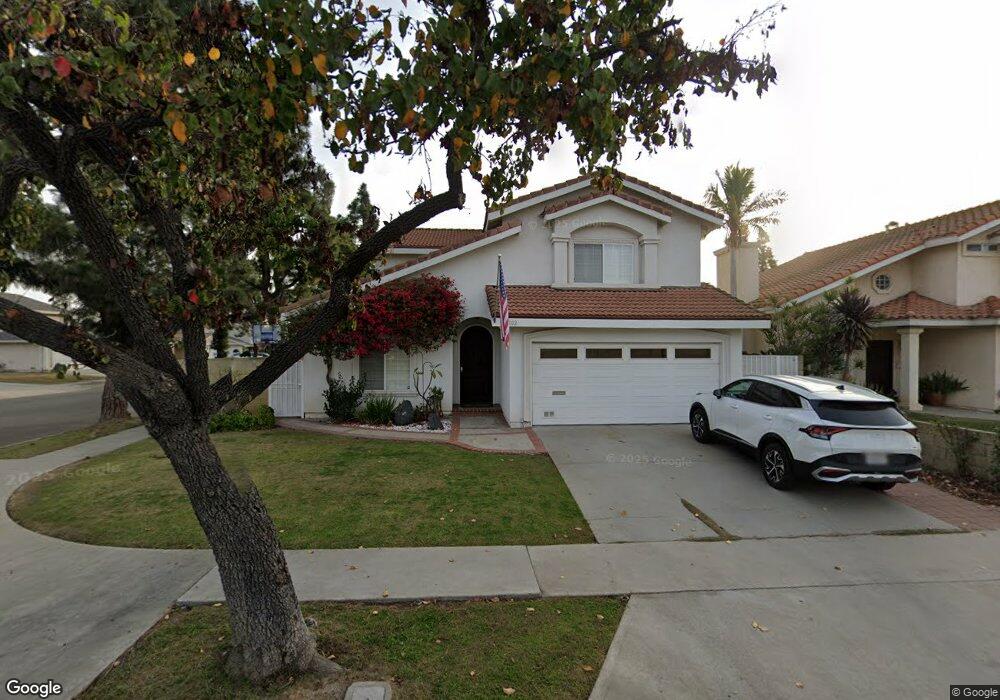
18802 Queens Ct Cerritos, CA 90703
Estimated Value: $1,253,795 - $1,380,000
4
Beds
3
Baths
2,546
Sq Ft
$511/Sq Ft
Est. Value
About This Home
This home is located at 18802 Queens Ct, Cerritos, CA 90703 and is currently estimated at $1,299,949, approximately $510 per square foot. 18802 Queens Ct is a home located in Los Angeles County with nearby schools including Frank C. Leal Elementary School, Tetzlaff (Martin B.) Middle School, and Cerritos High School.
Ownership History
Date
Name
Owned For
Owner Type
Purchase Details
Closed on
Apr 11, 2000
Sold by
Hwang Jae Ho
Bought by
Hwangbo John and Hwangbo Annette
Current Estimated Value
Home Financials for this Owner
Home Financials are based on the most recent Mortgage that was taken out on this home.
Original Mortgage
$197,600
Outstanding Balance
$67,843
Interest Rate
8.26%
Estimated Equity
$1,232,106
Purchase Details
Closed on
Mar 20, 1998
Sold by
Jae Ho Hwang and Min Sook Kim
Bought by
Hwang Jae Ho and Hwang Min Sook
Home Financials for this Owner
Home Financials are based on the most recent Mortgage that was taken out on this home.
Original Mortgage
$168,500
Interest Rate
7.06%
Create a Home Valuation Report for This Property
The Home Valuation Report is an in-depth analysis detailing your home's value as well as a comparison with similar homes in the area
Home Values in the Area
Average Home Value in this Area
Purchase History
| Date | Buyer | Sale Price | Title Company |
|---|---|---|---|
| Hwangbo John | $247,000 | Lawyers Title Company | |
| Hwang Jae Ho | -- | Old Republic Title Company |
Source: Public Records
Mortgage History
| Date | Status | Borrower | Loan Amount |
|---|---|---|---|
| Open | Hwangbo John | $197,600 | |
| Previous Owner | Hwang Jae Ho | $168,500 |
Source: Public Records
Tax History
| Year | Tax Paid | Tax Assessment Tax Assessment Total Assessment is a certain percentage of the fair market value that is determined by local assessors to be the total taxable value of land and additions on the property. | Land | Improvement |
|---|---|---|---|---|
| 2025 | $7,202 | $593,384 | $252,974 | $340,410 |
| 2024 | $7,202 | $581,750 | $248,014 | $333,736 |
| 2023 | $6,970 | $570,344 | $243,151 | $327,193 |
| 2022 | $6,864 | $559,162 | $238,384 | $320,778 |
| 2021 | $6,697 | $548,199 | $233,710 | $314,489 |
| 2019 | $6,544 | $531,941 | $226,779 | $305,162 |
| 2018 | $6,067 | $521,512 | $222,333 | $299,179 |
| 2016 | $5,815 | $501,262 | $213,700 | $287,562 |
| 2015 | $5,742 | $493,734 | $210,491 | $283,243 |
| 2014 | $5,629 | $484,063 | $206,368 | $277,695 |
Source: Public Records
Map
Nearby Homes
- 18727 Holmes Ave
- 18622 Kamstra Ave
- 13026 San Salvador Place
- 12711 Castleford Ln
- 13048 Acoro St
- 4922 El Rancho Verde Dr
- 4841 Sharon Dr
- 7662 Cory Cir
- 12502 Brent St
- 18704 Stefani Ave
- 13010 Artesia Blvd
- 5091 Sharon Dr
- 12342 Edgefield St
- 19705 Teresa Ct
- 17400 Laurelbrook Ct
- 7371 Spruce Cir
- 17112 Maurice Ave
- 12525 Semora St
- 8032 Lancashire Cir
- 13626 Aclare Ln
- 18808 Queens Ct
- 18803 Pinewood Cir
- 18814 Queens Ct
- 13144 Droxford St
- 13155 Droxford St
- 18811 Pinewood Cir
- 13161 Droxford St
- 13151 Droxford St
- 13203 Droxford St
- 18818 Queens Ct
- 13145 Droxford St
- 13143 Caravel St
- 13136 Droxford St
- 13207 Droxford St
- 18815 Pinewood Cir
- 13141 Droxford St
- 13135 Caravel St
- 13213 Droxford St
- 13156 Andy St
- 13132 Droxford St
Your Personal Tour Guide
Ask me questions while you tour the home.