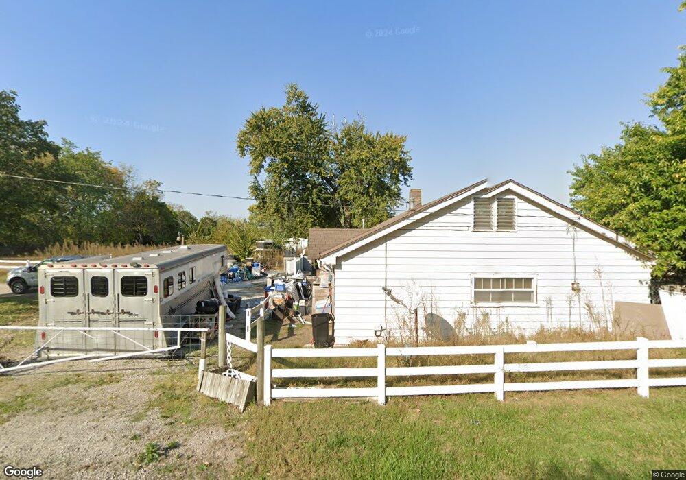
18808 State Route J Raymore, MO 64083
Estimated Value: $590,000 - $798,000
3
Beds
3
Baths
3,552
Sq Ft
$196/Sq Ft
Est. Value
About This Home
This home is located at 18808 State Route J, Raymore, MO 64083 and is currently estimated at $696,996, approximately $196 per square foot. 18808 State Route J is a home located in Cass County with nearby schools including Bridle Ridge Intermediate School, Raymore-Peculiar South Middle School, and Raymore-Peculiar Senior High School.
Ownership History
Date
Name
Owned For
Owner Type
Purchase Details
Closed on
Jun 29, 2006
Sold by
Beck Ernest P and Beck Vicki L
Bought by
Segars Larry and Segars Denise
Current Estimated Value
Home Financials for this Owner
Home Financials are based on the most recent Mortgage that was taken out on this home.
Original Mortgage
$347,400
Outstanding Balance
$203,264
Interest Rate
6.58%
Mortgage Type
New Conventional
Estimated Equity
$493,732
Create a Home Valuation Report for This Property
The Home Valuation Report is an in-depth analysis detailing your home's value as well as a comparison with similar homes in the area
Home Values in the Area
Average Home Value in this Area
Purchase History
| Date | Buyer | Sale Price | Title Company |
|---|---|---|---|
| Segars Larry | -- | -- |
Source: Public Records
Mortgage History
| Date | Status | Borrower | Loan Amount |
|---|---|---|---|
| Open | Segars Larry | $347,400 |
Source: Public Records
Tax History
| Year | Tax Paid | Tax Assessment Tax Assessment Total Assessment is a certain percentage of the fair market value that is determined by local assessors to be the total taxable value of land and additions on the property. | Land | Improvement |
|---|---|---|---|---|
| 2025 | $4,981 | $80,990 | $11,570 | $69,420 |
| 2024 | $4,981 | $72,000 | $10,520 | $61,480 |
| 2023 | $4,975 | $72,000 | $10,520 | $61,480 |
| 2022 | $4,437 | $63,960 | $10,520 | $53,440 |
| 2021 | $4,437 | $63,960 | $10,520 | $53,440 |
| 2020 | $4,389 | $62,030 | $10,520 | $51,510 |
| 2019 | $4,213 | $62,030 | $10,520 | $51,510 |
| 2018 | $3,920 | $55,670 | $8,420 | $47,250 |
| 2017 | $3,551 | $55,670 | $8,420 | $47,250 |
| 2016 | $3,551 | $52,860 | $8,420 | $44,440 |
| 2015 | $3,553 | $52,860 | $8,420 | $44,440 |
| 2014 | $3,456 | $51,390 | $6,950 | $44,440 |
| 2013 | -- | $51,390 | $6,950 | $44,440 |
Source: Public Records
Map
Nearby Homes
- 19615 S State Route J
- 13512 E 198th St
- 1024 S Madison St
- 720 Sandpiper St
- 804 S Washington St
- 0 S School Rd Unit HMS2591054
- 702 Twilight Ct
- 522 Neptune Dr
- Lot 12 Municipal Cir
- Lot 6 Municipal Cir
- Lot 13 Municipal Cir
- 605 S Franklin St
- 528 S Saturn Dr
- 709 Derby St
- 515 S Saturn Dr
- 503 S Harrison Ave
- 1205 Sendera Trail
- 1117 Sendera Trail
- 1009 Balboa Trail
- 405 S Monroe St
- 18804 State Route J
- 18812 State Route J
- 18802 State Route J
- 18800 State Route J
- 18800 State Route J
- 19020 State Route J
- 1301 Southwind Dr
- 18708 State Route J
- 19110 State Route J
- 1303 Southwind Dr
- 1201 Southwind Dr
- 703 E Hubach Hill Rd
- 1203 Southwind Dr
- 1305 Southwind Dr
- 19200 State Route J
- 611 E Hubach Hill Rd
- 1307 Southwind Dr
- 1300 Southwind Dr
- 1302 Southwind Dr
- 609 E Hubach Hill Rd
Your Personal Tour Guide
Ask me questions while you tour the home.