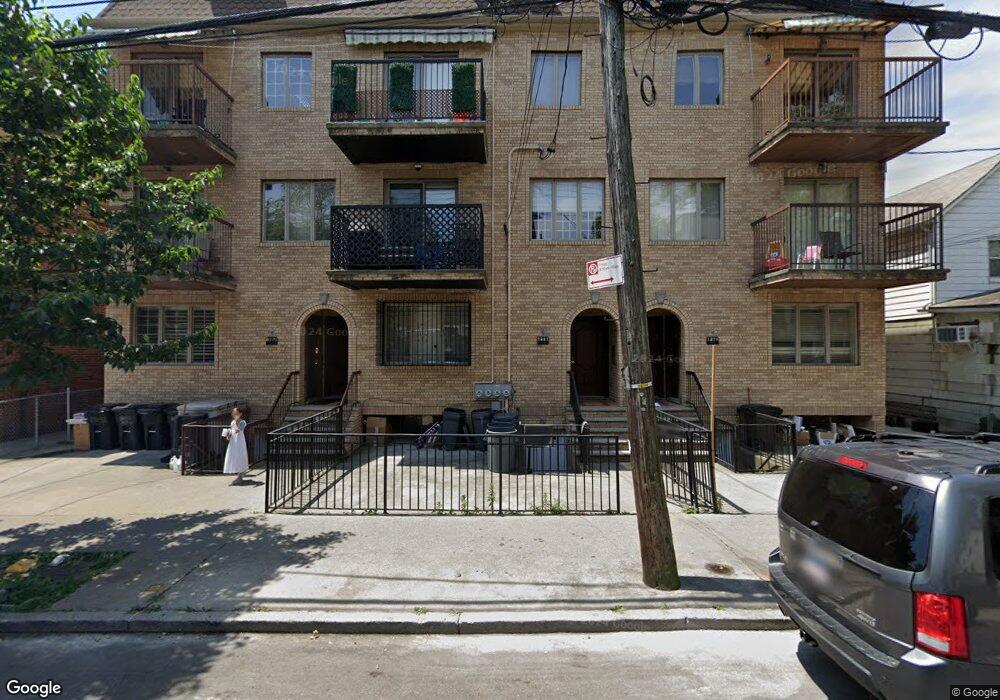
1882 53rd St Unit 1 Brooklyn, NY 11204
Borough Park NeighborhoodEstimated Value: $1,223,000 - $1,403,871
Studio
--
Bath
1,897
Sq Ft
$700/Sq Ft
Est. Value
About This Home
This home is located at 1882 53rd St Unit 1, Brooklyn, NY 11204 and is currently estimated at $1,328,718, approximately $700 per square foot. 1882 53rd St Unit 1 is a home located in Kings County with nearby schools including P.S. 121 Nelson A Rockefeller, I.S. 223 The Montauk, and Franklin Delano Roosevelt High School.
Ownership History
Date
Name
Owned For
Owner Type
Purchase Details
Closed on
Dec 24, 2020
Sold by
Kaff Morris
Bought by
Mandelbaum Benzion
Current Estimated Value
Purchase Details
Closed on
Dec 7, 2006
Sold by
1878-84 53Rd St Llc
Bought by
Kaff Morris
Home Financials for this Owner
Home Financials are based on the most recent Mortgage that was taken out on this home.
Original Mortgage
$300,000
Interest Rate
6.35%
Mortgage Type
Purchase Money Mortgage
Create a Home Valuation Report for This Property
The Home Valuation Report is an in-depth analysis detailing your home's value as well as a comparison with similar homes in the area
Home Values in the Area
Average Home Value in this Area
Purchase History
| Date | Buyer | Sale Price | Title Company |
|---|---|---|---|
| Mandelbaum Benzion | $405,000 | -- | |
| Kaff Morris | $570,000 | -- |
Source: Public Records
Mortgage History
| Date | Status | Borrower | Loan Amount |
|---|---|---|---|
| Previous Owner | Kaff Morris | $300,000 |
Source: Public Records
Tax History
| Year | Tax Paid | Tax Assessment Tax Assessment Total Assessment is a certain percentage of the fair market value that is determined by local assessors to be the total taxable value of land and additions on the property. | Land | Improvement |
|---|---|---|---|---|
| 2025 | $11,258 | $87,268 | $6,877 | $80,391 |
| 2024 | $11,258 | $79,949 | $6,877 | $73,072 |
| 2023 | $11,266 | $73,069 | $6,877 | $66,192 |
| 2022 | $10,447 | $67,158 | $6,877 | $60,281 |
| 2021 | $8,537 | $62,726 | $6,877 | $55,849 |
| 2020 | $3,155 | $61,225 | $6,877 | $54,348 |
| 2019 | $4,579 | $52,891 | $6,877 | $46,014 |
| 2018 | $2,756 | $46,226 | $5,200 | $41,026 |
| 2017 | $1,089 | $43,610 | $5,314 | $38,296 |
| 2016 | $1,068 | $41,142 | $5,404 | $35,738 |
| 2015 | $729 | $38,924 | $5,695 | $33,229 |
| 2014 | $729 | $38,924 | $6,006 | $32,918 |
Source: Public Records
Map
Nearby Homes
- 1772 55th St
- 1768 55th St
- 1692 52nd St
- 1129 McDonald Ave
- 1026 E 2nd St
- 123 Avenue J
- 2050 58th St
- 6109 19th Ave
- 1091 E 3rd St
- 1831 62nd St
- 6119 20th Ave
- 414 Elmwood Ave Unit 6H
- 414 Elmwood Ave Unit 4C
- 414 Elmwood Ave Unit 5A
- 414 Elmwood Ave Unit 2D
- 2084 61st St
- 943 McDonald Ave
- 2180 59th St
- 902 Ocean Pkwy Unit 3F
- 902 Ocean Pkwy Unit 4G
- 1882 53rd St Unit 3
- 1882 53rd St Unit 2
- 1882 53rd St
- 1878 53rd St Unit 3
- 1878 53rd St Unit 2
- 1878 53rd St Unit 1
- 1878 53rd St
- 1884 53rd St Unit 3
- 1884 53rd St Unit 2
- 1884 53rd St Unit 1
- 1884 53rd St
- 1876 53rd St
- 1888 53rd St
- 1872 53rd St
- 1870 53rd St
- 1881 54th St
- 1879 54th St
- 1883 54th St
- 1877 54th St
- 1885 54th St
Your Personal Tour Guide
Ask me questions while you tour the home.