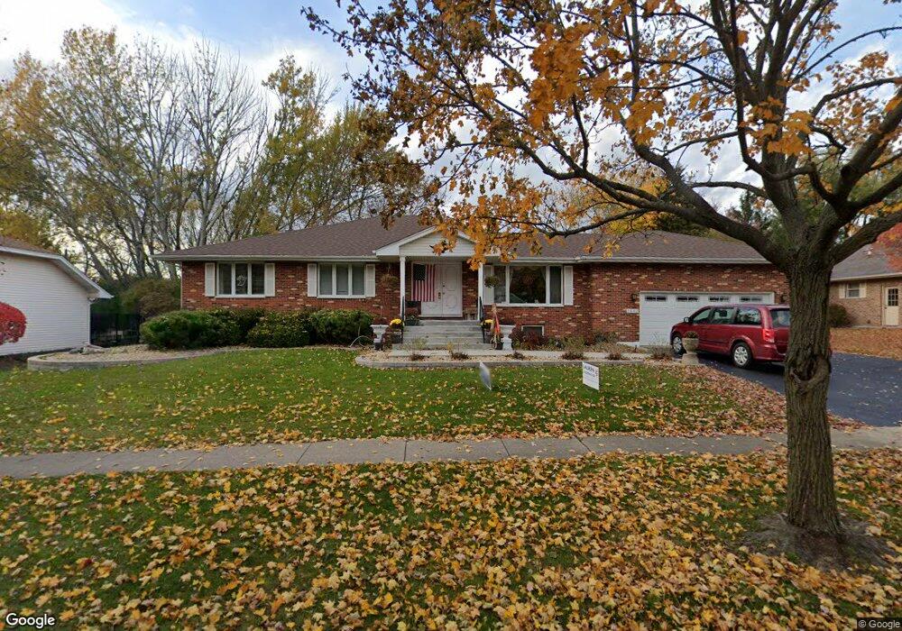
1882 Heather Rd Geneva, IL 60134
Southwest Central Geneva NeighborhoodEstimated Value: $557,327 - $679,000
4
Beds
3
Baths
2,544
Sq Ft
$247/Sq Ft
Est. Value
About This Home
This home is located at 1882 Heather Rd, Geneva, IL 60134 and is currently estimated at $629,332, approximately $247 per square foot. 1882 Heather Rd is a home located in Kane County with nearby schools including Western Avenue Elementary School, Geneva Community High School, and Holy Cross Catholic School.
Ownership History
Date
Name
Owned For
Owner Type
Purchase Details
Closed on
Oct 19, 2001
Sold by
Ajazi Stefano
Bought by
Denormandie John B and Denormandie Chancy E
Current Estimated Value
Home Financials for this Owner
Home Financials are based on the most recent Mortgage that was taken out on this home.
Original Mortgage
$252,000
Outstanding Balance
$111,558
Interest Rate
8.7%
Estimated Equity
$517,774
Create a Home Valuation Report for This Property
The Home Valuation Report is an in-depth analysis detailing your home's value as well as a comparison with similar homes in the area
Home Values in the Area
Average Home Value in this Area
Purchase History
| Date | Buyer | Sale Price | Title Company |
|---|---|---|---|
| Denormandie John B | $269,000 | Chicago Title Insurance Co |
Source: Public Records
Mortgage History
| Date | Status | Borrower | Loan Amount |
|---|---|---|---|
| Open | Denormandie John B | $252,000 |
Source: Public Records
Tax History Compared to Growth
Tax History
| Year | Tax Paid | Tax Assessment Tax Assessment Total Assessment is a certain percentage of the fair market value that is determined by local assessors to be the total taxable value of land and additions on the property. | Land | Improvement |
|---|---|---|---|---|
| 2024 | $2,590 | $152,619 | $44,388 | $108,231 |
| 2023 | $9,865 | $138,745 | $40,353 | $98,392 |
| 2022 | $9,637 | $128,921 | $37,496 | $91,425 |
| 2021 | $9,488 | $124,129 | $36,102 | $88,027 |
| 2020 | $9,425 | $122,234 | $35,551 | $86,683 |
| 2019 | $9,392 | $119,920 | $34,878 | $85,042 |
| 2018 | $8,997 | $115,487 | $34,878 | $80,609 |
| 2017 | $8,883 | $112,407 | $33,948 | $78,459 |
| 2016 | $8,920 | $110,888 | $33,489 | $77,399 |
| 2015 | -- | $105,427 | $31,840 | $73,587 |
| 2014 | -- | $105,427 | $31,840 | $73,587 |
| 2013 | -- | $105,427 | $31,840 | $73,587 |
Source: Public Records
Map
Nearby Homes
- 1837 Heather Rd
- 1666 Eagle Brook Dr
- 1580 Turnberry Ct
- 705 W Fabyan Pkwy
- 605 W Fabyan Pkwy
- 655 Blackhawk Dr
- 1516 S Batavia Ave
- 1088 Dunstan Rd
- 545 Blackhawk Dr Unit 2
- 921 Western Ave
- 1417 Sherwood Ln
- 1301 S Batavia Ave
- 710 Peck Rd
- 1270 North Ave Unit 1
- 467 Taubert Ave
- 615 Easton Ave
- 372 Mill St
- 425 Mill St
- 839 S Randall Rd
- 747 Cheever Ave
- 1842 Heather Rd
- 1912 Heather Rd
- 1915 Western Ave Unit 1
- 1919 Western Ave
- 1918 Heather Rd
- 1840 Heather Rd
- 1911 Western Ave
- 1871 Heather Rd Unit 3
- 1915 Heather Rd
- 1851 Heather Rd
- 1923 Western Ave Unit 1
- 1919 Heather Rd
- 1905 Western Ave
- 1838 Heather Rd
- 1924 Heather Rd
- 1918 Tanager Ln
- 1923 Heather Rd
- 1927 Western Ave
- 1922 Tanager Ln
- 755 Tanager Ln