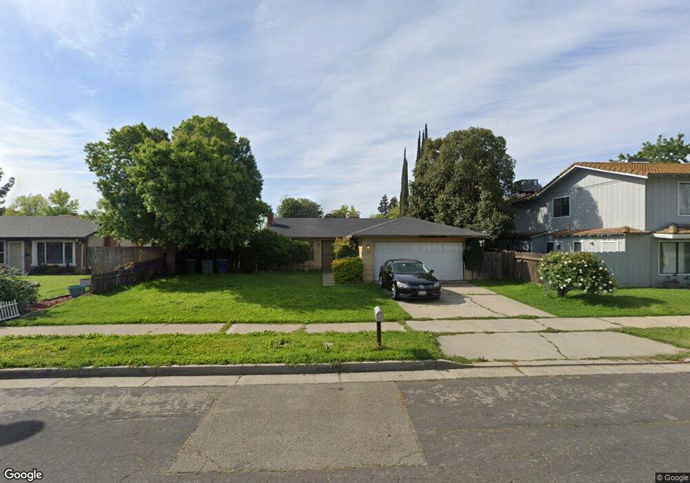
1882 Shadowbrook Dr Merced, CA 95348
Estimated Value: $293,000 - $320,000
3
Beds
2
Baths
1,140
Sq Ft
$270/Sq Ft
Est. Value
About This Home
This home is located at 1882 Shadowbrook Dr, Merced, CA 95348 and is currently estimated at $308,009, approximately $270 per square foot. 1882 Shadowbrook Dr is a home located in Merced County with nearby schools including Luther Burbank Elementary School, Tenaya Middle School, and Merced High School.
Ownership History
Date
Name
Owned For
Owner Type
Purchase Details
Closed on
Jun 29, 2010
Sold by
Federal National Mortgage Association
Bought by
Silva Gilbert O
Current Estimated Value
Home Financials for this Owner
Home Financials are based on the most recent Mortgage that was taken out on this home.
Original Mortgage
$66,602
Interest Rate
4.52%
Mortgage Type
FHA
Purchase Details
Closed on
Oct 23, 2009
Sold by
Konopka Charles M
Bought by
Federal National Mortgage Association
Purchase Details
Closed on
Jun 7, 2001
Sold by
Wunder William and Wunder Jean L
Bought by
Konopka Charles M
Home Financials for this Owner
Home Financials are based on the most recent Mortgage that was taken out on this home.
Original Mortgage
$73,200
Interest Rate
7.09%
Create a Home Valuation Report for This Property
The Home Valuation Report is an in-depth analysis detailing your home's value as well as a comparison with similar homes in the area
Purchase History
| Date | Buyer | Sale Price | Title Company |
|---|---|---|---|
| Silva Gilbert O | $67,500 | Stewart Title Of California | |
| Federal National Mortgage Association | $157,180 | Accommodation | |
| Konopka Charles M | $91,500 | Transcounty Title Company |
Source: Public Records
Mortgage History
| Date | Status | Borrower | Loan Amount |
|---|---|---|---|
| Previous Owner | Silva Gilbert O | $66,602 | |
| Previous Owner | Konopka Charles M | $73,200 |
Source: Public Records
Tax History
| Year | Tax Paid | Tax Assessment Tax Assessment Total Assessment is a certain percentage of the fair market value that is determined by local assessors to be the total taxable value of land and additions on the property. | Land | Improvement |
|---|---|---|---|---|
| 2025 | $920 | $86,464 | $14,085 | $72,379 |
| 2024 | $920 | $84,769 | $13,809 | $70,960 |
| 2023 | $907 | $83,108 | $13,539 | $69,569 |
| 2022 | $894 | $81,479 | $13,274 | $68,205 |
| 2021 | $892 | $79,882 | $13,014 | $66,868 |
| 2020 | $898 | $79,064 | $12,881 | $66,183 |
| 2019 | $884 | $77,515 | $12,629 | $64,886 |
| 2018 | $806 | $75,996 | $12,382 | $63,614 |
| 2017 | $836 | $74,507 | $12,140 | $62,367 |
| 2016 | $823 | $73,047 | $11,902 | $61,145 |
| 2015 | $810 | $71,951 | $11,724 | $60,227 |
| 2014 | $793 | $70,543 | $11,495 | $59,048 |
Source: Public Records
Map
Nearby Homes
- 1648 W North Bear Creek Dr
- 1646 W North Bear Creek Dr
- 1656 W North Bear Creek Dr Unit 9
- 1664 W North Bear Creek Dr Unit 5
- 2500 N State Highway 59 Unit 36
- 2500 N State Highway 59 Unit 278
- 2500 N State Highway 59 Unit 239
- 2500 N State Highway 59 Unit 18
- 2500 N State Highway 59
- 1541 W North Bear Creek Dr
- 1438 W 19th St
- 1441 W 20th St
- 2790 N State Highway 59
- 1482 Autry Way
- 1463 W 25th St
- 1145 W 22nd St
- 1044 W 20th St
- 1127 W 23rd St
- 1274 Devonwood Dr
- 3157 Juneau Ct
- 1902 Shadowbrook Dr
- 1902 Shadowbrook Dr Unit 3
- 1902 Shadowbrook Dr Unit 2
- 1902 Shadowbrook Dr Unit 1
- 1902 Shadowbrook Dr Unit 4
- 1872 Shadowbrook Dr
- 1862 Shadowbrook Dr
- 1871 Driftwood Dr
- 1881 Driftwood Dr
- 2443 Driftwood Dr
- 1883 Shadowbrook Dr
- 1901 Driftwood Dr Unit 1
- 1901 Driftwood Dr Unit 1
- 1901 Driftwood Dr Unit 2
- 1901 Driftwood Dr Unit 3
- 1901 Driftwood Dr Unit 4
- 1903 Shadowbrook Dr
- 1873 Shadowbrook Dr
- 2433 Driftwood Dr
- 1922 Shadowbrook Dr Unit 1
Your Personal Tour Guide
Ask me questions while you tour the home.