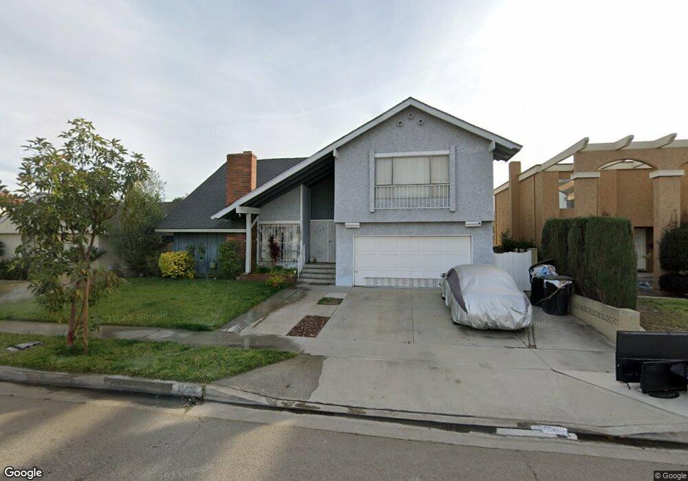
18820 Stark Ave Cerritos, CA 90703
Estimated Value: $1,390,000 - $1,484,000
5
Beds
3
Baths
2,739
Sq Ft
$525/Sq Ft
Est. Value
About This Home
This home is located at 18820 Stark Ave, Cerritos, CA 90703 and is currently estimated at $1,438,089, approximately $525 per square foot. 18820 Stark Ave is a home located in Los Angeles County with nearby schools including Carver Elementary School, Tetzlaff (Martin B.) Middle School, and Cerritos High School.
Ownership History
Date
Name
Owned For
Owner Type
Purchase Details
Closed on
Apr 15, 2024
Sold by
Camarena Josephine
Bought by
Josephine Camarena Living Trust and Camarena
Current Estimated Value
Purchase Details
Closed on
Jul 2, 2003
Sold by
Camarena Josephine
Bought by
Camarena Manuel
Home Financials for this Owner
Home Financials are based on the most recent Mortgage that was taken out on this home.
Original Mortgage
$240,500
Interest Rate
5.18%
Mortgage Type
Purchase Money Mortgage
Create a Home Valuation Report for This Property
The Home Valuation Report is an in-depth analysis detailing your home's value as well as a comparison with similar homes in the area
Home Values in the Area
Average Home Value in this Area
Purchase History
| Date | Buyer | Sale Price | Title Company |
|---|---|---|---|
| Josephine Camarena Living Trust | -- | None Listed On Document | |
| Camarena Manuel | -- | Fidelity National Title Co |
Source: Public Records
Mortgage History
| Date | Status | Borrower | Loan Amount |
|---|---|---|---|
| Previous Owner | Camarena Manuel | $240,500 |
Source: Public Records
Tax History Compared to Growth
Tax History
| Year | Tax Paid | Tax Assessment Tax Assessment Total Assessment is a certain percentage of the fair market value that is determined by local assessors to be the total taxable value of land and additions on the property. | Land | Improvement |
|---|---|---|---|---|
| 2025 | $7,896 | $660,341 | $242,691 | $417,650 |
| 2024 | $7,896 | $647,394 | $237,933 | $409,461 |
| 2023 | $7,639 | $634,701 | $233,268 | $401,433 |
| 2022 | $7,522 | $622,257 | $228,695 | $393,562 |
| 2021 | $7,338 | $610,057 | $224,211 | $385,846 |
| 2019 | $7,168 | $591,963 | $217,561 | $374,402 |
| 2018 | $6,637 | $580,357 | $213,296 | $367,061 |
| 2016 | $6,360 | $557,822 | $205,014 | $352,808 |
| 2015 | $6,279 | $549,444 | $201,935 | $347,509 |
| 2014 | $6,151 | $538,682 | $197,980 | $340,702 |
Source: Public Records
Map
Nearby Homes
- 12361 Caravel Place
- 12360 Hedda Dr
- 12251 Carver Ln
- 18430 Horst Ave
- 0 Parcel: 7016-014-017 Ave Unit PW25183248
- 19335 Derbyshire Ln
- 12711 Castleford Ln
- 18035 Horst Ave
- 19657 Sequoia Ave
- 11974 Bos St
- 18403 Devlin Ave
- 12525 Semora St
- 17721 Norwalk Blvd Unit 47
- 19008 Jeffrey Ave
- 19528 Ray Cir
- 13044 Hedda Ln
- 19518 Nancy Cir
- 12967 Moorshire Dr
- 19127 Pioneer Blvd Unit 30
- 19127 Pioneer Blvd Unit 9
- 18826 Stark Ave
- 18814 Stark Ave
- 18821 Christina Ave
- 18827 Christina Ave
- 18815 Christina Ave
- 18832 Stark Ave
- 18808 Stark Ave
- 12386 Caravel Place
- 18833 Christina Ave
- 18809 Christina Ave
- 12387 Edgefield St
- 18838 Stark Ave
- 18802 Stark Ave
- 12387 Caravel Place
- 12380 Caravel Place
- 18839 Christina Ave
- 18803 Christina Ave
- 12381 Edgefield St
- 18820 Christina Ave
- 12381 Caravel Place