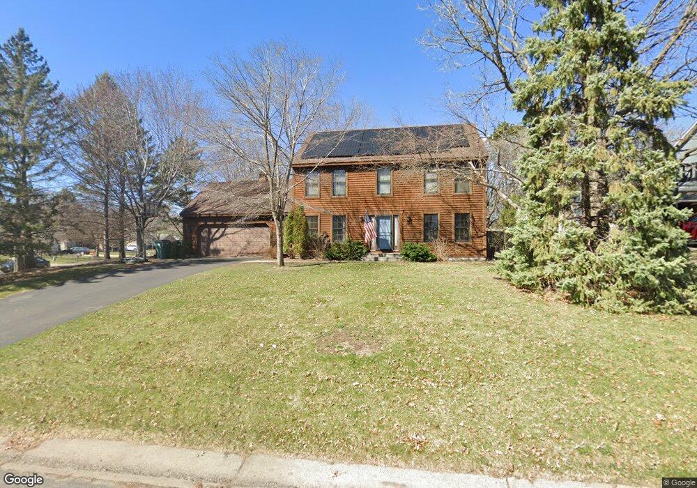
1883 132nd Ave NW Coon Rapids, MN 55448
Estimated Value: $397,278 - $437,000
3
Beds
3
Baths
2,010
Sq Ft
$209/Sq Ft
Est. Value
About This Home
This home is located at 1883 132nd Ave NW, Coon Rapids, MN 55448 and is currently estimated at $419,820, approximately $208 per square foot. 1883 132nd Ave NW is a home located in Anoka County with nearby schools including Morris Bye Elementary School, Coon Rapids Middle School, and Coon Rapids Senior High School.
Ownership History
Date
Name
Owned For
Owner Type
Purchase Details
Closed on
Sep 7, 2007
Sold by
Republic Mortgage Insurance
Bought by
Berg Erik D and Berg Kari Lee
Current Estimated Value
Create a Home Valuation Report for This Property
The Home Valuation Report is an in-depth analysis detailing your home's value as well as a comparison with similar homes in the area
Home Values in the Area
Average Home Value in this Area
Purchase History
| Date | Buyer | Sale Price | Title Company |
|---|---|---|---|
| Berg Erik D | $279,900 | -- |
Source: Public Records
Tax History
| Year | Tax Paid | Tax Assessment Tax Assessment Total Assessment is a certain percentage of the fair market value that is determined by local assessors to be the total taxable value of land and additions on the property. | Land | Improvement |
|---|---|---|---|---|
| 2025 | $3,837 | $375,200 | $90,000 | $285,200 |
| 2024 | $3,837 | $364,600 | $87,000 | $277,600 |
| 2023 | $3,635 | $363,600 | $72,000 | $291,600 |
| 2022 | $3,156 | $369,200 | $72,000 | $297,200 |
| 2021 | $3,083 | $288,700 | $56,000 | $232,700 |
| 2020 | $3,191 | $276,200 | $56,000 | $220,200 |
| 2019 | $3,165 | $273,800 | $56,000 | $217,800 |
| 2018 | $3,028 | $264,000 | $0 | $0 |
| 2017 | $2,767 | $246,100 | $0 | $0 |
| 2016 | $2,802 | $221,000 | $0 | $0 |
| 2015 | -- | $221,000 | $50,000 | $171,000 |
| 2014 | -- | $183,500 | $35,400 | $148,100 |
Source: Public Records
Map
Nearby Homes
- 13232 Grouse St NW
- 1914 128th Ave NW
- 1680 129th Cir NW
- 1681 128th Ave NW
- 13416 Swallow St NW
- 13519 Partridge Cir NW
- 13525 Partridge Cir NW
- 13518 Thrush St NW
- 13034 Verdin St NW
- 13207 Yukon St NW
- 13773 Partridge St NW
- 12739 Drake Cir NW
- 2120 138th Ave NW
- 13208 Zion St NW
- 2060 125th Ln NW
- 13637 Yukon St NW
- 12806 Yellow Pine St NW
- 2246 125th Ln NW
- 1258 127th Ave NW
- 12459 Drake St NW
- 13213 Martin St NW
- 1873 132nd Ave NW
- 3023 132nd Ave NW
- 3042 132nd Ave NW
- 1886 132nd Ave NW
- 13208 Martin St NW
- 13200 Martin St NW
- 13216 Killdeer St NW
- 1876 132nd Ave NW
- 13237 Martin St NW
- 13216 Martin St NW
- 13205 Killdeer St NW
- 13184 Martin St NW
- 13228 Killdeer St NW
- 158XX Killdeer St NW
- 1866 132nd Ave NW
- 13234 Martin St NW
- 13217 Killdeer St NW
- 1856 132nd Ave NW
- 1884 132nd Ln NW
Your Personal Tour Guide
Ask me questions while you tour the home.