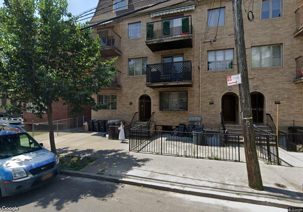
1884 53rd St Unit 2 Brooklyn, NY 11204
Borough Park NeighborhoodEstimated Value: $882,000 - $989,000
--
Bed
--
Bath
1,108
Sq Ft
$849/Sq Ft
Est. Value
About This Home
This home is located at 1884 53rd St Unit 2, Brooklyn, NY 11204 and is currently estimated at $940,970, approximately $849 per square foot. 1884 53rd St Unit 2 is a home located in Kings County with nearby schools including P.S. 121 Nelson A Rockefeller, I.S. 223 The Montauk, and Franklin Delano Roosevelt High School.
Ownership History
Date
Name
Owned For
Owner Type
Purchase Details
Closed on
Feb 9, 2022
Sold by
Meisels Allen
Bought by
Meisels Aaron and Meisels Marc T
Current Estimated Value
Purchase Details
Closed on
Sep 6, 2018
Sold by
Aaron Meisels As Trustee
Bought by
Meisels Allen
Purchase Details
Closed on
May 29, 2017
Sold by
Meisels Allen
Bought by
Aaron Meisels As Trustee and Gm 4-17 Trust
Purchase Details
Closed on
Nov 8, 2006
Sold by
1878-84 53Rd St Llc
Bought by
Meisels Allen and Meisels Singer Esther
Create a Home Valuation Report for This Property
The Home Valuation Report is an in-depth analysis detailing your home's value as well as a comparison with similar homes in the area
Home Values in the Area
Average Home Value in this Area
Purchase History
| Date | Buyer | Sale Price | Title Company |
|---|---|---|---|
| Meisels Aaron | -- | -- | |
| Meisels Allen | -- | -- | |
| Aaron Meisels As Trustee | -- | -- | |
| Meisels Allen | $456,300 | -- |
Source: Public Records
Tax History Compared to Growth
Tax History
| Year | Tax Paid | Tax Assessment Tax Assessment Total Assessment is a certain percentage of the fair market value that is determined by local assessors to be the total taxable value of land and additions on the property. | Land | Improvement |
|---|---|---|---|---|
| 2025 | $6,723 | $53,458 | $6,232 | $47,226 |
| 2024 | $6,723 | $48,265 | $6,232 | $42,033 |
| 2023 | $6,798 | $42,663 | $6,232 | $36,431 |
| 2022 | $5,443 | $35,943 | $6,232 | $29,711 |
| 2021 | $4,247 | $35,943 | $6,232 | $29,711 |
| 2020 | $1,453 | $37,092 | $6,232 | $30,860 |
| 2019 | $1,743 | $39,043 | $6,232 | $32,811 |
| 2018 | $701 | $27,895 | $4,652 | $23,243 |
| 2017 | $701 | $27,685 | $4,984 | $22,701 |
| 2016 | $687 | $26,118 | $5,734 | $20,384 |
| 2015 | $469 | $24,640 | $5,504 | $19,136 |
| 2014 | $469 | $23,246 | $6,232 | $17,014 |
Source: Public Records
Map
Nearby Homes
- 1917 51st St
- 1772 55th St
- 1768 55th St
- 1026 E 2nd St
- 1856 60th St
- 6109 19th Ave
- 1091 E 3rd St
- 6115 20th Ave
- 6117 20th Ave
- 6121 20th Ave
- 414 Elmwood Ave Unit 3F
- 414 Elmwood Ave Unit 4C
- 2084 61st St
- 1710 62nd St
- 1833 64th St
- 515 Avenue I Unit 1J
- 2180 59th St
- 902 Ocean Pkwy Unit 4G
- 2154 60th St
- 1718 63rd St
- 1884 53rd St Unit 3
- 1884 53rd St Unit 1
- 1884 53rd St
- 1888 53rd St
- 1882 53rd St Unit 3
- 1882 53rd St Unit 2
- 1882 53rd St Unit 1
- 1882 53rd St
- 1878 53rd St Unit 3
- 1878 53rd St Unit 2
- 1878 53rd St Unit 1
- 1878 53rd St
- 1876 53rd St
- 1872 53rd St
- 1883 54th St
- 1885 54th St
- 1881 54th St
- 1887 54th St
- 1879 54th St
- 1870 53rd St