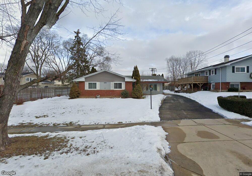
1885 Hampton Rd Hoffman Estates, IL 60169
Highlands-Schaumburg NeighborhoodEstimated Value: $382,518 - $435,000
4
Beds
3
Baths
1,567
Sq Ft
$260/Sq Ft
Est. Value
About This Home
This home is located at 1885 Hampton Rd, Hoffman Estates, IL 60169 and is currently estimated at $408,130, approximately $260 per square foot. 1885 Hampton Rd is a home located in Cook County with nearby schools including Churchill Elementary School, Dwight D Eisenhower Junior High School, and Hoffman Estates High School.
Ownership History
Date
Name
Owned For
Owner Type
Purchase Details
Closed on
Aug 24, 2005
Sold by
Donovan William R and Donovan Nanette M
Bought by
Donovan William R
Current Estimated Value
Purchase Details
Closed on
May 23, 2002
Sold by
Craig Timothy A and Lacoco Sandra D
Bought by
Donovan William R and Donovan Nanette M
Home Financials for this Owner
Home Financials are based on the most recent Mortgage that was taken out on this home.
Original Mortgage
$210,105
Interest Rate
6.87%
Mortgage Type
FHA
Purchase Details
Closed on
Oct 29, 1999
Sold by
Popek Sophie
Bought by
Craig Timothy A and Lacoco Sandra D
Home Financials for this Owner
Home Financials are based on the most recent Mortgage that was taken out on this home.
Original Mortgage
$166,515
Interest Rate
7.72%
Create a Home Valuation Report for This Property
The Home Valuation Report is an in-depth analysis detailing your home's value as well as a comparison with similar homes in the area
Home Values in the Area
Average Home Value in this Area
Purchase History
| Date | Buyer | Sale Price | Title Company |
|---|---|---|---|
| Donovan William R | -- | None Available | |
| Donovan William R | $217,000 | -- | |
| Craig Timothy A | $168,000 | -- |
Source: Public Records
Mortgage History
| Date | Status | Borrower | Loan Amount |
|---|---|---|---|
| Previous Owner | Donovan William R | $210,105 | |
| Previous Owner | Craig Timothy A | $166,515 |
Source: Public Records
Tax History
| Year | Tax Paid | Tax Assessment Tax Assessment Total Assessment is a certain percentage of the fair market value that is determined by local assessors to be the total taxable value of land and additions on the property. | Land | Improvement |
|---|---|---|---|---|
| 2025 | $7,493 | $36,000 | $7,127 | $28,873 |
| 2024 | $7,493 | $27,734 | $6,109 | $21,625 |
| 2023 | $7,221 | $27,734 | $6,109 | $21,625 |
| 2022 | $7,221 | $27,734 | $6,109 | $21,625 |
| 2021 | $6,484 | $22,684 | $5,854 | $16,830 |
| 2020 | $6,407 | $22,684 | $5,854 | $16,830 |
| 2019 | $6,294 | $24,928 | $5,854 | $19,074 |
| 2018 | $6,692 | $23,958 | $4,835 | $19,123 |
| 2017 | $6,592 | $23,958 | $4,835 | $19,123 |
| 2016 | $6,394 | $23,958 | $4,835 | $19,123 |
| 2015 | $6,055 | $21,476 | $4,072 | $17,404 |
| 2014 | $5,966 | $21,476 | $4,072 | $17,404 |
| 2013 | $5,794 | $21,476 | $4,072 | $17,404 |
Source: Public Records
Map
Nearby Homes
- 347 Arbor Glen Blvd
- 1935 Larchmont Rd
- 1625 Dennison Rd
- 1750 Sleepy Hollow Ct Unit 3
- 1570 Jefferson Rd
- 75 Kristin Cir Unit 123
- 132 White Oak Ct Unit 5
- 1335 Gentry Rd
- 1418 Bladon Rd
- 755 Cambridge Ln
- 1095 Lancaster Ct
- 1980 Chippendale Rd
- 555 Heritage Dr Unit 315
- 1180 Meadow Ln Unit 6306
- 720 Hill Dr Unit 8303
- 730 Hill Dr Unit 9205
- 988 Butter Creek Ct Unit 4ND
- 600 Mesa Dr Unit 103
- 368 Willow Tree Ct
- 1045 Higgins Quarters Dr Unit 4-101
- 1865 Hampton Rd
- 475 W Newport Rd
- 495 W Newport Rd
- 1835 Hampton Rd
- 505 Jamison Ln
- 1920 Hampton Rd
- 445 W Newport Rd
- 1815 Hampton Rd
- 515 Jamison Ln
- 1950 Hampton Rd
- 435 W Newport Rd
- 546 Hillcrest Blvd
- 470 W Newport Rd
- 490 W Newport Rd
- 1805 Hampton Rd
- 525 Jamison Ln
- 460 W Newport Rd
- 550 Hillcrest Blvd
- 510 Jamison Ln
- 415 W Newport Rd
Your Personal Tour Guide
Ask me questions while you tour the home.