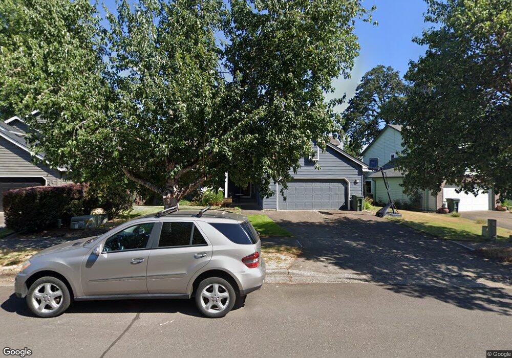
1885 Primrose Ln Forest Grove, OR 97116
Estimated Value: $579,000 - $645,000
5
Beds
3
Baths
2,415
Sq Ft
$250/Sq Ft
Est. Value
About This Home
This home is located at 1885 Primrose Ln, Forest Grove, OR 97116 and is currently estimated at $602,875, approximately $249 per square foot. 1885 Primrose Ln is a home located in Washington County with nearby schools including Harvey Clarke Elementary School, Tom McCall Upper Elementary School, and Neil Armstrong Middle School.
Ownership History
Date
Name
Owned For
Owner Type
Purchase Details
Closed on
Aug 23, 2005
Sold by
Smith Michael P and Smith Laura R
Bought by
Kennedy Dean A and Kennedy Anne L
Current Estimated Value
Home Financials for this Owner
Home Financials are based on the most recent Mortgage that was taken out on this home.
Original Mortgage
$165,000
Interest Rate
5.61%
Mortgage Type
Unknown
Purchase Details
Closed on
Nov 7, 2001
Sold by
Pitt Munro W and Pitt Sheryl G
Bought by
Smith Michael P and Smith Laura R
Home Financials for this Owner
Home Financials are based on the most recent Mortgage that was taken out on this home.
Original Mortgage
$216,505
Interest Rate
6.73%
Purchase Details
Closed on
May 21, 1996
Sold by
Chart Development Corp
Bought by
Pitt Munro W and Pitt Sheryl G
Home Financials for this Owner
Home Financials are based on the most recent Mortgage that was taken out on this home.
Original Mortgage
$167,600
Interest Rate
6.25%
Create a Home Valuation Report for This Property
The Home Valuation Report is an in-depth analysis detailing your home's value as well as a comparison with similar homes in the area
Home Values in the Area
Average Home Value in this Area
Purchase History
| Date | Buyer | Sale Price | Title Company |
|---|---|---|---|
| Kennedy Dean A | $315,000 | Chicago Title Insurance Comp | |
| Smith Michael P | $227,900 | Chicago Title Insurance Co | |
| Pitt Munro W | $209,500 | Ticor Title Insurance |
Source: Public Records
Mortgage History
| Date | Status | Borrower | Loan Amount |
|---|---|---|---|
| Closed | Kennedy Dean A | $165,000 | |
| Previous Owner | Smith Michael P | $216,505 | |
| Previous Owner | Pitt Munro W | $167,600 |
Source: Public Records
Tax History Compared to Growth
Tax History
| Year | Tax Paid | Tax Assessment Tax Assessment Total Assessment is a certain percentage of the fair market value that is determined by local assessors to be the total taxable value of land and additions on the property. | Land | Improvement |
|---|---|---|---|---|
| 2026 | $5,937 | $333,410 | -- | -- |
| 2025 | $5,937 | $323,700 | -- | -- |
| 2024 | $5,728 | $314,280 | -- | -- |
| 2023 | $5,728 | $305,130 | $0 | $0 |
| 2022 | $5,008 | $305,130 | $0 | $0 |
| 2021 | $4,944 | $287,630 | $0 | $0 |
| 2020 | $4,917 | $279,260 | $0 | $0 |
| 2019 | $4,807 | $271,130 | $0 | $0 |
| 2018 | $4,660 | $263,240 | $0 | $0 |
| 2017 | $4,516 | $255,580 | $0 | $0 |
| 2016 | $4,389 | $248,140 | $0 | $0 |
| 2015 | $4,220 | $240,920 | $0 | $0 |
| 2014 | $4,200 | $233,910 | $0 | $0 |
Source: Public Records
Map
Nearby Homes
- 3300 N Main St Unit 110
- 2106 Charlie Ct
- 1425 Willamina Ave
- 3522 Arleen Ct
- 1815 35th Ave
- 1611 Camino Dr
- 2081 Silverstone Dr
- 1609 Camino Dr
- 3594 Ash St Unit Lot 25
- 1224 Alyssum Ave
- 2251 27th Ave
- 2035 35th Ave
- 2043 35th Ave
- 2091 35th Ave
- 2180 36th Ave
- 2150 36th Ave
- 2130 36th Ave
- 2120 36th Ave
- 2160 36th Ave
- 3605 Main St
- 1879 Primrose Ln
- 1891 Primrose Ln
- 1873 Primrose Ln
- 1897 Primrose Ln
- 1890 Primrose Ln
- 1874 Primrose Ln
- 1903 Primrose Ln
- 1861 Primrose Ln
- 1866 Primrose Ln
- 1867 Primrose Ln
- 1853 Primrose Ln
- 3056 Concord Way
- 1858 Primrose Ln
- 3048 Concord Way
- 1845 Primrose Ln
- 1850 Primrose Ln
- 1915 Primrose Ln
- 3213 Aspenwood Place
- 1837 Primrose Ln
- 3032 Concord Way