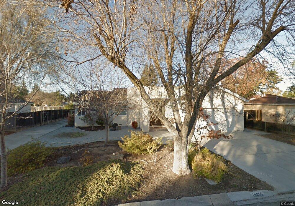
18859 Mcfarland Ave Saratoga, CA 95070
Quito Village NeighborhoodEstimated Value: $3,277,000 - $3,871,000
4
Beds
3
Baths
944
Sq Ft
$3,723/Sq Ft
Est. Value
About This Home
This home is located at 18859 Mcfarland Ave, Saratoga, CA 95070 and is currently estimated at $3,514,170, approximately $3,722 per square foot. 18859 Mcfarland Ave is a home located in Santa Clara County with nearby schools including Westmont High School, Forest Hill Elementary School, and Marshall Lane Elementary School.
Ownership History
Date
Name
Owned For
Owner Type
Purchase Details
Closed on
Mar 25, 2015
Sold by
Lemen James Randall and Lemen Julie Ann
Bought by
The Lemen Family Trust and Lemen Julie Ann
Current Estimated Value
Home Financials for this Owner
Home Financials are based on the most recent Mortgage that was taken out on this home.
Original Mortgage
$1,000,000
Outstanding Balance
$768,155
Interest Rate
3.76%
Mortgage Type
New Conventional
Estimated Equity
$2,746,015
Purchase Details
Closed on
Jan 23, 2008
Sold by
Lemen James Randall and Lemen Julie Ann
Bought by
Lemen James Randall and Lemen Julie Ann
Purchase Details
Closed on
May 13, 2005
Sold by
Togami James L and Togami Gale N
Bought by
Lemen James Randall and Lemen Julie Ann
Home Financials for this Owner
Home Financials are based on the most recent Mortgage that was taken out on this home.
Original Mortgage
$650,000
Interest Rate
5.37%
Mortgage Type
Purchase Money Mortgage
Purchase Details
Closed on
Jul 29, 1997
Sold by
Shoffner Seremitar
Bought by
Togami James L and Togami Gale N
Home Financials for this Owner
Home Financials are based on the most recent Mortgage that was taken out on this home.
Original Mortgage
$312,000
Interest Rate
7.58%
Purchase Details
Closed on
Jun 4, 1997
Sold by
Donaldson Judith A
Bought by
Shoffner Michael J and Shoffner Paige J
Home Financials for this Owner
Home Financials are based on the most recent Mortgage that was taken out on this home.
Original Mortgage
$312,000
Interest Rate
7.58%
Purchase Details
Closed on
Jul 31, 1995
Sold by
Donaldson Judith A
Bought by
Donaldson Judith A
Home Financials for this Owner
Home Financials are based on the most recent Mortgage that was taken out on this home.
Original Mortgage
$203,150
Interest Rate
7.62%
Create a Home Valuation Report for This Property
The Home Valuation Report is an in-depth analysis detailing your home's value as well as a comparison with similar homes in the area
Home Values in the Area
Average Home Value in this Area
Purchase History
| Date | Buyer | Sale Price | Title Company |
|---|---|---|---|
| The Lemen Family Trust | -- | First American Title Company | |
| Lemen James Randall | -- | First American Title Company | |
| Lemen James Randall | -- | None Available | |
| Lemen James Randall | -- | Old Republic Title Company | |
| Togami James L | $390,000 | Commonwealth Land Title Co | |
| Shoffner Seremitar | -- | Commonwealth Land Title Co | |
| Shoffner Michael J | $305,000 | Commonwealth Land Title Co | |
| Donaldson Judith A | $60,000 | Chicago Title |
Source: Public Records
Mortgage History
| Date | Status | Borrower | Loan Amount |
|---|---|---|---|
| Open | Lemen James Randall | $1,000,000 | |
| Closed | Lemen James Randall | $650,000 | |
| Previous Owner | Togami James L | $312,000 | |
| Previous Owner | Shoffner Michael J | $228,750 | |
| Previous Owner | Donaldson Judith A | $203,150 |
Source: Public Records
Tax History Compared to Growth
Tax History
| Year | Tax Paid | Tax Assessment Tax Assessment Total Assessment is a certain percentage of the fair market value that is determined by local assessors to be the total taxable value of land and additions on the property. | Land | Improvement |
|---|---|---|---|---|
| 2025 | $20,842 | $1,715,138 | $1,184,820 | $530,318 |
| 2024 | $20,842 | $1,681,509 | $1,161,589 | $519,920 |
| 2023 | $19,930 | $1,597,539 | $1,138,813 | $458,726 |
| 2022 | $19,744 | $1,566,216 | $1,116,484 | $449,732 |
| 2021 | $19,436 | $1,535,507 | $1,094,593 | $440,914 |
| 2020 | $19,047 | $1,519,763 | $1,083,370 | $436,393 |
| 2019 | $18,778 | $1,489,965 | $1,062,128 | $427,837 |
| 2018 | $18,348 | $1,460,751 | $1,041,302 | $419,449 |
| 2017 | $17,469 | $1,380,660 | $1,020,885 | $359,775 |
| 2016 | $15,334 | $1,259,913 | $1,000,868 | $259,045 |
| 2015 | $15,096 | $1,240,989 | $985,835 | $255,154 |
| 2014 | $14,630 | $1,216,680 | $966,524 | $250,156 |
Source: Public Records
Map
Nearby Homes
- 10730 Elm Cir Unit 86-17 Plan 2
- 11010 Maple Place Unit 25-06 Plan 4
- 10750 Elm Cir Unit 88-17 Plan 2
- 11645 Redwood Place Unit 56-12 Plan 4
- 11040 Maple Place Unit 28-06 Plan 2
- 10330 Elm Cir Unit 12-03 Plan 2
- 11050 Maple Place Unit 29-06 Plan 3
- 11115 Maple Place Unit 30-07
- 11125 Maple Place Unit 31-07 Plan 2
- 11145 Maple Place Unit 33-07 Plan 2
- 11155 Maple Place Unit 34-07 Plan 3
- 11210 Cottonwood Place Unit 35-08 Plan 4
- 11220 Cottonwood Place Unit 36-08 Plan 2
- 11240 Cottonwood Place Unit 38-08 Plan 3
- 11315 Cottonwood Place Unit 39-09 Plan 3
- 18677 Mccoy Ave
- 13446 Alvarado Ct
- 19113 Vineyard Ln
- 19423 Vineyard Ln
- 13550 Myren Dr
- 18873 Mcfarland Ave
- 18845 Mcfarland Ave
- 18858 Devon Ave
- 18844 Devon Ave
- 18838 Devon Ave
- 18872 Devon Ave
- 18831 Mcfarland Ave
- 18887 Mcfarland Ave
- 18858 Mcfarland Ave
- 18886 Devon Ave
- 18830 Devon Ave
- 18844 Mcfarland Ave
- 18817 Mcfarland Ave
- 13090 Heath St
- 18830 Mcfarland Ave
- 18900 Devon Ave
- 18816 Devon Ave
- 13075 Heath St
- 18859 Devon Ave
- 18900 Mcfarland Ave