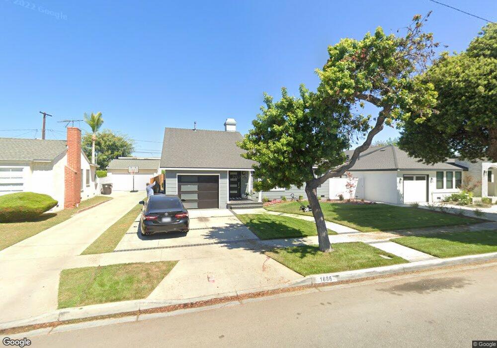
1886 Litchfield Ave Long Beach, CA 90815
Los Altos South NeighborhoodEstimated Value: $1,094,000 - $1,306,000
3
Beds
2
Baths
1,874
Sq Ft
$648/Sq Ft
Est. Value
About This Home
This home is located at 1886 Litchfield Ave, Long Beach, CA 90815 and is currently estimated at $1,214,861, approximately $648 per square foot. 1886 Litchfield Ave is a home located in Los Angeles County with nearby schools including Bixby Elementary School, Stanford Middle School, and Woodrow Wilson High School.
Ownership History
Date
Name
Owned For
Owner Type
Purchase Details
Closed on
Feb 5, 2024
Sold by
Dent Ricky and Dent Stacy
Bought by
Dent Family Trust and Dent
Current Estimated Value
Purchase Details
Closed on
Sep 29, 2003
Sold by
Dent Ricky and Dent Stacy Panfilio
Bought by
Dent Ricky
Home Financials for this Owner
Home Financials are based on the most recent Mortgage that was taken out on this home.
Original Mortgage
$441,000
Interest Rate
6.4%
Mortgage Type
Construction
Create a Home Valuation Report for This Property
The Home Valuation Report is an in-depth analysis detailing your home's value as well as a comparison with similar homes in the area
Home Values in the Area
Average Home Value in this Area
Purchase History
| Date | Buyer | Sale Price | Title Company |
|---|---|---|---|
| Dent Family Trust | -- | None Listed On Document | |
| Dent Ricky | -- | Fidelity National Title Co |
Source: Public Records
Mortgage History
| Date | Status | Borrower | Loan Amount |
|---|---|---|---|
| Previous Owner | Dent Ricky | $441,000 |
Source: Public Records
Tax History Compared to Growth
Tax History
| Year | Tax Paid | Tax Assessment Tax Assessment Total Assessment is a certain percentage of the fair market value that is determined by local assessors to be the total taxable value of land and additions on the property. | Land | Improvement |
|---|---|---|---|---|
| 2025 | $4,997 | $374,827 | $241,141 | $133,686 |
| 2024 | $4,997 | $367,478 | $236,413 | $131,065 |
| 2023 | $4,913 | $360,274 | $231,778 | $128,496 |
| 2022 | $4,615 | $353,211 | $227,234 | $125,977 |
| 2021 | $4,516 | $346,286 | $222,779 | $123,507 |
| 2019 | $4,450 | $336,017 | $216,172 | $119,845 |
| 2018 | $4,310 | $329,430 | $211,934 | $117,496 |
| 2016 | $3,956 | $316,640 | $203,705 | $112,935 |
| 2015 | $3,801 | $311,885 | $200,646 | $111,239 |
| 2014 | $3,777 | $305,776 | $196,716 | $109,060 |
Source: Public Records
Map
Nearby Homes
- 1881 Tulane Ave
- 5200 E Atherton St Unit 108
- 5449 E Fairbrook St
- 1430 La Perla Ave
- 1949 Chatwin Ave
- 1425 La Perla Ave
- 1645 Clark Ave Unit 115
- 1655 Clark Ave Unit 324
- 2158 Rutgers Ave
- 5025 E Los Coyotes Diagonal
- 1770 Ximeno Ave Unit 314
- 4841 E Los Coyotes Diagonal
- 1425 Park Ave
- 2221 Granada Ave
- 1251 Bryant Rd
- 1424 Roycroft Ave
- 1210 Los Altos Ave
- 4701 E Anaheim St Unit 304
- 1849 Fanwood Ave
- 2038 San Vicente Ave
- 1880 Litchfield Ave
- 1892 Litchfield Ave
- 1933 Tulane Ave
- 1874 Litchfield Ave
- 1902 Litchfield Ave
- 1941 Tulane Ave
- 1925 Tulane Ave
- 1882 Ashbrook Ave
- 1949 Tulane Ave
- 1917 Tulane Ave
- 1868 Litchfield Ave
- 1908 Litchfield Ave
- 1951 Tulane Ave
- 1869 Litchfield Ave
- 1909 Tulane Ave
- 1874 Ashbrook Ave
- 1889 Ashbrook Ave
- 1862 Litchfield Ave
- 1916 Litchfield Ave
- 1965 Tulane Ave