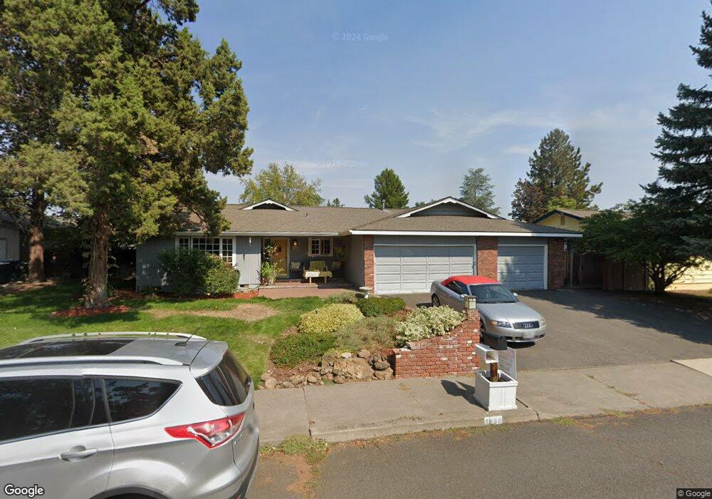
1886 NE Snowbird Ct Bend, OR 97701
Mountain View NeighborhoodEstimated Value: $663,000 - $695,642
4
Beds
2
Baths
1,954
Sq Ft
$346/Sq Ft
Est. Value
About This Home
This home is located at 1886 NE Snowbird Ct, Bend, OR 97701 and is currently estimated at $675,911, approximately $345 per square foot. 1886 NE Snowbird Ct is a home located in Deschutes County with nearby schools including Juniper Elementary School, Bend Senior High School, and Eastmont Community School.
Ownership History
Date
Name
Owned For
Owner Type
Purchase Details
Closed on
Apr 12, 2011
Sold by
Fannie Mae
Bought by
Shelden Charles D
Current Estimated Value
Home Financials for this Owner
Home Financials are based on the most recent Mortgage that was taken out on this home.
Original Mortgage
$120,000
Interest Rate
4.83%
Mortgage Type
New Conventional
Purchase Details
Closed on
Dec 28, 2010
Sold by
Frantz Linda D and Frantz David P
Bought by
Federal National Mortgage Association
Create a Home Valuation Report for This Property
The Home Valuation Report is an in-depth analysis detailing your home's value as well as a comparison with similar homes in the area
Home Values in the Area
Average Home Value in this Area
Purchase History
| Date | Buyer | Sale Price | Title Company |
|---|---|---|---|
| Shelden Charles D | $160,000 | Amerititle | |
| Federal National Mortgage Association | $332,805 | Accommodation |
Source: Public Records
Mortgage History
| Date | Status | Borrower | Loan Amount |
|---|---|---|---|
| Closed | Shelden Charles D | $120,000 |
Source: Public Records
Tax History Compared to Growth
Tax History
| Year | Tax Paid | Tax Assessment Tax Assessment Total Assessment is a certain percentage of the fair market value that is determined by local assessors to be the total taxable value of land and additions on the property. | Land | Improvement |
|---|---|---|---|---|
| 2025 | $4,777 | $314,290 | -- | -- |
| 2024 | $4,596 | $305,140 | -- | -- |
| 2023 | $4,261 | $296,260 | $0 | $0 |
| 2022 | $3,975 | $279,270 | $0 | $0 |
| 2021 | $3,981 | $271,140 | $0 | $0 |
| 2020 | $3,777 | $271,140 | $0 | $0 |
| 2019 | $3,672 | $263,250 | $0 | $0 |
| 2018 | $3,568 | $255,590 | $0 | $0 |
| 2017 | $3,464 | $248,150 | $0 | $0 |
| 2016 | $3,303 | $240,930 | $0 | $0 |
| 2015 | $3,212 | $233,920 | $0 | $0 |
| 2014 | $3,117 | $227,110 | $0 | $0 |
Source: Public Records
Map
Nearby Homes
- 1687 NE Lotus Dr
- 1419 NE Lucinda Ct
- 1767 NE Lotus Dr Unit 1 and 2
- 1072 NE Parkview Ct
- 2025 NE Neil Way
- 2011 NE Neil Way
- 2026 NE Neil Way
- 2101 NE Holliday Ave
- 1622 NE Parkridge Dr
- 1848 NE 14th St
- 1630 NE 13th St
- 940 NE Purcell Blvd
- 1333 NE Dempsey Dr
- 940 NE Paula Dr Unit 21
- 2508 NE Buckwheat Ct
- 2382 NE Jackson Ave
- 2224 NE Indigo Ln
- 2394 NE Crocus Way
- 2574 NE Robinson St
- 2254 NE Indigo Ln
- 1685 NE Cliff Dr
- 1876 NE Snowbird Ct
- 1717 NE Cliff Dr
- 1745 NE Cliff Dr
- 1891 NE Snowbird Ct
- 1881 NE Snowbird Ct
- 1870 NE Snowbird Ct
- 1863 NE Moonglow Ct
- 1863 NE Moonglow Way
- 1865 NE Snowbird Ct
- 1863 NE Moonglow Ct
- 1680 NE Cliff Dr
- 1881 NE Moonglow Way
- 1631 NE Cliff Dr
- 1704 NE Cliff Dr
- 1730 NE Cliff Dr
- 1836 NE Kristi Ct
- 1752 NE Cliff Dr
- 1843 NE Kristi Ct