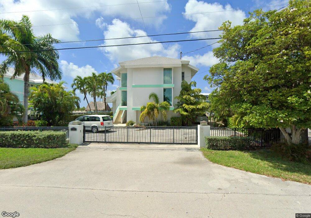
189 Atlantic Blvd Key Largo, FL 33037
Estimated Value: $1,316,000 - $2,490,000
6
Beds
6
Baths
4,841
Sq Ft
$409/Sq Ft
Est. Value
About This Home
This home is located at 189 Atlantic Blvd, Key Largo, FL 33037 and is currently estimated at $1,978,667, approximately $408 per square foot. 189 Atlantic Blvd is a home located in Monroe County with nearby schools including Key Largo School, Coral Shores High School, and Dolphin Montessori Children's House.
Ownership History
Date
Name
Owned For
Owner Type
Purchase Details
Closed on
Sep 24, 2020
Sold by
Karen L Mcdermit Revocable Trust and Mcdermit Dennis P
Bought by
Mcdermit Dennis P and Mcdermit Karen L
Current Estimated Value
Purchase Details
Closed on
Mar 14, 2005
Sold by
Mcdermit Dennis and Mcdermit Karen
Bought by
Mcdermit Karen L and Mcdermit Dennis P
Purchase Details
Closed on
May 1, 1985
Bought by
Mcdermit Karen L Rev Tr 03/14/2005
Create a Home Valuation Report for This Property
The Home Valuation Report is an in-depth analysis detailing your home's value as well as a comparison with similar homes in the area
Home Values in the Area
Average Home Value in this Area
Purchase History
| Date | Buyer | Sale Price | Title Company |
|---|---|---|---|
| Mcdermit Dennis P | -- | Hershoff Lupino & Yagel Llp | |
| Mcdermit Karen L | -- | -- | |
| Mcdermit Karen L Rev Tr 03/14/2005 | $315,000 | -- |
Source: Public Records
Tax History Compared to Growth
Tax History
| Year | Tax Paid | Tax Assessment Tax Assessment Total Assessment is a certain percentage of the fair market value that is determined by local assessors to be the total taxable value of land and additions on the property. | Land | Improvement |
|---|---|---|---|---|
| 2024 | $9,427 | $1,002,481 | -- | -- |
| 2023 | $9,427 | $973,283 | $0 | $0 |
| 2022 | $8,930 | $944,935 | $0 | $0 |
| 2021 | $9,049 | $917,413 | $316,406 | $601,007 |
| 2020 | $9,614 | $999,290 | $353,906 | $645,384 |
| 2019 | $9,867 | $1,028,561 | $0 | $0 |
| 2018 | $10,192 | $1,110,637 | $461,719 | $648,918 |
| 2017 | $9,930 | $1,047,799 | $0 | $0 |
| 2016 | $8,988 | $913,435 | $0 | $0 |
| 2015 | $8,066 | $703,434 | $0 | $0 |
| 2014 | $7,646 | $620,945 | $0 | $0 |
Source: Public Records
Map
Nearby Homes
- 184 Bahama Ave
- 202 Atlantic Blvd
- 238 Atlantic Blvd
- 131 Marina Ave
- 71 Coral Dr
- 162 Marina Ave
- 392 Laguna Ave
- 201 Wildwood Cir
- 68 Seagate Blvd
- 210 Wildwood Cir
- 45 Coral Dr
- 81 Marina Ave
- 215 Wildwood Cir
- 505 Caribbean Dr
- 60 Bahama Ave
- 30 Ocean Front Dr
- 20 Coral Dr
- 16 N Channel Dr
- 119 Poinciana Dr
- 109 Jasmine Dr
- 188 Atlantic Blvd Unit C
- 188 Atlantic Blvd Unit B
- 188 Atlantic Blvd
- 190 Atlantic Blvd
- 191 Atlantic Blvd
- 253 Atlantic Blvd
- 251 Atlantic Blvd
- 252 Atlantic Blvd
- 250 Atlantic Blvd
- 185 Bahama Ave
- 192 Atlantic Blvd
- 186 Bahama Ave
- 186 Atlantic Blvd
- 187 Atlantic Blvd
- 187 Atlantic Blvd
- 249 Atlantic Blvd
- 249 Atlantic Blvd
- 254 Atlantic Blvd
- 193 Atlantic Blvd
- 183 Bahama Ave