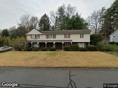
189 Braeburn Rd East Longmeadow, MA 01028
Estimated Value: $400,601 - $460,000
4
Beds
2
Baths
2,914
Sq Ft
$150/Sq Ft
Est. Value
About This Home
This home is located at 189 Braeburn Rd, East Longmeadow, MA 01028 and is currently estimated at $435,900, approximately $149 per square foot. 189 Braeburn Rd is a home located in Hampden County with nearby schools including Meadowbrook Elementary School, Birchland Park Middle School, and East Longmeadow High School.
Ownership History
Date
Name
Owned For
Owner Type
Purchase Details
Closed on
Feb 28, 2002
Sold by
Zak Rafail and Zak Bela
Bought by
Fondon Tommy L and Fondon Janine
Current Estimated Value
Home Financials for this Owner
Home Financials are based on the most recent Mortgage that was taken out on this home.
Original Mortgage
$164,250
Interest Rate
6.85%
Mortgage Type
Purchase Money Mortgage
Create a Home Valuation Report for This Property
The Home Valuation Report is an in-depth analysis detailing your home's value as well as a comparison with similar homes in the area
Home Values in the Area
Average Home Value in this Area
Purchase History
| Date | Buyer | Sale Price | Title Company |
|---|---|---|---|
| Fondon Tommy L | $182,500 | -- |
Source: Public Records
Mortgage History
| Date | Status | Borrower | Loan Amount |
|---|---|---|---|
| Open | Fondon Janine | $34,000 | |
| Open | Fondon Janine | $70,000 | |
| Open | Fondon Janine | $154,000 | |
| Closed | Zak Rafail | $164,250 | |
| Previous Owner | Zak Rafail | $75,000 |
Source: Public Records
Tax History Compared to Growth
Tax History
| Year | Tax Paid | Tax Assessment Tax Assessment Total Assessment is a certain percentage of the fair market value that is determined by local assessors to be the total taxable value of land and additions on the property. | Land | Improvement |
|---|---|---|---|---|
| 2025 | $5,681 | $307,400 | $84,200 | $223,200 |
| 2024 | $5,406 | $291,600 | $84,200 | $207,400 |
| 2023 | $5,144 | $267,900 | $76,500 | $191,400 |
| 2022 | $5,010 | $246,900 | $69,500 | $177,400 |
| 2021 | $4,955 | $235,300 | $64,400 | $170,900 |
| 2020 | $4,837 | $232,100 | $64,400 | $167,700 |
| 2019 | $2,082 | $226,100 | $62,500 | $163,600 |
| 2018 | $4,745 | $226,600 | $62,500 | $164,100 |
| 2017 | $4,584 | $220,700 | $59,400 | $161,300 |
| 2016 | $4,727 | $223,800 | $64,000 | $159,800 |
| 2015 | $4,637 | $223,800 | $64,000 | $159,800 |
Source: Public Records
Map
Nearby Homes
- 277 Dwight Rd
- 141 Cooper St
- 40 Fenimore Blvd
- 0 Donald Ave
- 112 Entrybrook Dr
- 106 Hartwick St
- 26 Dwight Rd
- 3 Birch Ave
- 6 Rosemont St
- 93 Crestmont St
- 0 Niagara St
- 84 Eleanor Rd
- 53 Gail St
- 69 Bassing St
- 90 Westwood Ave
- 235 Dorset St
- 302 W Allen Ridge Rd
- 0 Carver St Unit 73334545
- 33 Taber St
- 101 Melwood Ave
- 189 Braeburn Rd
- 183 Braeburn Rd
- 3 Holy Cross Cir
- 76 Admiral St
- 47 Tufts St
- 195 Braeburn Rd
- 4 Princeton St
- 36-37 Tufts Rd & Channing Rd
- 4 Holy Cross Cir
- 48 Tufts St
- 58 Tufts St
- 57 Tufts Rd
- 84 Admiral St
- 48 Tufts St
- 53 Tufts St
- 36 Tufts St
- 9 Holy Cross Cir
- 201 Braeburn Rd
- 175 Braeburn Rd
- 8 Princeton St