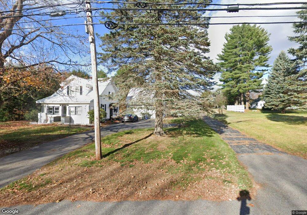
189 Conant St Westbrook, ME 04092
Estimated Value: $324,000 - $453,000
2
Beds
1
Bath
1,092
Sq Ft
$358/Sq Ft
Est. Value
About This Home
This home is located at 189 Conant St, Westbrook, ME 04092 and is currently estimated at $390,553, approximately $357 per square foot. 189 Conant St is a home located in Cumberland County with nearby schools including Westbrook High School, The Little Dolphin School Foundation, and Breakwater School.
Ownership History
Date
Name
Owned For
Owner Type
Purchase Details
Closed on
Jul 19, 2019
Sold by
Roberts Ann M and Roberts Peter J
Bought by
Studley Joslynn M and Barrows Tyler T
Current Estimated Value
Home Financials for this Owner
Home Financials are based on the most recent Mortgage that was taken out on this home.
Original Mortgage
$231,725
Outstanding Balance
$203,012
Interest Rate
3.82%
Mortgage Type
FHA
Estimated Equity
$187,541
Purchase Details
Closed on
May 31, 2019
Sold by
Roberts Ann M and Roberts Peter J
Bought by
Roberts Peter J and Roberts Ann M
Home Financials for this Owner
Home Financials are based on the most recent Mortgage that was taken out on this home.
Original Mortgage
$231,725
Outstanding Balance
$203,012
Interest Rate
3.82%
Mortgage Type
FHA
Estimated Equity
$187,541
Purchase Details
Closed on
Sep 6, 2011
Sold by
Finnerty Dawn E and Finnerty Richard
Bought by
Roberts Ann M and Roberts Peter J
Home Financials for this Owner
Home Financials are based on the most recent Mortgage that was taken out on this home.
Original Mortgage
$145,000
Interest Rate
4.52%
Mortgage Type
Purchase Money Mortgage
Create a Home Valuation Report for This Property
The Home Valuation Report is an in-depth analysis detailing your home's value as well as a comparison with similar homes in the area
Home Values in the Area
Average Home Value in this Area
Purchase History
| Date | Buyer | Sale Price | Title Company |
|---|---|---|---|
| Studley Joslynn M | -- | -- | |
| Roberts Peter J | -- | -- | |
| Roberts Ann M | -- | -- |
Source: Public Records
Mortgage History
| Date | Status | Borrower | Loan Amount |
|---|---|---|---|
| Open | Studley Joslynn M | $231,725 | |
| Previous Owner | Roberts Ann M | $145,000 |
Source: Public Records
Tax History
| Year | Tax Paid | Tax Assessment Tax Assessment Total Assessment is a certain percentage of the fair market value that is determined by local assessors to be the total taxable value of land and additions on the property. | Land | Improvement |
|---|---|---|---|---|
| 2023 | $4,450 | $266,800 | $91,200 | $175,600 |
| 2022 | $4,040 | $223,200 | $76,200 | $147,000 |
| 2021 | $3,980 | $223,200 | $76,200 | $147,000 |
| 2020 | $3,986 | $223,200 | $76,200 | $147,000 |
| 2019 | $3,986 | $223,200 | $76,200 | $147,000 |
| 2018 | $4,017 | $206,900 | $75,300 | $131,600 |
| 2017 | $3,906 | $206,900 | $75,300 | $131,600 |
| 2016 | $3,807 | $206,900 | $75,300 | $131,600 |
| 2015 | $3,716 | $206,900 | $75,300 | $131,600 |
| 2014 | $3,559 | $206,900 | $75,300 | $131,600 |
| 2013 | $3,559 | $206,900 | $75,300 | $131,600 |
Source: Public Records
Map
Nearby Homes
- 50 Hogan Cir Unit 2
- 30 Lincoln St Unit 213
- 30 Lincoln St Unit 220
- 10 Hogan Cir Unit 35
- 32 Kennard St
- 4 Longfellow Dr
- 36 Arlington Ave
- 17 Mechanic St
- 115 Saco St Unit 4
- 132 North St
- 77 Mechanic St
- 18 Cole St
- 25 Cole St Unit 2
- 78 North St
- 26 Stillwater Dr Unit 26
- 26 King St Unit 1
- 21 Clover Ln Unit 109
- 21 Clover Ln Unit 210
- 21 Clover Ln Unit 306
- 21 Clover Ln Unit 112
- 173 Conant St
- 180 Conant St
- 213 Conant St
- 00 Conant St
- 161 Conant St
- 219 Conant St
- 156 Conant St
- 156 Lot A Conant St
- 220 Conant St
- 227 Conant St
- 148 Conant St
- 153 Conant St
- 243 Conant St Unit 12
- 243 Conant St Unit 11
- 243 Conant St Unit 10
- 243 Conant St Unit 9
- 243 Conant St Unit 8
- 243 Conant St Unit 7
- 243 Conant St Unit 6
- 243 Conant St Unit 5
Your Personal Tour Guide
Ask me questions while you tour the home.