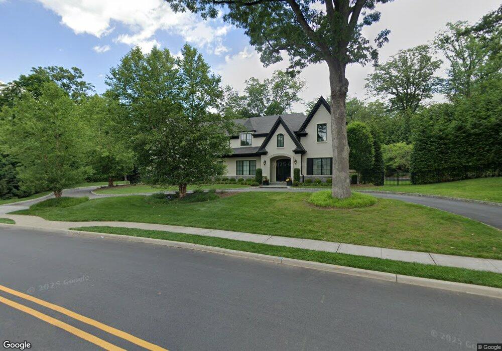
189 Highwood Ave Tenafly, NJ 07670
Estimated Value: $2,868,000 - $3,636,000
5
Beds
6
Baths
4,808
Sq Ft
$671/Sq Ft
Est. Value
About This Home
This home is located at 189 Highwood Ave, Tenafly, NJ 07670 and is currently estimated at $3,227,243, approximately $671 per square foot. 189 Highwood Ave is a home located in Bergen County with nearby schools including Tenafly Middle School, Tenafly High School, and Academy of Our Lady of Mount Carmel.
Ownership History
Date
Name
Owned For
Owner Type
Purchase Details
Closed on
Sep 11, 2017
Sold by
Quantum Development Group Iii Llc
Bought by
Yu Heng and Shen Tong
Current Estimated Value
Purchase Details
Closed on
Oct 20, 2014
Sold by
Silverman Kurtz Carol A
Bought by
Quantum Development Group Iii Llc
Purchase Details
Closed on
Jan 19, 2014
Sold by
Kurtz Barry
Bought by
Kurtz Carol Silverman
Purchase Details
Closed on
Jul 28, 2006
Sold by
Joseph A Silverman Trustee
Bought by
Kurtz Barry and Kurtz Carol A Silverman
Purchase Details
Closed on
Oct 9, 2002
Sold by
Estate Of Florence Silverman
Bought by
Florence Silverman Family Part
Create a Home Valuation Report for This Property
The Home Valuation Report is an in-depth analysis detailing your home's value as well as a comparison with similar homes in the area
Home Values in the Area
Average Home Value in this Area
Purchase History
| Date | Buyer | Sale Price | Title Company |
|---|---|---|---|
| Yu Heng | $2,500,000 | None Available | |
| Quantum Development Group Iii Llc | $1,005,000 | None Available | |
| Kurtz Carol Silverman | -- | None Available | |
| Kurtz Barry | $325,000 | -- | |
| Kurtz Carol A Silverman | -- | -- | |
| Florence Silverman Family Part | -- | -- |
Source: Public Records
Tax History Compared to Growth
Tax History
| Year | Tax Paid | Tax Assessment Tax Assessment Total Assessment is a certain percentage of the fair market value that is determined by local assessors to be the total taxable value of land and additions on the property. | Land | Improvement |
|---|---|---|---|---|
| 2025 | $61,613 | $2,168,700 | $793,200 | $1,375,500 |
| 2024 | $60,116 | $2,168,700 | $793,200 | $1,375,500 |
| 2023 | $58,663 | $2,168,700 | $793,200 | $1,375,500 |
| 2022 | $58,663 | $2,168,700 | $793,200 | $1,375,500 |
| 2021 | $57,622 | $2,168,700 | $793,200 | $1,375,500 |
| 2020 | $56,777 | $2,168,700 | $793,200 | $1,375,500 |
| 2019 | $55,779 | $2,168,700 | $793,200 | $1,375,500 |
| 2018 | $54,501 | $2,152,500 | $793,200 | $1,359,300 |
| 2017 | $20,012 | $793,200 | $793,200 | $0 |
| 2016 | $19,616 | $793,200 | $793,200 | $0 |
| 2015 | $23,769 | $983,000 | $793,200 | $189,800 |
| 2014 | $23,327 | $983,000 | $793,200 | $189,800 |
Source: Public Records
Map
Nearby Homes
- 5 Leslie Place
- 84 Depeyster Ave
- 67 Forest Rd
- 2 N Brae Ct
- 8 Stanton Rd
- 22 Old Smith Rd
- 109 Stonehurst Dr
- 55 Ridge Rd
- 10 Orchard Place
- 136 Stonehurst Dr
- 366 E Madison Ave
- 196 Vaccaro Dr
- 117 Truman Dr
- 149 Magnolia Ave
- 118 Hoover Dr
- 12 Westervelt Ave
- 20 Westervelt Ave
- 29 Woodland Park Dr
- 27 W Clinton Ave Unit 2-M
- 21 Crest Dr S
- 25 Homestead Rd
- 184 Highwood Ave
- 183 Highwood Ave
- 20 Homestead Rd
- 199 Highwood Ave
- 179 Highwood Ave
- 188 Highwood Ave
- 30 Homestead Rd
- 39 Homestead Rd
- 38 Glenwood Rd
- 32 Glenwood Rd
- 38 Homestead Rd
- 8 Leslie Place
- 26 Glenwood Rd
- 50 Glenwood Rd
- 207 Highwood Ave
- 47 Homestead Rd
- 1 Wilson Rd
- 48 Homestead Rd
- 22 Glenwood Rd