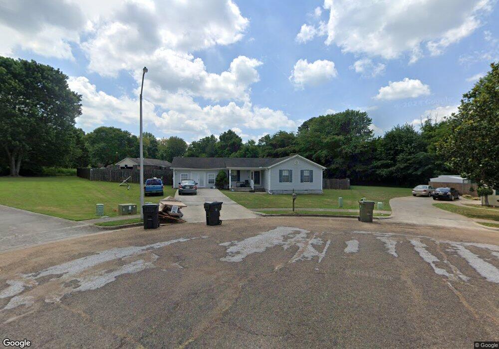
189 Pops Corner Huntsville, AL 35811
Ryland NeighborhoodEstimated Value: $272,000 - $278,023
3
Beds
2
Baths
1,652
Sq Ft
$167/Sq Ft
Est. Value
About This Home
This home is located at 189 Pops Corner, Huntsville, AL 35811 and is currently estimated at $275,756, approximately $166 per square foot. 189 Pops Corner is a home located in Madison County with nearby schools including Central School and Madison County High School.
Ownership History
Date
Name
Owned For
Owner Type
Purchase Details
Closed on
May 6, 2009
Sold by
Leslie Larry K and Leslie Hope M
Bought by
Heatherly Carrie D
Current Estimated Value
Home Financials for this Owner
Home Financials are based on the most recent Mortgage that was taken out on this home.
Original Mortgage
$142,373
Outstanding Balance
$90,003
Interest Rate
4.86%
Mortgage Type
FHA
Estimated Equity
$185,753
Purchase Details
Closed on
Sep 14, 2007
Sold by
Davenport Daniel Reid and Davenport Chastity Castell
Bought by
Leslie Larry K and Leslie Hope M
Home Financials for this Owner
Home Financials are based on the most recent Mortgage that was taken out on this home.
Original Mortgage
$128,881
Interest Rate
6.62%
Mortgage Type
FHA
Purchase Details
Closed on
Sep 1, 2006
Sold by
Casteel Michael E and Casteel Alicia D
Bought by
Davenport Daniel Reid and Davenport Chastity Casteel
Home Financials for this Owner
Home Financials are based on the most recent Mortgage that was taken out on this home.
Original Mortgage
$105,000
Interest Rate
6.67%
Mortgage Type
New Conventional
Create a Home Valuation Report for This Property
The Home Valuation Report is an in-depth analysis detailing your home's value as well as a comparison with similar homes in the area
Home Values in the Area
Average Home Value in this Area
Purchase History
| Date | Buyer | Sale Price | Title Company |
|---|---|---|---|
| Heatherly Carrie D | -- | -- | |
| Leslie Larry K | -- | -- | |
| Davenport Daniel Reid | -- | -- |
Source: Public Records
Mortgage History
| Date | Status | Borrower | Loan Amount |
|---|---|---|---|
| Open | Heatherly Carrie D | $142,373 | |
| Previous Owner | Leslie Larry K | $128,881 | |
| Previous Owner | Davenport Daniel Reid | $105,000 |
Source: Public Records
Tax History Compared to Growth
Tax History
| Year | Tax Paid | Tax Assessment Tax Assessment Total Assessment is a certain percentage of the fair market value that is determined by local assessors to be the total taxable value of land and additions on the property. | Land | Improvement |
|---|---|---|---|---|
| 2024 | $738 | $20,500 | $4,500 | $16,000 |
| 2023 | $687 | $20,500 | $4,500 | $16,000 |
| 2022 | $576 | $17,360 | $3,260 | $14,100 |
| 2021 | $467 | $14,320 | $2,500 | $11,820 |
| 2020 | $424 | $13,130 | $2,500 | $10,630 |
| 2019 | $410 | $12,740 | $2,500 | $10,240 |
| 2018 | $394 | $12,320 | $0 | $0 |
| 2017 | $383 | $12,020 | $0 | $0 |
| 2016 | $383 | $12,020 | $0 | $0 |
| 2015 | $383 | $12,020 | $0 | $0 |
| 2014 | $380 | $11,920 | $0 | $0 |
Source: Public Records
Map
Nearby Homes
- 2368 Jordan Rd
- 129 Season Ln
- 232 Pops Corner
- 105 Alice Janes Cir
- 403 Ryland Pike
- 118 Sydney St
- 104 Louise Taylor
- 908 Wess Taylor Rd
- 900 Wes Taylor Rd
- 101 Dolf Leaf Ln
- 103 Dolf Leaf Ln
- 109 Dolf Leaf Ln
- 105 Dolf Leaf Ln
- 2387 Highway 72 E
- Ionia III H Plan at Cedar Gap Estates
- Rodessa IV H Plan at Cedar Gap Estates
- Rodessa IV G Plan at Cedar Gap Estates
- Comstock III G Plan at Cedar Gap Estates
- Comstock III H Plan at Cedar Gap Estates
- Taft IV G Plan at Cedar Gap Estates
- 273 Pops Corner
- 188 Pops Corner
- 191 Pops Corner
- 2349 Jordan Rd
- 2355 Jordan Rd
- 271 Pops Corner
- 190 Pops Corner
- 269 Pops Corner
- 275 Pops Corner
- 100 Skinner Dr
- 2367 Jordan Rd Unit A
- 2367 Jordan Rd
- 276 Pops Corner
- 104 Skinner Dr
- 192 Pops Corner
- 272 Pops Corner
- 274 Pops Corner
- 106 Skinner Dr
- 270 Pops Corner
- 106 Abbottsford Rd