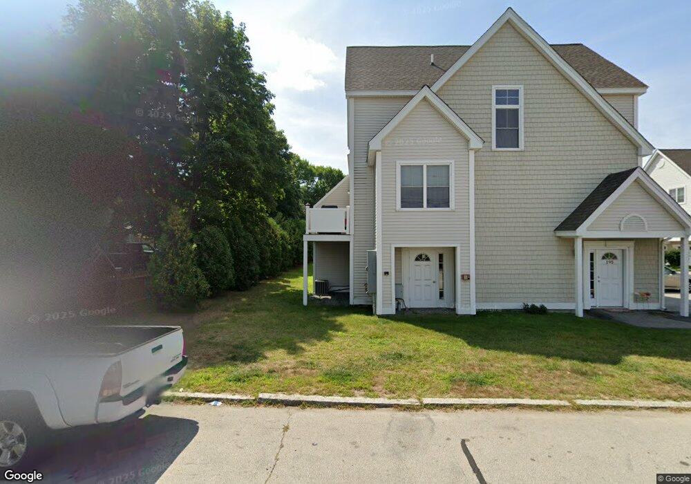
189 Silver St Unit 12 Manchester, NH 03103
Kalivas-Union NeighborhoodEstimated Value: $316,000 - $369,000
2
Beds
2
Baths
1,044
Sq Ft
$326/Sq Ft
Est. Value
About This Home
This home is located at 189 Silver St Unit 12, Manchester, NH 03103 and is currently estimated at $340,824, approximately $326 per square foot. 189 Silver St Unit 12 is a home located in Hillsborough County with nearby schools including Bakersville School, Southside Middle School, and Manchester Memorial High School.
Ownership History
Date
Name
Owned For
Owner Type
Purchase Details
Closed on
Jul 14, 2016
Sold by
Conde Naomi
Bought by
Conde Naomi and Ortiz Rafael
Current Estimated Value
Purchase Details
Closed on
May 19, 2015
Sold by
Ortiz Rafael
Bought by
Conde Naomi
Purchase Details
Closed on
May 19, 2008
Sold by
Kam Development Llc
Bought by
Ortiz Rafael and Conde Naomi
Home Financials for this Owner
Home Financials are based on the most recent Mortgage that was taken out on this home.
Original Mortgage
$135,920
Interest Rate
5.91%
Create a Home Valuation Report for This Property
The Home Valuation Report is an in-depth analysis detailing your home's value as well as a comparison with similar homes in the area
Home Values in the Area
Average Home Value in this Area
Purchase History
| Date | Buyer | Sale Price | Title Company |
|---|---|---|---|
| Conde Naomi | -- | -- | |
| Conde Naomi | -- | -- | |
| Ortiz Rafael | $169,900 | -- |
Source: Public Records
Mortgage History
| Date | Status | Borrower | Loan Amount |
|---|---|---|---|
| Previous Owner | Ortiz Rafael | $135,920 |
Source: Public Records
Tax History Compared to Growth
Tax History
| Year | Tax Paid | Tax Assessment Tax Assessment Total Assessment is a certain percentage of the fair market value that is determined by local assessors to be the total taxable value of land and additions on the property. | Land | Improvement |
|---|---|---|---|---|
| 2024 | $4,464 | $228,000 | $0 | $228,000 |
| 2023 | $4,300 | $228,000 | $0 | $228,000 |
| 2022 | $4,159 | $228,000 | $0 | $228,000 |
| 2021 | $4,031 | $228,000 | $0 | $228,000 |
| 2020 | $3,862 | $156,600 | $0 | $156,600 |
| 2019 | $3,809 | $156,600 | $0 | $156,600 |
| 2018 | $3,708 | $156,600 | $0 | $156,600 |
| 2017 | $3,652 | $156,600 | $0 | $156,600 |
| 2016 | $3,624 | $156,600 | $0 | $156,600 |
| 2015 | $3,682 | $157,100 | $0 | $157,100 |
| 2014 | $3,692 | $157,100 | $0 | $157,100 |
| 2013 | $3,561 | $157,100 | $0 | $157,100 |
Source: Public Records
Map
Nearby Homes
- 131 Calef Rd
- 470 Silver St Unit 223
- 186 Bell St
- 507 Clay St
- 152 Oakdale Ave
- 615 Clay St
- 594 Dix St Unit 2
- 618 Prescott St
- 278 Auburn St
- 160 S Elm St
- 87 S Wilson St
- 328 Cedar St
- 47 Rosedale Ave
- 394 Cedar St
- 106 W Hillcrest Ave
- 33 W Elmhurst Ave Unit B
- 118 W Hillcrest Ave
- 272 Lake Ave
- 651 Summer St
- 87 Harrington Ave
- 183 Silver St Unit 9
- 187 Silver St Unit 11
- 185 Silver St Unit 10
- 191 Silver St Unit 13
- 169 Silver St Unit 7
- 173 Silver St Unit 5
- 175 Silver St Unit 4
- 181 Silver St Unit 1
- 193 Silver St Unit 14
- 179 Silver St Unit 2
- 195 Silver St Unit 15
- 177 Silver St Unit 3
- 197 Silver St
- 201 Silver St Unit 201
- 167 Silver St Unit 8
- 106 Union St
- 213 Silver St
- 213 Silver St Unit B
- 27 Pine St
- 23 Pine St