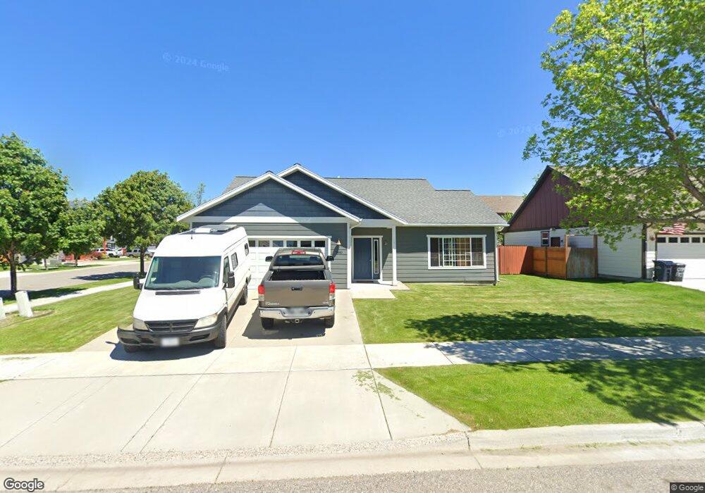
1890 Brisk Ct Bozeman, MT 59718
North Bozeman NeighborhoodEstimated Value: $617,000 - $711,000
3
Beds
2
Baths
1,550
Sq Ft
$415/Sq Ft
Est. Value
About This Home
This home is located at 1890 Brisk Ct, Bozeman, MT 59718 and is currently estimated at $643,405, approximately $415 per square foot. 1890 Brisk Ct is a home located in Gallatin County with nearby schools including Emily Dickinson School, Chief Joseph Middle School, and Gallatin High School.
Ownership History
Date
Name
Owned For
Owner Type
Purchase Details
Closed on
Jul 26, 2011
Sold by
Steckler Gregory M and Steckler Dee Ann
Bought by
Steckler Gregory M and Steckler Ashley D
Current Estimated Value
Purchase Details
Closed on
Apr 29, 2008
Sold by
Cook Gene E
Bought by
Steckler Gregory M and Steckler Dee Ann
Home Financials for this Owner
Home Financials are based on the most recent Mortgage that was taken out on this home.
Original Mortgage
$158,000
Outstanding Balance
$99,694
Interest Rate
5.81%
Mortgage Type
Purchase Money Mortgage
Estimated Equity
$543,711
Create a Home Valuation Report for This Property
The Home Valuation Report is an in-depth analysis detailing your home's value as well as a comparison with similar homes in the area
Home Values in the Area
Average Home Value in this Area
Purchase History
| Date | Buyer | Sale Price | Title Company |
|---|---|---|---|
| Steckler Gregory M | -- | None Available | |
| Steckler Gregory M | -- | American Land Title Company |
Source: Public Records
Mortgage History
| Date | Status | Borrower | Loan Amount |
|---|---|---|---|
| Open | Steckler Gregory M | $158,000 |
Source: Public Records
Tax History Compared to Growth
Tax History
| Year | Tax Paid | Tax Assessment Tax Assessment Total Assessment is a certain percentage of the fair market value that is determined by local assessors to be the total taxable value of land and additions on the property. | Land | Improvement |
|---|---|---|---|---|
| 2025 | $2,892 | $639,900 | $0 | $0 |
| 2024 | $3,967 | $595,900 | $0 | $0 |
| 2023 | $3,839 | $595,900 | $0 | $0 |
| 2022 | $2,867 | $373,900 | $0 | $0 |
| 2021 | $3,164 | $373,900 | $0 | $0 |
| 2020 | $2,805 | $328,100 | $0 | $0 |
| 2019 | $2,868 | $328,100 | $0 | $0 |
| 2018 | $2,611 | $276,700 | $0 | $0 |
| 2017 | $2,442 | $276,700 | $0 | $0 |
| 2016 | $2,284 | $241,900 | $0 | $0 |
| 2015 | $2,286 | $241,900 | $0 | $0 |
| 2014 | $2,201 | $137,058 | $0 | $0 |
Source: Public Records
Map
Nearby Homes
- 1295 Thomas Dr Unit 203
- 2232 Baxter Lane Units 1-12
- 2720 Sartain St Unit 202
- 2236 Baxter Ln Unit 5
- 1242 Thomas Dr
- 2240 Baxter Ln Unit 6
- 2440 Tschache Ln Unit 302
- 2440 Tschache Ln Unit 204
- 1109 & 1143 Thomas Dr
- 1585 N 25th Ave Unit A
- 2050 Baxter Ln
- 1372 Zephyr Way
- 1140 N 27th Ave Unit 2
- TBD Simmental & Baxter
- 1205 New Holland Dr
- 1142 New Holland Dr
- 2926 Warbler Way Unit B
- 2657 Blackbird Dr
- 1120 Brentwood Ave
- 3095 Lori Ln
- 1870 Brisk Ct
- 1891 Leeward Ct
- 1877 Leeward Ct
- 1867 Leeward Ct
- 1856 Brisk Ct
- 1893 Brisk Ct
- 1853 Leeward Ct
- 2723 Trade Wind Ln
- 2741 Trade Wind Ln
- 1871 Brisk Ct
- 2755 Trade Wind Ln
- 2726 Hedgerow Ct
- 1835 Leeward Ct
- 2715 Trade Wind Ln
- 1828 Brisk Ct
- 1828 Brisk Ct
- 2763 Trade Wind Ln
- 1857 Brisk Ct
- 1823 Leeward Ct
- 1831 Brisk Ct