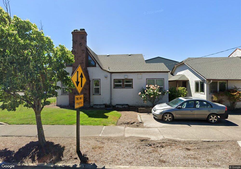
1890 Pearl St Eugene, OR 97401
South University NeighborhoodEstimated Value: $730,841 - $862,000
6
Beds
2
Baths
2,863
Sq Ft
$274/Sq Ft
Est. Value
About This Home
This home is located at 1890 Pearl St, Eugene, OR 97401 and is currently estimated at $783,960, approximately $273 per square foot. 1890 Pearl St is a home located in Lane County with nearby schools including Edison Elementary School, Roosevelt Middle School, and South Eugene High School.
Ownership History
Date
Name
Owned For
Owner Type
Purchase Details
Closed on
May 23, 2016
Sold by
Tuski Brad J and Tuski Tammy K
Bought by
19Th & Pearl Street Llc
Current Estimated Value
Purchase Details
Closed on
Apr 3, 2013
Sold by
Pearl Garden Limited Partnership
Bought by
Tuski Brad J and Tuski Tammy K
Home Financials for this Owner
Home Financials are based on the most recent Mortgage that was taken out on this home.
Original Mortgage
$226,000
Interest Rate
3.54%
Mortgage Type
New Conventional
Purchase Details
Closed on
Oct 30, 2003
Sold by
Wu Ryuko
Bought by
Pearl Garden Lp
Home Financials for this Owner
Home Financials are based on the most recent Mortgage that was taken out on this home.
Original Mortgage
$1,640,000
Interest Rate
5.98%
Mortgage Type
Purchase Money Mortgage
Create a Home Valuation Report for This Property
The Home Valuation Report is an in-depth analysis detailing your home's value as well as a comparison with similar homes in the area
Home Values in the Area
Average Home Value in this Area
Purchase History
| Date | Buyer | Sale Price | Title Company |
|---|---|---|---|
| 19Th & Pearl Street Llc | -- | Accommodation | |
| Tuski Brad J | -- | Nextitle | |
| Pearl Garden Lp | $2,050,000 | Cascade Title Co |
Source: Public Records
Mortgage History
| Date | Status | Borrower | Loan Amount |
|---|---|---|---|
| Previous Owner | Tuski Brad J | $226,000 | |
| Previous Owner | Pearl Garden Lp | $1,640,000 |
Source: Public Records
Tax History
| Year | Tax Paid | Tax Assessment Tax Assessment Total Assessment is a certain percentage of the fair market value that is determined by local assessors to be the total taxable value of land and additions on the property. | Land | Improvement |
|---|---|---|---|---|
| 2025 | $6,005 | $308,206 | -- | -- |
| 2024 | $5,930 | $299,230 | -- | -- |
| 2023 | $5,930 | $290,515 | $0 | $0 |
| 2022 | $5,556 | $282,054 | $0 | $0 |
| 2021 | $5,218 | $273,839 | $0 | $0 |
| 2020 | $5,237 | $265,864 | $0 | $0 |
| 2019 | $5,057 | $258,121 | $0 | $0 |
| 2018 | $4,761 | $243,304 | $0 | $0 |
| 2017 | $4,547 | $243,304 | $0 | $0 |
| 2016 | $4,434 | $236,217 | $0 | $0 |
| 2015 | $4,307 | $229,337 | $0 | $0 |
| 2014 | $4,220 | $222,657 | $0 | $0 |
Source: Public Records
Map
Nearby Homes
- 1857 Pearl St
- 181 Civic Dr
- 193 E 20th Ave
- 177 E 20th Ave
- 171 E 20th Ave
- 1826 Mill St
- 1733 Mill Aly
- 1600 Pearl St Unit 608
- 2031 Olive St
- 1673 Olive Aly
- 1492 Pearl St
- 2096 Charnelton St
- 344 E 14th Ave
- 1375 Olive St Unit 503
- 508 E 14th Ave
- 1313 Lincoln St Unit 503
- 1313 Lincoln St Unit 308
- 1313 Lincoln St Unit 1005
- 1313 Lincoln St Unit 401
- 780 E 22nd Ave
Your Personal Tour Guide
Ask me questions while you tour the home.