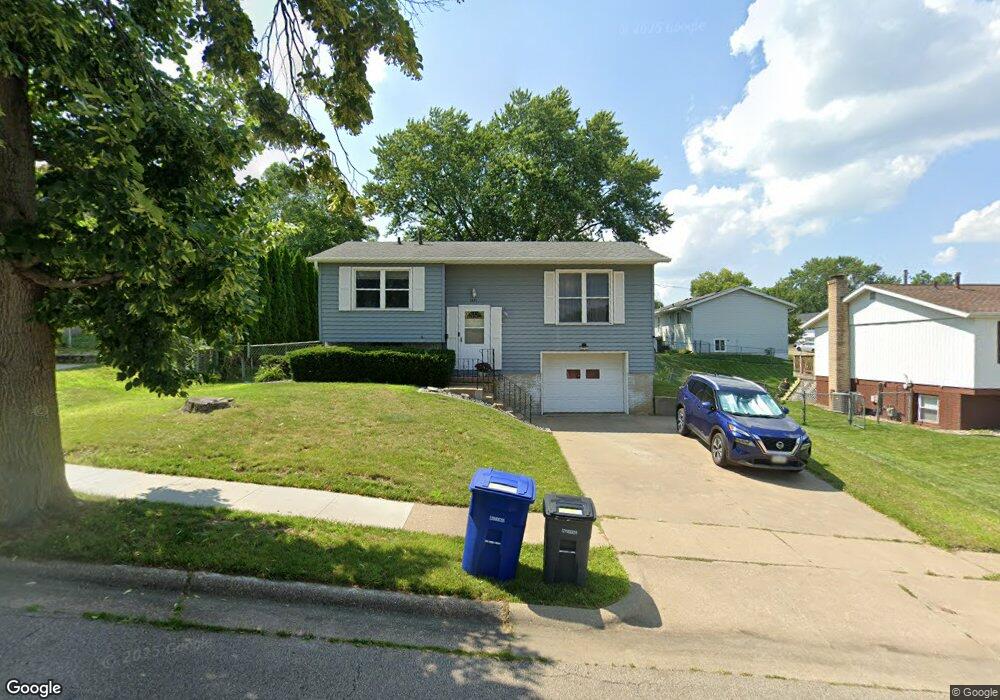
1891 Key Way Dubuque, IA 52002
Estimated Value: $183,000 - $214,000
3
Beds
1
Bath
840
Sq Ft
$235/Sq Ft
Est. Value
About This Home
This home is located at 1891 Key Way, Dubuque, IA 52002 and is currently estimated at $197,204, approximately $234 per square foot. 1891 Key Way is a home located in Dubuque County with nearby schools including John Kennedy Elementary School, Eleanor Roosevelt Middle School, and Hempstead High School.
Ownership History
Date
Name
Owned For
Owner Type
Purchase Details
Closed on
Feb 15, 2022
Sold by
Glab Sr Thomas J
Bought by
Quinn Logan J
Current Estimated Value
Home Financials for this Owner
Home Financials are based on the most recent Mortgage that was taken out on this home.
Original Mortgage
$147,250
Outstanding Balance
$136,733
Interest Rate
3.55%
Mortgage Type
New Conventional
Estimated Equity
$60,471
Purchase Details
Closed on
Feb 16, 2017
Sold by
Glab Georgia A
Bought by
Glab Thomas J
Create a Home Valuation Report for This Property
The Home Valuation Report is an in-depth analysis detailing your home's value as well as a comparison with similar homes in the area
Purchase History
| Date | Buyer | Sale Price | Title Company |
|---|---|---|---|
| Quinn Logan J | $155,000 | Noel Law Office | |
| Glab Thomas J | -- | None Available |
Source: Public Records
Mortgage History
| Date | Status | Borrower | Loan Amount |
|---|---|---|---|
| Open | Quinn Logan J | $147,250 |
Source: Public Records
Tax History
| Year | Tax Paid | Tax Assessment Tax Assessment Total Assessment is a certain percentage of the fair market value that is determined by local assessors to be the total taxable value of land and additions on the property. | Land | Improvement |
|---|---|---|---|---|
| 2025 | $2,376 | $179,100 | $39,100 | $140,000 |
| 2024 | $2,376 | $165,200 | $34,000 | $131,200 |
| 2023 | $2,306 | $165,200 | $34,000 | $131,200 |
| 2022 | $1,986 | $132,410 | $30,600 | $101,810 |
| 2021 | $1,986 | $132,410 | $30,600 | $101,810 |
| 2020 | $1,930 | $120,660 | $30,600 | $90,060 |
| 2019 | $1,940 | $120,660 | $30,600 | $90,060 |
| 2018 | $1,906 | $116,150 | $30,600 | $85,550 |
| 2017 | $1,904 | $116,150 | $30,600 | $85,550 |
| 2016 | $1,904 | $110,400 | $30,600 | $79,800 |
| 2015 | $1,860 | $110,400 | $30,600 | $79,800 |
| 2014 | $1,754 | $107,330 | $30,600 | $76,730 |
Source: Public Records
Map
Nearby Homes
- 1804 Norland Dr
- 3470 Hillcrest Rd Unit 13
- 2071 Ellen St
- 2204 Graham Cir
- 2281 Pasadena #57 Dr
- 2305 Pasadena #67 Dr
- 2315 Pasadena Dr
- 1780 Horizon Ct
- 1765 Eden Ln
- 3463 Kimberly Dr
- 1921 Avalon Rd
- 2035 Broadlawn Rd
- 2160 Avalon Rd
- 2330 Evergreen Dr
- 2935 Van Buren St
- 1930 Saint Anne Ct
- 2319 Harvest View Dr
- 0 Associates Dr
- 1642 Drexel Ave
- 2750 Pennsylvania Ave
Your Personal Tour Guide
Ask me questions while you tour the home.