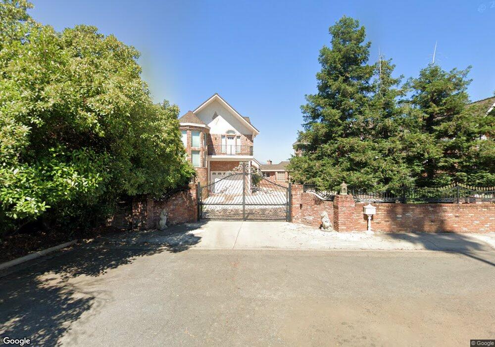
1892 Crestmont Dr Redding, CA 96002
Estimated Value: $961,000 - $1,466,748
5
Beds
8
Baths
7,000
Sq Ft
$165/Sq Ft
Est. Value
About This Home
This home is located at 1892 Crestmont Dr, Redding, CA 96002 and is currently estimated at $1,154,583, approximately $164 per square foot. 1892 Crestmont Dr is a home located in Shasta County with nearby schools including Rother Elementary School, Parsons Junior High School, and Enterprise High School.
Ownership History
Date
Name
Owned For
Owner Type
Purchase Details
Closed on
Jan 27, 2003
Sold by
Rodriguez Antonio and Rodriguez Anthony
Bought by
Campbell Sanford F and Campbell Geraldine L
Current Estimated Value
Home Financials for this Owner
Home Financials are based on the most recent Mortgage that was taken out on this home.
Original Mortgage
$548,000
Outstanding Balance
$235,036
Interest Rate
5.97%
Mortgage Type
Credit Line Revolving
Estimated Equity
$919,547
Create a Home Valuation Report for This Property
The Home Valuation Report is an in-depth analysis detailing your home's value as well as a comparison with similar homes in the area
Home Values in the Area
Average Home Value in this Area
Purchase History
| Date | Buyer | Sale Price | Title Company |
|---|---|---|---|
| Campbell Sanford F | $685,000 | Placer Title Company |
Source: Public Records
Mortgage History
| Date | Status | Borrower | Loan Amount |
|---|---|---|---|
| Open | Campbell Sanford F | $548,000 | |
| Closed | Campbell Sanford F | $68,500 |
Source: Public Records
Tax History Compared to Growth
Tax History
| Year | Tax Paid | Tax Assessment Tax Assessment Total Assessment is a certain percentage of the fair market value that is determined by local assessors to be the total taxable value of land and additions on the property. | Land | Improvement |
|---|---|---|---|---|
| 2025 | $13,312 | $1,250,000 | $400,000 | $850,000 |
| 2024 | $13,392 | $1,220,000 | $420,000 | $800,000 |
| 2023 | $13,392 | $1,220,000 | $420,000 | $800,000 |
| 2022 | $13,275 | $1,220,000 | $420,000 | $800,000 |
| 2021 | $13,079 | $1,220,000 | $420,000 | $800,000 |
| 2020 | $13,160 | $1,220,000 | $420,000 | $800,000 |
| 2019 | $13,315 | $1,220,000 | $420,000 | $800,000 |
| 2018 | $13,427 | $1,220,000 | $420,000 | $800,000 |
| 2017 | $13,715 | $1,200,000 | $400,000 | $800,000 |
| 2016 | $11,001 | $1,010,000 | $280,000 | $730,000 |
| 2015 | $10,945 | $998,000 | $280,000 | $718,000 |
| 2014 | $10,550 | $950,000 | $275,000 | $675,000 |
Source: Public Records
Map
Nearby Homes
- 1928 Bechelli Ln
- 1968 Bechelli Ln
- 2258 Park Marina Dr
- 1018 Pineland Dr
- 350 Park Marina Cir
- 2165 Paris Ave
- 2155 Paris Ave
- 2010 Lazare Path
- 1271 Mistletoe Ln
- 2056 Canal Dr
- 385 Manzanita Ln
- 1026 Palisades Ave
- 1925 Verda St
- 780 Lincoln St
- 2786 Larkspur Ln
- 11 Tanglewood Ln
- 2590 Henderson Rd
- 760 Locust St
- 2810 Bechelli Ln
- 1221 E Cypress Ave Unit 67
- 1913 Bechelli Ln
- 1914 Bechelli Ln
- 1880 Crestmont Dr
- 1915 Bechelli Ln
- 1916 Bechelli Ln
- 1912 Bechelli Ln
- 1911 Bechelli Ln
- 1917 Bechelli Ln Unit The Bluffs
- 1917 Bechelli Ln
- 1910 Bechelli Ln
- 1918 Bechelli Ln
- 1908 Bechelli Ln
- 1909 Bechelli Ln
- 1870 Crestmont Dr
- 1897 Crestmont Dr
- 1927 Bechelli Ln
- 1919 Bechelli Ln Unit SFR
- 1919 Bechelli Ln
- 1907 Bechelli Ln
- 0 Crestmont Dr