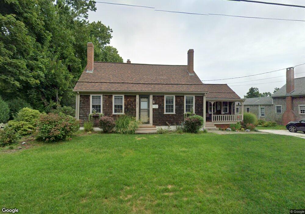
1892 Main Rd Westport Point, MA 02791
Westport Point NeighborhoodEstimated Value: $746,000 - $1,445,000
2
Beds
--
Bath
1,500
Sq Ft
$692/Sq Ft
Est. Value
About This Home
This home is located at 1892 Main Rd, Westport Point, MA 02791 and is currently estimated at $1,037,499, approximately $691 per square foot. 1892 Main Rd is a home with nearby schools including Alice A. Macomber Primary School, Westport Elementary School, and Westport Middle-High School.
Ownership History
Date
Name
Owned For
Owner Type
Purchase Details
Closed on
Aug 1, 2024
Sold by
Levalley Victoria A and Lubell Donna M
Bought by
Lubell-Levalley Ft and Levalley
Current Estimated Value
Purchase Details
Closed on
Jul 21, 1992
Sold by
Healy William A Est
Bought by
Levalley Leonard D
Create a Home Valuation Report for This Property
The Home Valuation Report is an in-depth analysis detailing your home's value as well as a comparison with similar homes in the area
Home Values in the Area
Average Home Value in this Area
Purchase History
| Date | Buyer | Sale Price | Title Company |
|---|---|---|---|
| Lubell-Levalley Ft | -- | None Available | |
| Lubell-Levalley Ft | -- | None Available | |
| Lubell-Levalley Ft | -- | None Available | |
| Levalley Leonard D | $43,000 | -- | |
| Levalley Leonard D | $43,000 | -- |
Source: Public Records
Tax History
| Year | Tax Paid | Tax Assessment Tax Assessment Total Assessment is a certain percentage of the fair market value that is determined by local assessors to be the total taxable value of land and additions on the property. | Land | Improvement |
|---|---|---|---|---|
| 2025 | $5,998 | $805,100 | $591,600 | $213,500 |
| 2024 | $5,607 | $725,300 | $516,300 | $209,000 |
| 2023 | $5,385 | $659,900 | $461,300 | $198,600 |
| 2022 | $4,273 | $549,800 | $412,800 | $137,000 |
| 2021 | $3,137 | $495,700 | $358,700 | $137,000 |
| 2020 | $3,150 | $481,300 | $344,300 | $137,000 |
| 2019 | $3,065 | $460,100 | $328,400 | $131,700 |
| 2018 | $2,907 | $459,400 | $351,400 | $108,000 |
| 2017 | $2,622 | $461,400 | $351,400 | $110,000 |
| 2016 | $3,613 | $456,800 | $351,400 | $105,400 |
| 2015 | $3,681 | $464,200 | $362,700 | $101,500 |
Source: Public Records
Map
Nearby Homes
- 2 Olin Howland Way
- 1371 Drift Rd
- 238-242 E Beach Rd
- 255 John Dyer Rd
- Lot 2 Horseneck Rd
- 25 Quail Trail
- 920 Drift Rd
- 245 John Dyer Rd
- 17 Quail Trail
- 101 Adamsville Rd
- 332 Division Rd
- 837 Main Road & Lot 2
- Lot 2E Horseneck Rd
- 2 Slades Farm Ln
- 505 Long Hwy
- 116 Amy Hart Path
- 8 Village Way
- 31 Brookwood Dr
- 18 Old Barn Rd
- 140 Long Hwy
- 1898 Main Rd
- 1886 Main Rd
- 1900 Main Rd
- 1927 Drift Rd Unit 1
- 1927 Drift Rd
- 0 Cherry & Webb Ln Unit 70852953
- 0 Cherry & Webb Ln Unit 859061
- 1878 Main Rd
- 1904 Main Rd
- 1904 Main Rd
- 1923 Drift Rd
- 1893 Main Rd
- 1943 Drift Rd
- 1903 Main Rd
- 1919 Drift Rd
- 1905 Main Hwy
- 1919 Drift Rd
- 1874 Main Rd
- 1942 Drift Rd
- 1875 Main Rd
Your Personal Tour Guide
Ask me questions while you tour the home.