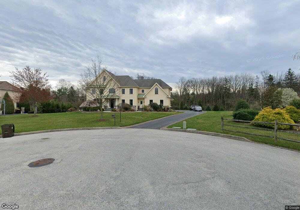
1892 Old Forge Way Norristown, PA 19403
Estimated Value: $1,088,000 - $1,628,000
4
Beds
5
Baths
5,300
Sq Ft
$253/Sq Ft
Est. Value
About This Home
This home is located at 1892 Old Forge Way, Norristown, PA 19403 and is currently estimated at $1,340,113, approximately $252 per square foot. 1892 Old Forge Way is a home located in Montgomery County with nearby schools including Worcester Elementary School, Skyview Upper Elementary School, and Arcola Intermediate School.
Ownership History
Date
Name
Owned For
Owner Type
Purchase Details
Closed on
Jul 13, 2011
Sold by
Wild Maria E and Wild Roger W
Bought by
Wild Maria E
Current Estimated Value
Purchase Details
Closed on
Jul 10, 2008
Sold by
Noble Manor Inc
Bought by
Wild Maria E and Wild Roger W
Home Financials for this Owner
Home Financials are based on the most recent Mortgage that was taken out on this home.
Original Mortgage
$343,000
Outstanding Balance
$225,341
Interest Rate
6.35%
Estimated Equity
$1,114,772
Create a Home Valuation Report for This Property
The Home Valuation Report is an in-depth analysis detailing your home's value as well as a comparison with similar homes in the area
Home Values in the Area
Average Home Value in this Area
Purchase History
| Date | Buyer | Sale Price | Title Company |
|---|---|---|---|
| Wild Maria E | -- | None Available | |
| Wild Maria E | $950,000 | None Available |
Source: Public Records
Mortgage History
| Date | Status | Borrower | Loan Amount |
|---|---|---|---|
| Open | Wild Maria E | $343,000 | |
| Closed | Wild Maria E | $417,000 |
Source: Public Records
Tax History Compared to Growth
Tax History
| Year | Tax Paid | Tax Assessment Tax Assessment Total Assessment is a certain percentage of the fair market value that is determined by local assessors to be the total taxable value of land and additions on the property. | Land | Improvement |
|---|---|---|---|---|
| 2025 | $14,752 | $389,470 | -- | -- |
| 2024 | $14,752 | $389,470 | -- | -- |
| 2023 | $14,149 | $389,470 | $0 | $0 |
| 2022 | $13,876 | $389,470 | $0 | $0 |
| 2021 | $15,066 | $431,380 | $0 | $0 |
| 2020 | $14,786 | $431,380 | $0 | $0 |
| 2019 | $16,560 | $487,900 | $0 | $0 |
| 2018 | $1,902 | $487,900 | $0 | $0 |
| 2017 | $15,925 | $487,900 | $0 | $0 |
| 2016 | $15,734 | $487,900 | $0 | $0 |
| 2015 | $15,174 | $487,900 | $0 | $0 |
| 2014 | $15,174 | $487,900 | $0 | $0 |
Source: Public Records
Map
Nearby Homes
- 2725 Skippack Pike
- 2 Capri Ln Unit KINSLEY
- 2648 Hawthorn Dr
- 1716 Landis Rd
- 2624 Hawthorn Dr
- 1921 Whitehall Rd
- 2203 Weber Rd
- 1600 Potshop Rd
- 2564 W Skippack Pike
- 1534 N Trooper Rd
- 2099 Deep Meadow Ln
- 2806 Morris Rd
- 3180 Zacharias Rd
- 825 Morris Rd
- 4 Anglesey
- 1401 Oak Cir
- 1507 Potshop Rd
- LOT 28 Heebner Rd
- 1939 Penngrove Terrace
- 2967 Township Line Rd
- 1894 Old Forge Way
- 1890 Old Forge Way
- 1894 Old Forge Way
- 1895 Old Forge Way
- 1895 Old Forge Way Unit LOT 4
- 1896 Old Forge Way
- 1897 Old Forge Way
- 1899 Old Forge Way
- 1899 Old Forge Way Unit LOT 2
- 1898 Old Forge Way
- 1901 Old Forge Way
- Lot 2 Old Forge Way
- 1805 Berks Rd
- 2840 Highview Dr
- 2841 Highview Dr
- 2716 Applewood Dr Unit LOT 12
- 2716 Applewood Dr
- 2718 Applewood Dr
- 2842 Highview Dr
- 2806 Skippack Pike