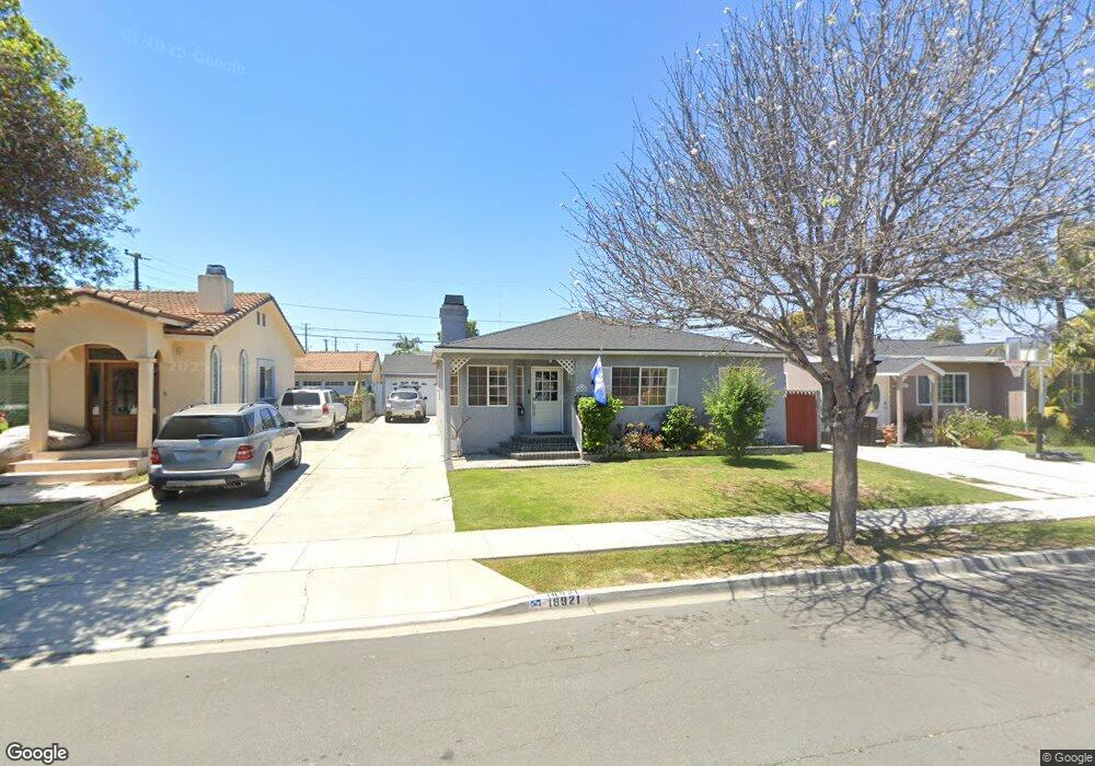
18921 Florwood Ave Torrance, CA 90504
North Torrance NeighborhoodEstimated Value: $1,064,000 - $1,256,000
3
Beds
2
Baths
1,719
Sq Ft
$660/Sq Ft
Est. Value
About This Home
This home is located at 18921 Florwood Ave, Torrance, CA 90504 and is currently estimated at $1,134,427, approximately $659 per square foot. 18921 Florwood Ave is a home located in Los Angeles County with nearby schools including Edison Elementary School, Philip Magruder Middle School, and North High School.
Ownership History
Date
Name
Owned For
Owner Type
Purchase Details
Closed on
Jul 22, 2019
Sold by
Sanders Mary F and Sanders Walter L
Bought by
Lane Mark A and Lane Brenda L
Current Estimated Value
Home Financials for this Owner
Home Financials are based on the most recent Mortgage that was taken out on this home.
Original Mortgage
$340,000
Interest Rate
3.7%
Mortgage Type
New Conventional
Purchase Details
Closed on
Jul 25, 1995
Sold by
Sanders Walter L and Sanders Mary F
Bought by
Sanders Walter L
Create a Home Valuation Report for This Property
The Home Valuation Report is an in-depth analysis detailing your home's value as well as a comparison with similar homes in the area
Home Values in the Area
Average Home Value in this Area
Purchase History
| Date | Buyer | Sale Price | Title Company |
|---|---|---|---|
| Lane Mark A | $715,000 | Orange Coast Ttl Co Of Socal | |
| Sanders Walter L | -- | -- |
Source: Public Records
Mortgage History
| Date | Status | Borrower | Loan Amount |
|---|---|---|---|
| Previous Owner | Lane Mark A | $340,000 |
Source: Public Records
Tax History Compared to Growth
Tax History
| Year | Tax Paid | Tax Assessment Tax Assessment Total Assessment is a certain percentage of the fair market value that is determined by local assessors to be the total taxable value of land and additions on the property. | Land | Improvement |
|---|---|---|---|---|
| 2025 | $8,874 | $781,951 | $625,562 | $156,389 |
| 2024 | $8,874 | $766,620 | $613,297 | $153,323 |
| 2023 | $8,710 | $751,589 | $601,272 | $150,317 |
| 2022 | $8,592 | $736,853 | $589,483 | $147,370 |
| 2021 | $8,513 | $722,406 | $577,925 | $144,481 |
| 2019 | $1,956 | $144,761 | $47,883 | $96,878 |
| 2018 | $1,835 | $141,924 | $46,945 | $94,979 |
| 2016 | $1,735 | $136,415 | $45,123 | $91,292 |
| 2015 | $1,697 | $134,367 | $44,446 | $89,921 |
| 2014 | $1,664 | $131,736 | $43,576 | $88,160 |
Source: Public Records
Map
Nearby Homes
- 3960 W 187th St
- 3826 W 185th St
- 3615 W 187th St
- 3910 W 182nd St Unit 1
- 4101 W 184th St
- 3717 W 182nd St
- 3420 W 186th St
- North Pointe Plan at North Pointe
- 18309 Faysmith Ave
- 3349 W 183rd St
- 17805 Florwood Ave
- 18801 Hawthorne Blvd Unit 19
- 18801 Hawthorne Blvd Unit 59
- 4325 W 182nd St Unit 18
- 18405 Delia Ave
- 18413 Burin Ave
- 2905 Spreckels Ct
- 18403 Eriel Ave
- 4019 W 176th St
- 3151 W 182nd St
- 18915 Florwood Ave
- 18927 Florwood Ave
- 18920 Cordary Ave
- 18909 Florwood Ave
- 18933 Florwood Ave
- 18926 Cordary Ave
- 18914 Cordary Ave
- 18908 Cordary Ave
- 18932 Cordary Ave
- 18903 Florwood Ave
- 18920 Florwood Ave
- 18914 Florwood Ave
- 18926 Florwood Ave
- 18902 Cordary Ave
- 18908 Florwood Ave
- 18932 Florwood Ave
- 18833 Florwood Ave
- 18902 Florwood Ave
- 18832 Cordary Ave
- 18827 Florwood Ave