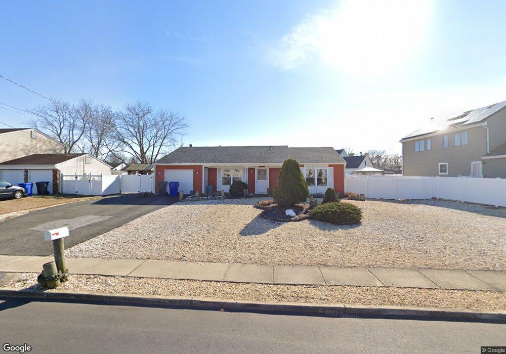
1893 Merrimac Dr Toms River, NJ 08753
Estimated Value: $553,000 - $617,000
4
Beds
2
Baths
1,728
Sq Ft
$338/Sq Ft
Est. Value
About This Home
This home is located at 1893 Merrimac Dr, Toms River, NJ 08753 and is currently estimated at $583,272, approximately $337 per square foot. 1893 Merrimac Dr is a home located in Ocean County.
Ownership History
Date
Name
Owned For
Owner Type
Purchase Details
Closed on
Sep 27, 2005
Sold by
Pinter James B and Pinter Laura R
Bought by
Gray Kim B
Current Estimated Value
Home Financials for this Owner
Home Financials are based on the most recent Mortgage that was taken out on this home.
Original Mortgage
$164,950
Outstanding Balance
$89,233
Interest Rate
5.93%
Mortgage Type
Fannie Mae Freddie Mac
Estimated Equity
$494,039
Purchase Details
Closed on
Nov 21, 2002
Sold by
Nemeth Robert
Bought by
Pinter James and Pinter Laura
Create a Home Valuation Report for This Property
The Home Valuation Report is an in-depth analysis detailing your home's value as well as a comparison with similar homes in the area
Home Values in the Area
Average Home Value in this Area
Purchase History
| Date | Buyer | Sale Price | Title Company |
|---|---|---|---|
| Gray Kim B | $329,900 | -- | |
| Pinter James | $189,245 | -- |
Source: Public Records
Mortgage History
| Date | Status | Borrower | Loan Amount |
|---|---|---|---|
| Open | Gray Kim B | $164,950 |
Source: Public Records
Tax History Compared to Growth
Tax History
| Year | Tax Paid | Tax Assessment Tax Assessment Total Assessment is a certain percentage of the fair market value that is determined by local assessors to be the total taxable value of land and additions on the property. | Land | Improvement |
|---|---|---|---|---|
| 2025 | $6,965 | $382,500 | $118,000 | $264,500 |
| 2024 | $6,621 | $382,500 | $118,000 | $264,500 |
| 2023 | $6,384 | $382,500 | $118,000 | $264,500 |
| 2022 | $6,384 | $382,500 | $118,000 | $264,500 |
| 2021 | $5,228 | $225,700 | $97,000 | $128,700 |
| 2020 | $5,629 | $225,700 | $97,000 | $128,700 |
| 2019 | $5,385 | $225,700 | $97,000 | $128,700 |
| 2018 | $5,313 | $225,700 | $97,000 | $128,700 |
| 2017 | $5,268 | $225,700 | $97,000 | $128,700 |
| 2016 | $5,130 | $225,700 | $97,000 | $128,700 |
| 2015 | $4,936 | $225,700 | $97,000 | $128,700 |
| 2014 | $4,699 | $225,700 | $97,000 | $128,700 |
Source: Public Records
Map
Nearby Homes
- 1939 Ship Ct
- 1145 Kenton Dr
- 1850 Ensign Ct
- 141 Yellowbank Rd
- 1836 Ensign Ct
- 1083 Crystal Dr
- 890 Fairview Dr
- 5 Dublin Ct
- 1035 Tralee Dr
- 8 Pumpshire Rd
- 1099 Fairview Dr
- 2517 Waters Edge Dr Unit 17
- 921 Tudor Dr
- 1916 Waters Edge Dr Unit 16
- 954 Vaughn Ave
- 1813 Waters Edge Dr
- 912 New Jersey Ave
- 1019 Waters Edge Dr
- 1090 Westlake Dr
- 1097 Westlake Dr
- 1897 Merrimac Dr
- 1887 Merrimac Dr
- 1926 Shore Blvd
- 1171 Fern St
- 1901 Merrimac Dr
- 1900 Merrimac Dr
- 1918 Shore Blvd
- 1886 Merrimac Dr
- 1173 Fern St
- 1930 Shore Blvd
- 1882 Merrimac Dr
- 1175 Fern St
- 1805 Lookout Dr
- 1905 Merrimac Dr
- 1878 Merrimac Dr
- 1934 Shore Blvd
- 1809 Lookout Dr
- 1908 Merrimac Dr
- 1874 Merrimac Dr
- 1916 Shore Blvd