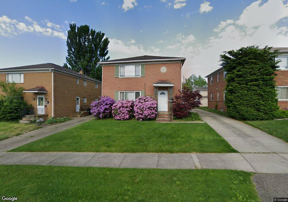
1896 Carter Ave Unit 1898 Akron, OH 44301
Firestone Park NeighborhoodEstimated Value: $190,000 - $200,046
4
Beds
2
Baths
2,322
Sq Ft
$84/Sq Ft
Est. Value
About This Home
This home is located at 1896 Carter Ave Unit 1898, Akron, OH 44301 and is currently estimated at $195,012, approximately $83 per square foot. 1896 Carter Ave Unit 1898 is a home located in Summit County with nearby schools including Kenmore Garfield Community Learning Center, Main Preparatory Academy, and Eagle Elementary.
Ownership History
Date
Name
Owned For
Owner Type
Purchase Details
Closed on
Jul 8, 2005
Sold by
Clark Terry B
Bought by
Clark Terry B and Clark Kelly Marie
Current Estimated Value
Purchase Details
Closed on
Sep 28, 1999
Sold by
Folden Ruth Elizabeth
Bought by
Clark Terry B
Home Financials for this Owner
Home Financials are based on the most recent Mortgage that was taken out on this home.
Original Mortgage
$82,350
Outstanding Balance
$25,055
Interest Rate
7.93%
Mortgage Type
Purchase Money Mortgage
Estimated Equity
$169,957
Create a Home Valuation Report for This Property
The Home Valuation Report is an in-depth analysis detailing your home's value as well as a comparison with similar homes in the area
Home Values in the Area
Average Home Value in this Area
Purchase History
| Date | Buyer | Sale Price | Title Company |
|---|---|---|---|
| Clark Terry B | -- | Portage Lawyers Title | |
| Clark Terry B | $91,500 | Endress/Lawyers Title |
Source: Public Records
Mortgage History
| Date | Status | Borrower | Loan Amount |
|---|---|---|---|
| Open | Clark Terry B | $82,350 |
Source: Public Records
Tax History Compared to Growth
Tax History
| Year | Tax Paid | Tax Assessment Tax Assessment Total Assessment is a certain percentage of the fair market value that is determined by local assessors to be the total taxable value of land and additions on the property. | Land | Improvement |
|---|---|---|---|---|
| 2025 | $3,261 | $60,344 | $8,677 | $51,667 |
| 2024 | $3,261 | $60,344 | $8,677 | $51,667 |
| 2023 | $3,261 | $60,344 | $8,677 | $51,667 |
| 2022 | $3,044 | $44,198 | $6,286 | $37,912 |
| 2021 | $3,047 | $44,198 | $6,286 | $37,912 |
| 2020 | $3,002 | $44,200 | $6,290 | $37,910 |
| 2019 | $2,789 | $37,220 | $6,290 | $30,930 |
| 2018 | $2,752 | $37,220 | $6,290 | $30,930 |
| 2017 | $2,887 | $37,220 | $6,290 | $30,930 |
| 2016 | $2,889 | $37,220 | $6,290 | $30,930 |
| 2015 | $2,887 | $37,220 | $6,290 | $30,930 |
| 2014 | $2,865 | $37,220 | $6,290 | $30,930 |
| 2013 | $2,913 | $38,730 | $6,290 | $32,440 |
Source: Public Records
Map
Nearby Homes
- 739 S Firestone Blvd
- 1882 Gless Ave
- 1698 Sunset Ave
- 315 Clinton Ave
- 1699 Redwood Ave
- 1663 Sunset Ave
- 1731 Highview Ave
- 1708 Highview Ave
- 1645 Hammel St
- 369 Mission Dr
- 361 Mission Dr
- 1642 Highview Ave
- 1604 Oakwood Ave
- 1576 Hammel St
- 249 Naomi St
- 1614 Glenmount Ave
- 0 Woodview Dr
- 1571 Redwood Ave
- 676 E Catawba Ave
- 2179 Glenmount Ave
- 1892 Carter Ave Unit 1894
- 1900 Carter Ave Unit 1902
- 1888 Carter Ave Unit 1890
- 1906 Carter Ave Unit 1908
- 755 S Firestone Blvd Unit 757
- 755 757 S Firestone Blvd
- 763 S Firestone Blvd Unit 765
- 1882 Carter Ave Unit 1884
- 757 S Firestone Blvd
- 751 753 S Firestone Blvd
- 751 S Firestone Blvd Unit 753
- 751 S Firestone Blvd Unit 753
- 751 S Firestone Blvd Unit 753
- 751 S Firestone Blvd
- 1893 Carter Ave
- 745 S Firestone Blvd Unit 747
- 1895 Carter Ave Unit 1897
- 1899 Carter Ave Unit 1901
- 1891 Carter Ave Unit 1893
- 1878 Carter Ave Unit 1880