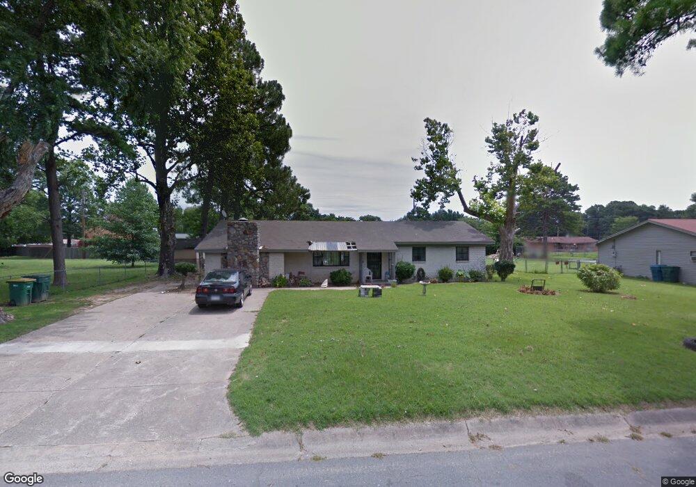
19 Beauregard Dr Little Rock, AR 72206
East Little Rock NeighborhoodEstimated Value: $136,000 - $168,000
3
Beds
2
Baths
1,815
Sq Ft
$83/Sq Ft
Est. Value
About This Home
This home is located at 19 Beauregard Dr, Little Rock, AR 72206 and is currently estimated at $150,247, approximately $82 per square foot. 19 Beauregard Dr is a home located in Pulaski County with nearby schools including Washington Magnet Elementary School, Pulaski Heights Middle School, and Central High School.
Ownership History
Date
Name
Owned For
Owner Type
Purchase Details
Closed on
Jul 27, 2018
Sold by
Brown Debra and Harris Charles
Bought by
Brown Debra and Harris Charles
Current Estimated Value
Purchase Details
Closed on
Aug 24, 2007
Sold by
Thomas Ray and Thomas Valencia
Bought by
Jackson Berneice
Purchase Details
Closed on
Jan 31, 2002
Sold by
Tucker Beulah
Bought by
Thomas Ray E and Thomas Valencia Gayle
Purchase Details
Closed on
Apr 9, 2001
Sold by
Moran Gary W
Bought by
Tucker Beulah
Home Financials for this Owner
Home Financials are based on the most recent Mortgage that was taken out on this home.
Original Mortgage
$37,800
Interest Rate
7%
Mortgage Type
Purchase Money Mortgage
Purchase Details
Closed on
Jan 6, 1998
Sold by
Sipes Stephen C
Bought by
Moran Gary W
Create a Home Valuation Report for This Property
The Home Valuation Report is an in-depth analysis detailing your home's value as well as a comparison with similar homes in the area
Home Values in the Area
Average Home Value in this Area
Purchase History
| Date | Buyer | Sale Price | Title Company |
|---|---|---|---|
| Brown Debra | -- | None Available | |
| Jackson Berneice | $97,000 | Little Rock Title Company | |
| Thomas Ray E | $37,000 | -- | |
| Tucker Beulah | $42,000 | -- | |
| Moran Gary W | $22,028 | -- |
Source: Public Records
Mortgage History
| Date | Status | Borrower | Loan Amount |
|---|---|---|---|
| Previous Owner | Tucker Beulah | $37,800 |
Source: Public Records
Tax History Compared to Growth
Tax History
| Year | Tax Paid | Tax Assessment Tax Assessment Total Assessment is a certain percentage of the fair market value that is determined by local assessors to be the total taxable value of land and additions on the property. | Land | Improvement |
|---|---|---|---|---|
| 2025 | $1,026 | $18,987 | $600 | $18,387 |
| 2024 | $855 | $18,987 | $600 | $18,387 |
| 2023 | $855 | $18,987 | $600 | $18,387 |
| 2022 | $855 | $18,987 | $600 | $18,387 |
| 2021 | $861 | $12,210 | $2,200 | $10,010 |
| 2020 | $480 | $12,210 | $2,200 | $10,010 |
| 2019 | $480 | $12,210 | $2,200 | $10,010 |
| 2018 | $505 | $12,210 | $2,200 | $10,010 |
| 2017 | $505 | $12,210 | $2,200 | $10,010 |
| 2016 | $822 | $16,740 | $3,800 | $12,940 |
| 2015 | $1,173 | $16,740 | $3,800 | $12,940 |
| 2014 | $1,173 | $16,740 | $3,800 | $12,940 |
Source: Public Records
Map
Nearby Homes
- 6504 Tracy Ave
- 3007 Bermuda Ln
- 00 Baucum Pike
- 343 Oro Ct
- 25 Quillen Ave
- 22 Quillen Ave
- 137 Saunders Dr
- TBD E Roosevlt Rd
- 131 Saunders Dr
- 6512 Whippoorwill Ln
- 123 Saunders Dr
- 119 Saunders Dr
- 6613 Pioneer Rd
- 111 Saunders Dr
- 8 Spear Rd
- 11 Neal Place
- TBD E 33rd St
- 1 Neal Place
- 8200 Faulkner Lake Rd
- 204 Healy St
- 17 Beauregard Dr
- 18 Longstreet Dr
- 23 Beauregard Dr
- 20 Longstreet Dr
- 16 Longstreet Dr
- 15 Beauregard Dr
- 20 Beauregard Dr
- 22 Beauregard Dr
- 18 Beauregard Dr
- 14 Longstreet Dr
- 11 Beauregard Dr
- 166 Longstreet Dr
- 12 Longstreet Dr
- 0 Longstreet Dr
- 17 Longstreet Dr
- 12 Beauregard Dr
- 24 Beauregard Dr
- 9 Beauregard Dr
- 15 Longstreet Dr
- 10 Longstreet Dr