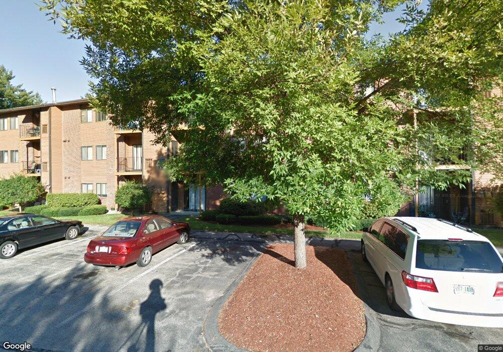
19 Blackstone Dr Unit U1926 Nashua, NH 03063
Northwest Nashua NeighborhoodEstimated Value: $278,792 - $290,000
2
Beds
1
Bath
912
Sq Ft
$311/Sq Ft
Est. Value
About This Home
This home is located at 19 Blackstone Dr Unit U1926, Nashua, NH 03063 and is currently estimated at $283,698, approximately $311 per square foot. 19 Blackstone Dr Unit U1926 is a home located in Hillsborough County with nearby schools including Birch Hill Elementary School, Pennichuck Middle School, and Nashua High School North.
Ownership History
Date
Name
Owned For
Owner Type
Purchase Details
Closed on
Jul 11, 2005
Sold by
Griswold Duane S
Bought by
Loth-Miller Annah S
Current Estimated Value
Home Financials for this Owner
Home Financials are based on the most recent Mortgage that was taken out on this home.
Original Mortgage
$132,900
Outstanding Balance
$69,599
Interest Rate
5.71%
Mortgage Type
Purchase Money Mortgage
Estimated Equity
$214,099
Create a Home Valuation Report for This Property
The Home Valuation Report is an in-depth analysis detailing your home's value as well as a comparison with similar homes in the area
Home Values in the Area
Average Home Value in this Area
Purchase History
| Date | Buyer | Sale Price | Title Company |
|---|---|---|---|
| Loth-Miller Annah S | $139,900 | -- |
Source: Public Records
Mortgage History
| Date | Status | Borrower | Loan Amount |
|---|---|---|---|
| Open | Loth-Miller Annah S | $132,900 |
Source: Public Records
Tax History Compared to Growth
Tax History
| Year | Tax Paid | Tax Assessment Tax Assessment Total Assessment is a certain percentage of the fair market value that is determined by local assessors to be the total taxable value of land and additions on the property. | Land | Improvement |
|---|---|---|---|---|
| 2024 | $4,096 | $257,600 | $0 | $257,600 |
| 2023 | $4,016 | $220,300 | $0 | $220,300 |
| 2022 | $3,981 | $220,300 | $0 | $220,300 |
| 2021 | $3,063 | $131,900 | $0 | $131,900 |
| 2020 | $2,982 | $131,900 | $0 | $131,900 |
| 2019 | $2,870 | $131,900 | $0 | $131,900 |
| 2018 | $2,798 | $131,900 | $0 | $131,900 |
| 2017 | $2,233 | $86,600 | $0 | $86,600 |
| 2016 | $2,171 | $86,600 | $0 | $86,600 |
| 2015 | $2,124 | $86,600 | $0 | $86,600 |
| 2014 | -- | $86,600 | $0 | $86,600 |
Source: Public Records
Map
Nearby Homes
- 201 Millwright Dr
- 3 Roedean Dr Unit C-207
- 5 Dumaine Ave Unit B
- 5 Dumaine Ave Unit N
- 75 Deerwood Dr Unit B
- 77 Deerwood Dr Unit E
- 66 Tinker Rd
- 26 Andover Down Unit 276
- 10 Drouin Way
- 38 Highbridge Hill Rd Unit 186
- 8 Pilgrim Cir
- 74 Cannongate III Unit 3
- 9 Cambridge Dr
- 123 Cannongate III
- 5 Chatfield Dr Unit U18
- 4 Jared Cir Unit U21
- 74 Profile Cir
- 7 Robert Dr
- 15 Four Winds Rd
- 47 Hanna Cir Unit 47
- 1929 Blackstone Dr Unit 1929
- 1929 Blackstone Dr Unit 1929
- 1913 Blackstone Dr Unit 13
- 19 Blackstone Dr Unit U1939
- 19 Blackstone Dr Unit U1938
- 19 Blackstone Dr Unit U1937
- 19 Blackstone Dr Unit U1936
- 19 Blackstone Dr Unit U1935
- 19 Blackstone Dr Unit U1934
- 19 Blackstone Dr Unit U1933
- 19 Blackstone Dr Unit U1932
- 19 Blackstone Dr Unit U1931
- 19 Blackstone Dr Unit U1930
- 19 Blackstone Dr Unit U1929
- 19 Blackstone Dr Unit U1928
- 19 Blackstone Dr Unit U1927
- 19 Blackstone Dr Unit U1925
- 19 Blackstone Dr Unit U1924
- 19 Blackstone Dr Unit U1923
- 19 Blackstone Dr Unit U1922