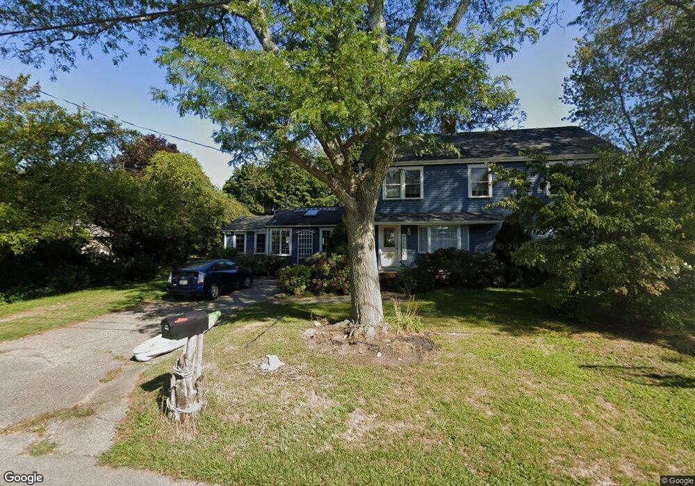
19 Blanchard Rd Scituate, MA 02066
Estimated Value: $877,000 - $1,345,000
3
Beds
2
Baths
1,776
Sq Ft
$662/Sq Ft
Est. Value
About This Home
This home is located at 19 Blanchard Rd, Scituate, MA 02066 and is currently estimated at $1,175,577, approximately $661 per square foot. 19 Blanchard Rd is a home located in Plymouth County with nearby schools including Jenkins Elementary School, Lester J. Gates Middle School, and Scituate High School.
Ownership History
Date
Name
Owned For
Owner Type
Purchase Details
Closed on
May 25, 2018
Sold by
Haze Nanci J
Bought by
Haze Rt
Current Estimated Value
Purchase Details
Closed on
Sep 30, 2016
Sold by
Haze Rt Of 2015
Bought by
Haze Nanci J
Purchase Details
Closed on
Dec 29, 2015
Sold by
Peters Nanci J
Bought by
Haze Rt
Purchase Details
Closed on
Jun 30, 2014
Sold by
Peters John R and Peters Nanci J
Bought by
Peters Nanci J
Purchase Details
Closed on
Jul 28, 2005
Sold by
Kennedy Thomasine F
Bought by
Peters John R and Peters Nanci J
Purchase Details
Closed on
Oct 28, 1987
Sold by
Cheverie William R
Bought by
Kennedy Thomasine F
Create a Home Valuation Report for This Property
The Home Valuation Report is an in-depth analysis detailing your home's value as well as a comparison with similar homes in the area
Home Values in the Area
Average Home Value in this Area
Purchase History
| Date | Buyer | Sale Price | Title Company |
|---|---|---|---|
| Haze Rt | -- | -- | |
| Haze Nanci J | -- | -- | |
| Haze Rt | -- | -- | |
| Peters Nanci J | -- | -- | |
| Peters John R | $450,000 | -- | |
| Kennedy Thomasine F | $180,000 | -- |
Source: Public Records
Mortgage History
| Date | Status | Borrower | Loan Amount |
|---|---|---|---|
| Previous Owner | Kennedy Thomasine F | $130,000 | |
| Previous Owner | Kennedy Thomasine F | $138,000 | |
| Previous Owner | Kennedy Thomasine F | $145,000 | |
| Previous Owner | Kennedy Thomasine F | $146,000 |
Source: Public Records
Tax History Compared to Growth
Tax History
| Year | Tax Paid | Tax Assessment Tax Assessment Total Assessment is a certain percentage of the fair market value that is determined by local assessors to be the total taxable value of land and additions on the property. | Land | Improvement |
|---|---|---|---|---|
| 2025 | $9,720 | $973,000 | $469,800 | $503,200 |
| 2024 | $9,537 | $920,600 | $427,100 | $493,500 |
| 2023 | $8,613 | $847,600 | $388,300 | $459,300 |
| 2022 | $8,613 | $682,500 | $330,800 | $351,700 |
| 2021 | $8,369 | $627,800 | $315,000 | $312,800 |
| 2020 | $8,170 | $605,200 | $302,900 | $302,300 |
| 2019 | $7,824 | $569,400 | $284,000 | $285,400 |
| 2018 | $6,462 | $463,200 | $291,900 | $171,300 |
| 2017 | $5,718 | $405,800 | $270,200 | $135,600 |
| 2016 | $5,280 | $373,400 | $237,800 | $135,600 |
| 2015 | $4,750 | $362,600 | $227,000 | $135,600 |
Source: Public Records
Map
Nearby Homes
- 59 Greenfield Ln
- 12 Meeting House Ln Unit 308
- 67 Greenfield Ln
- 2 Collier Rd
- 50 First Parish Rd
- 91 Front St Unit 106
- 37 Moorland Rd
- 48 Moorland Rd
- 76 A Brook St
- 76 A Brook St Unit 1
- 23 Sunset Rd
- 29 Ladds Way Unit 29
- 74 Tilden Rd
- 19 Ford Place Unit 3
- 19 Ford Place Unit 1
- 19 Ford Place Unit 4
- 32 Barker Rd Unit 3
- 12 Richfield Rd
- 12 Sassamon Rd
- 146 Chief Justice Cushing Hwy
- 23 Blanchard Rd
- 15 Blanchard Rd
- 20 Blanchard Rd
- 16 Blanchard Rd
- 24 Blanchard Rd
- 12 Seagull Ln
- 14 Seagull Ln
- 12 Seagull Ln Unit 1
- 14 Seagull Ln Unit 14
- 14 Seagull Ln Unit 1
- 27 Blanchard Rd
- 11 Blanchard Rd
- 11 Blanchard Rd
- 12 Blanchard Rd
- 13 Seagull Ln
- 28 Blanchard Rd
- 11 Seagull Ln
- 11 Seagull Ln Unit 11
- 8 Seagull Ln
- 10 Seagull Ln