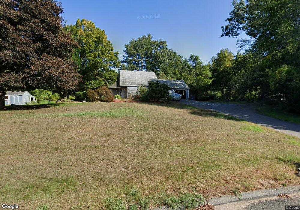
19 Brae Burn Rd Somers, CT 06071
Estimated Value: $487,000 - $567,000
3
Beds
3
Baths
2,217
Sq Ft
$241/Sq Ft
Est. Value
About This Home
This home is located at 19 Brae Burn Rd, Somers, CT 06071 and is currently estimated at $533,744, approximately $240 per square foot. 19 Brae Burn Rd is a home located in Tolland County with nearby schools including Somers Elementary School, Mabelle B. Avery Middle School, and Somers High School.
Ownership History
Date
Name
Owned For
Owner Type
Purchase Details
Closed on
Aug 2, 2005
Sold by
Mcmanus Theresa and Mcmanus Timothy
Bought by
Smith David and Smith Stephanie
Current Estimated Value
Home Financials for this Owner
Home Financials are based on the most recent Mortgage that was taken out on this home.
Original Mortgage
$73,500
Interest Rate
5.67%
Purchase Details
Closed on
May 26, 1995
Sold by
Vazquez Ray
Bought by
Mcmanus Theresa and Mcmanus Timothy
Create a Home Valuation Report for This Property
The Home Valuation Report is an in-depth analysis detailing your home's value as well as a comparison with similar homes in the area
Home Values in the Area
Average Home Value in this Area
Purchase History
| Date | Buyer | Sale Price | Title Company |
|---|---|---|---|
| Smith David | $367,500 | -- | |
| Smith David | $367,500 | -- | |
| Mcmanus Theresa | $195,000 | -- | |
| Mcmanus Theresa | $195,000 | -- |
Source: Public Records
Mortgage History
| Date | Status | Borrower | Loan Amount |
|---|---|---|---|
| Open | Mcmanus Theresa | $180,000 | |
| Closed | Mcmanus Theresa | $73,500 | |
| Previous Owner | Mcmanus Theresa | $181,000 |
Source: Public Records
Tax History
| Year | Tax Paid | Tax Assessment Tax Assessment Total Assessment is a certain percentage of the fair market value that is determined by local assessors to be the total taxable value of land and additions on the property. | Land | Improvement |
|---|---|---|---|---|
| 2025 | $6,275 | $207,700 | $71,900 | $135,800 |
| 2024 | $6,015 | $207,700 | $71,900 | $135,800 |
| 2023 | $5,880 | $207,700 | $71,900 | $135,800 |
| 2022 | $5,724 | $207,700 | $71,900 | $135,800 |
| 2021 | $5,537 | $207,700 | $71,900 | $135,800 |
| 2020 | $5,685 | $207,700 | $71,900 | $135,800 |
| 2019 | $5,521 | $201,700 | $77,500 | $124,200 |
| 2018 | $5,521 | $201,700 | $77,500 | $124,200 |
| 2017 | $5,137 | $201,700 | $77,500 | $124,200 |
| 2016 | $4,885 | $201,700 | $77,500 | $124,200 |
| 2015 | $5,130 | $219,500 | $84,300 | $135,200 |
| 2014 | $5,130 | $219,500 | $84,300 | $135,200 |
Source: Public Records
Map
Nearby Homes
- 1040 Main St
- 994 Main St
- 283 Mountain View Rd
- 142 Turnpike Rd
- 64 Bradfield Dr
- 18 Hillcrest Dr
- 63 Maple Ridge Dr
- 969 Main St
- 125 Chestnut Hill Rd
- 369 Turnpike Rd
- 51 Handel Rd
- 12 & 16 Haas Rd
- 64 Somerset Ln
- 190 Root Rd
- 12 Petersson Cir
- 20 Old Birch Rd
- 16 Old Birch Rd
- 0000 Webster Rd
- 11 King Rd
- 188B W Stafford Rd
- 952 Main St
- 22 Brae Burn Rd
- 25 Brae Burn Rd
- 32 Brae Burn Rd
- 33 Brae Burn Rd
- 935 Main St
- 40 Brae Burn Rd
- 947 Main St
- 30 Tumble Brook Cir
- 26 Tumble Brook Cir
- 49 Shady Dell Ln
- 941 Main St
- 18 Tumble Brook Cir
- 39 Brae Burn Rd
- 955 Main St
- 12 Tumble Brook Cir
- 20 Colorado Dr
- 8 Colorado Dr
- 47 Brae Burn Rd
- 912 Main St