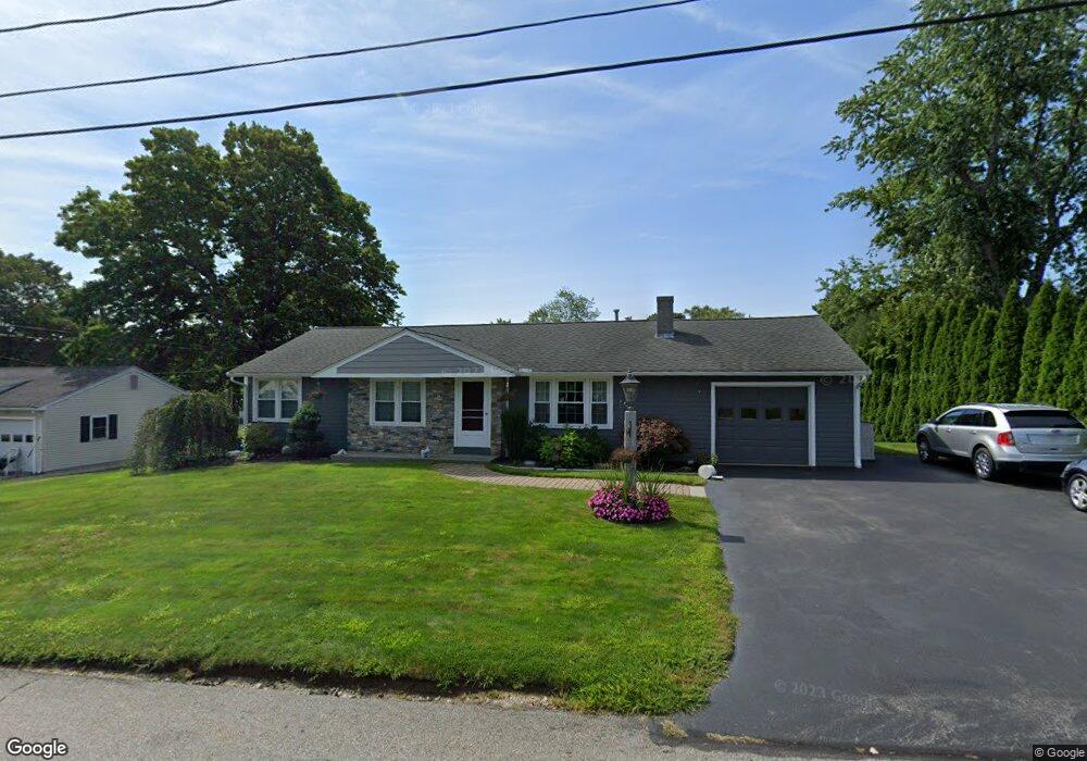
19 Brandywine Rd West Boylston, MA 01583
Estimated Value: $567,000 - $637,000
3
Beds
2
Baths
1,950
Sq Ft
$307/Sq Ft
Est. Value
About This Home
This home is located at 19 Brandywine Rd, West Boylston, MA 01583 and is currently estimated at $598,132, approximately $306 per square foot. 19 Brandywine Rd is a home located in Worcester County with nearby schools including Major Edwards Elementary School, West Boylston Junior/Senior High School, and Abby Kelley Foster Charter Public School.
Ownership History
Date
Name
Owned For
Owner Type
Purchase Details
Closed on
May 1, 2013
Sold by
Eagan David W and Cappabianca Kelly A
Bought by
Eagan David W and Eagan Kelly A
Current Estimated Value
Purchase Details
Closed on
May 25, 2000
Sold by
Fagerquist Betty M
Bought by
Eagan David W and Cappabianca Kelly A
Create a Home Valuation Report for This Property
The Home Valuation Report is an in-depth analysis detailing your home's value as well as a comparison with similar homes in the area
Home Values in the Area
Average Home Value in this Area
Purchase History
| Date | Buyer | Sale Price | Title Company |
|---|---|---|---|
| Eagan David W | -- | -- | |
| Eagan David W | $145,000 | -- |
Source: Public Records
Mortgage History
| Date | Status | Borrower | Loan Amount |
|---|---|---|---|
| Previous Owner | Eagan David W | $217,600 | |
| Previous Owner | Eagan David W | $50,000 | |
| Previous Owner | Eagan David W | $132,000 | |
| Previous Owner | Eagan David W | $130,000 |
Source: Public Records
Tax History Compared to Growth
Tax History
| Year | Tax Paid | Tax Assessment Tax Assessment Total Assessment is a certain percentage of the fair market value that is determined by local assessors to be the total taxable value of land and additions on the property. | Land | Improvement |
|---|---|---|---|---|
| 2025 | $77 | $557,800 | $93,700 | $464,100 |
| 2024 | $7,418 | $501,900 | $93,700 | $408,200 |
| 2023 | $7,027 | $451,000 | $93,100 | $357,900 |
| 2022 | $6,494 | $367,300 | $93,100 | $274,200 |
| 2021 | $6,273 | $339,800 | $89,200 | $250,600 |
| 2020 | $6,128 | $329,800 | $89,200 | $240,600 |
| 2019 | $5,689 | $301,800 | $89,200 | $212,600 |
| 2018 | $5,404 | $288,700 | $89,200 | $199,500 |
| 2017 | $4,724 | $251,300 | $89,200 | $162,100 |
| 2016 | $4,553 | $246,800 | $83,000 | $163,800 |
| 2015 | $4,420 | $241,000 | $82,200 | $158,800 |
Source: Public Records
Map
Nearby Homes
- 1 Highland Ave
- 39 Davidson Rd
- 62 Maple St
- 54 Maple St
- 152 Worcester St Unit 8
- 12 Birchbrush Ln
- 740 Burncoat St Unit B
- 33 Meola Ave
- 39 Meola Ave
- 156 Hillside Village Dr
- 33 Isleboro St
- 156 Prospect St
- 29 Isleboro St
- 1110 W Boylston St Unit A
- 1097 W Boylston St
- 83 Hillside Village Dr
- 7 Christy Ct
- 97 Hillside Village Dr
- 59 Santoro Rd
- 44 Dixfield St
- 15 Brandywine Rd
- 23 Brandywine Rd
- 18 Brandywine Rd
- 22 Brandywine Rd
- 51 Bunkerhill Pkwy
- 14 Brandywine Rd
- 11 Brandywine Rd
- 10 Trenton Ln
- 12 Brandywine Rd
- 46 Bunkerhill Pkwy
- 27 Bunkerhill Pkwy
- 50 Bunkerhill Pkwy
- 31 Bunkerhill Pkwy
- 17 Trenton Ln
- 7 Brandywine Rd
- 42 Bunkerhill Pkwy
- 21 Trenton Ln
- 23 Bunkerhill Pkwy
- 13 Trenton Ln
- 54 Bunkerhill Pkwy