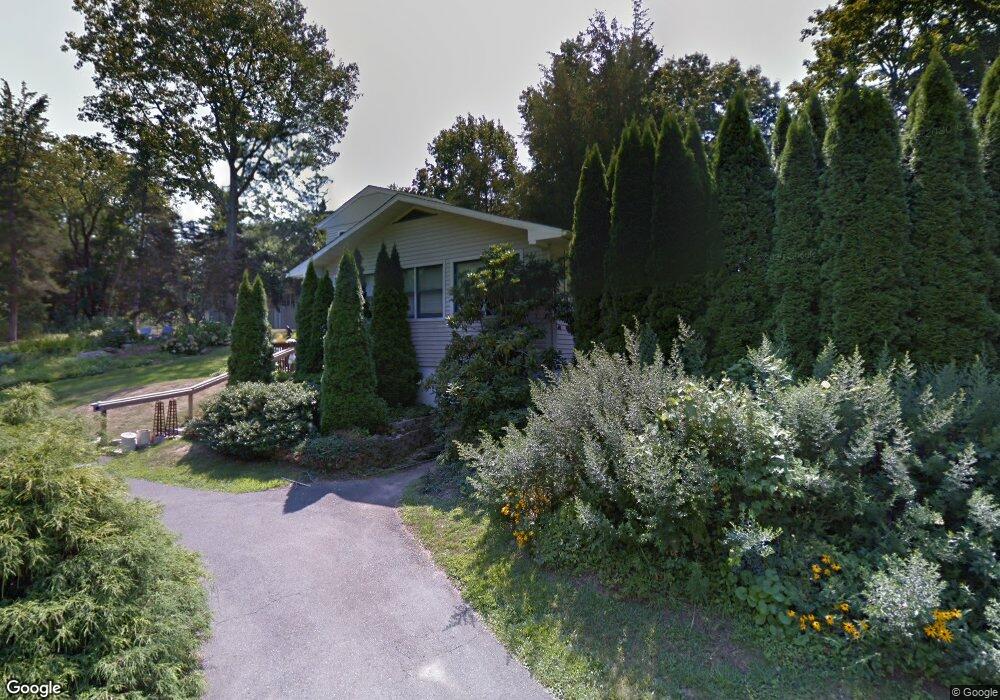
19 Cedar Grove Rd Guilford, CT 06437
Estimated Value: $591,000 - $813,000
3
Beds
2
Baths
1,728
Sq Ft
$405/Sq Ft
Est. Value
About This Home
This home is located at 19 Cedar Grove Rd, Guilford, CT 06437 and is currently estimated at $699,304, approximately $404 per square foot. 19 Cedar Grove Rd is a home located in New Haven County with nearby schools including E.C. Adams Middle School, A. Baldwin Middle School, and Guilford High School.
Ownership History
Date
Name
Owned For
Owner Type
Purchase Details
Closed on
Aug 20, 2009
Sold by
Garson Andrew E
Bought by
Garson Andrew E and Garson Patricia J
Current Estimated Value
Purchase Details
Closed on
Jun 6, 2008
Sold by
Link Darren R and Link Rie
Bought by
Garson Andrew E
Purchase Details
Closed on
Aug 23, 2005
Sold by
Smith Darren W and Smith Sandra B
Bought by
Link Darren R and Link Ric
Purchase Details
Closed on
Jan 30, 1996
Sold by
Keane Charles W and Keane Melissa L
Bought by
Smith Darren W and Smith Sandra B
Purchase Details
Closed on
Sep 1, 1989
Sold by
Sibley Fred C
Bought by
Keane Charles W
Create a Home Valuation Report for This Property
The Home Valuation Report is an in-depth analysis detailing your home's value as well as a comparison with similar homes in the area
Home Values in the Area
Average Home Value in this Area
Purchase History
| Date | Buyer | Sale Price | Title Company |
|---|---|---|---|
| Garson Andrew E | -- | -- | |
| Garson Andrew E | $375,500 | -- | |
| Link Darren R | $485,000 | -- | |
| Smith Darren W | $145,000 | -- | |
| Keane Charles W | $169,600 | -- |
Source: Public Records
Mortgage History
| Date | Status | Borrower | Loan Amount |
|---|---|---|---|
| Open | Keane Charles W | $258,000 | |
| Closed | Keane Charles W | $50,000 |
Source: Public Records
Tax History Compared to Growth
Tax History
| Year | Tax Paid | Tax Assessment Tax Assessment Total Assessment is a certain percentage of the fair market value that is determined by local assessors to be the total taxable value of land and additions on the property. | Land | Improvement |
|---|---|---|---|---|
| 2025 | $8,739 | $316,050 | $206,570 | $109,480 |
| 2024 | $8,401 | $316,050 | $206,570 | $109,480 |
| 2023 | $8,179 | $316,050 | $206,570 | $109,480 |
| 2022 | $6,313 | $189,850 | $134,370 | $55,480 |
| 2021 | $6,193 | $189,850 | $134,370 | $55,480 |
| 2020 | $6,134 | $189,850 | $134,370 | $55,480 |
| 2019 | $6,081 | $189,850 | $134,370 | $55,480 |
| 2018 | $5,939 | $189,850 | $134,370 | $55,480 |
| 2017 | $6,035 | $205,560 | $140,050 | $65,510 |
| 2016 | $5,893 | $205,560 | $140,050 | $65,510 |
| 2015 | $5,805 | $205,560 | $140,050 | $65,510 |
| 2014 | $5,636 | $205,560 | $140,050 | $65,510 |
Source: Public Records
Map
Nearby Homes
- 76 Sachem Head Rd
- 52 Seaside Ave
- 35 Bayberry Ln
- 379 Whitfield St Unit CN946
- 66 High St Unit 38
- 66 High St Unit 36
- 66 High St Unit 17
- 66 High St Unit 40
- 505 Old Whitfield St
- 140 Wildrose Ave
- 134 Water St
- 174 Whitfield St
- 12 Paddock Ln
- 65 Water St
- 427 3 Mile Course
- 64 Boston St
- 65 Prospect Ave
- 29 Circle Beach Rd
- 51 Pearl St
- 215 Uncas Point Rd
- 518 Mulberry Point Rd
- 23 High Ridge Rd
- 502 Mulberry Point Rd
- 502 Mulberry Point Rd
- 26 Cedar Grove Rd
- 16 Cedar Grove Rd
- 38 Cedar Grove Rd
- 29 Cedar Grove Rd
- 492 Mulberry Point Rd
- 55 Cedar Grove Rd
- 52 Cedar Grove Rd
- 532 Mulberry Point Rd
- 517 Mulberry Point Rd
- 503 Mulberry Point Rd
- 50 High Ridge Rd
- 22 High Ridge Rd
- 480 Mulberry Point Rd
- 1 Highland St
- 484 Mulberry Point Rd
- 485 Mulberry Point Rd