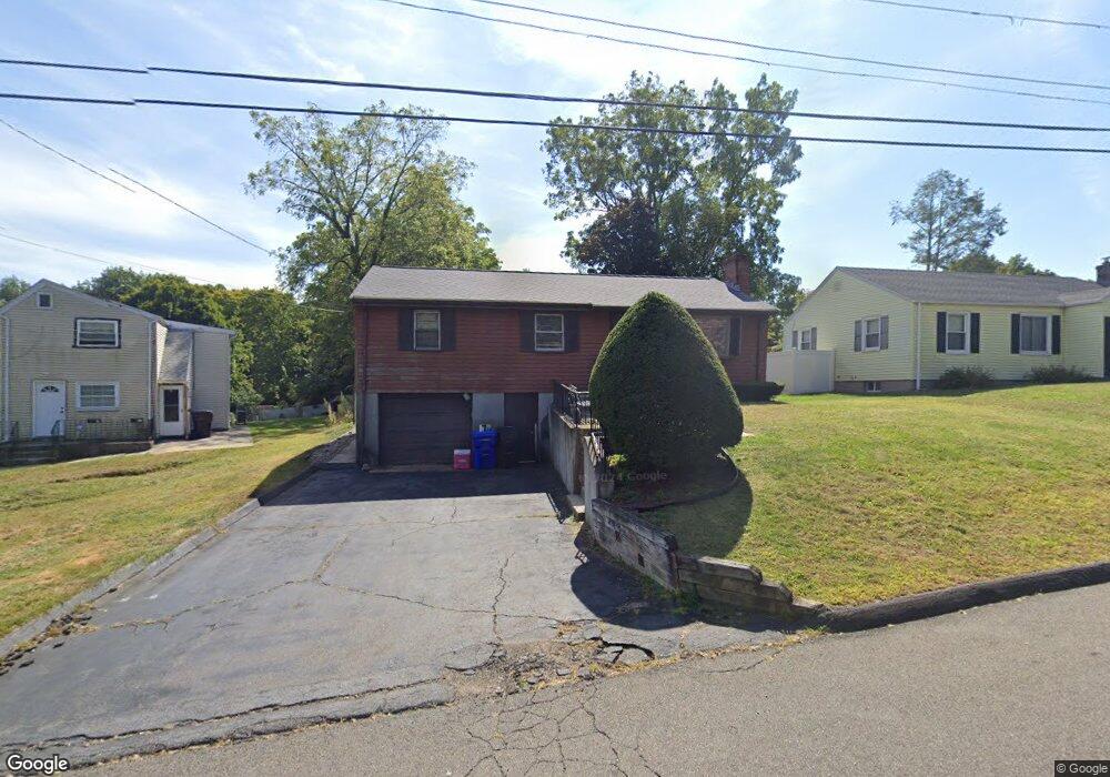
19 Connery Rd Middletown, CT 06457
Estimated Value: $329,464 - $347,000
3
Beds
2
Baths
1,092
Sq Ft
$311/Sq Ft
Est. Value
About This Home
This home is located at 19 Connery Rd, Middletown, CT 06457 and is currently estimated at $339,116, approximately $310 per square foot. 19 Connery Rd is a home located in Middlesex County with nearby schools including Wilbert Snow Elementary School, Middletown High School, and St John Paul II School.
Ownership History
Date
Name
Owned For
Owner Type
Purchase Details
Closed on
Jul 22, 2003
Sold by
Ramsey Frank and Ramsey Judith
Bought by
James Sheanetta
Current Estimated Value
Home Financials for this Owner
Home Financials are based on the most recent Mortgage that was taken out on this home.
Original Mortgage
$185,450
Outstanding Balance
$75,881
Interest Rate
5.34%
Estimated Equity
$263,235
Purchase Details
Closed on
Mar 23, 1998
Sold by
Faraci Frank
Bought by
Ramsey Frank and Ramsey Judith
Home Financials for this Owner
Home Financials are based on the most recent Mortgage that was taken out on this home.
Original Mortgage
$93,600
Interest Rate
9.74%
Mortgage Type
Unknown
Create a Home Valuation Report for This Property
The Home Valuation Report is an in-depth analysis detailing your home's value as well as a comparison with similar homes in the area
Purchase History
| Date | Buyer | Sale Price | Title Company |
|---|---|---|---|
| James Sheanetta | $187,000 | -- | |
| Ramsey Frank | $117,000 | -- |
Source: Public Records
Mortgage History
| Date | Status | Borrower | Loan Amount |
|---|---|---|---|
| Open | Ramsey Frank | $185,450 | |
| Previous Owner | Ramsey Frank | $139,500 | |
| Previous Owner | Ramsey Frank | $119,500 | |
| Previous Owner | Ramsey Frank | $93,600 |
Source: Public Records
Tax History
| Year | Tax Paid | Tax Assessment Tax Assessment Total Assessment is a certain percentage of the fair market value that is determined by local assessors to be the total taxable value of land and additions on the property. | Land | Improvement |
|---|---|---|---|---|
| 2025 | $6,212 | $159,690 | $61,580 | $98,110 |
| 2024 | $5,877 | $159,690 | $61,580 | $98,110 |
| 2023 | $5,605 | $159,690 | $61,580 | $98,110 |
| 2022 | $5,182 | $117,770 | $41,060 | $76,710 |
| 2021 | $5,182 | $117,770 | $41,060 | $76,710 |
| 2020 | $5,205 | $117,770 | $41,060 | $76,710 |
| 2019 | $5,229 | $117,770 | $41,060 | $76,710 |
| 2018 | $5,147 | $117,770 | $41,060 | $76,710 |
| 2017 | $4,984 | $117,550 | $47,500 | $70,050 |
| 2016 | $4,843 | $117,550 | $47,500 | $70,050 |
| 2015 | $4,655 | $117,550 | $47,500 | $70,050 |
| 2014 | $4,702 | $117,550 | $47,500 | $70,050 |
Source: Public Records
Map
Nearby Homes
- 58 Durant Terrace
- 1 Jefferson Ave
- 70 Jack English Dr
- 45 Mckenna Dr
- 909 Randolph Rd
- 122 Baldwin Dr
- 50 Cedar St
- 21 Butternut Knolls
- 91 Gleeson Rd
- 6 Hillside Ct
- 5 Wall St
- 42 Saybrook Rd
- Lot 3 Coleman Rd
- 63 Millbrook Rd
- 201 College St Unit 26
- 6 Bidwell Terrace
- 8 Macdonough Place
- 37 Dobson Cir
- 183 Aston Ln
- 15 Blue Spruce St
- 59 Highland Ave
- 25 Connery Rd
- 33 Connery Rd
- 65 Highland Ave
- 20 Connery Rd
- 30 Connery Rd
- 39 Stevens Ln
- 39 Connery Rd
- 67 Highland Ave
- 47 Stevens Ln
- 57 Highland Ave
- 62 Highland Ave
- 62 Highland Ave Unit 3
- 40 Connery Rd
- 47 Connery Rd
- 58 Highland Ave
- 71 Highland Ave
- 55 Stevens Ln
- 66 Ward St
- 70 Highland Ave
Your Personal Tour Guide
Ask me questions while you tour the home.