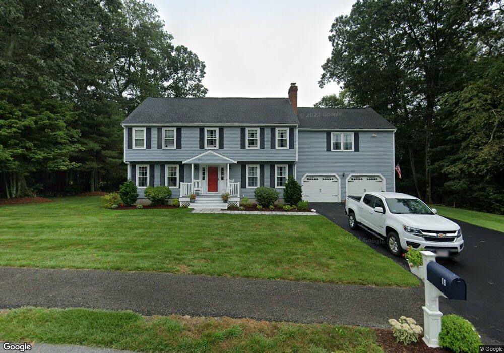
19 Crestview Ave Medway, MA 02053
Estimated Value: $830,413 - $1,019,000
4
Beds
3
Baths
2,976
Sq Ft
$311/Sq Ft
Est. Value
About This Home
This home is located at 19 Crestview Ave, Medway, MA 02053 and is currently estimated at $925,353, approximately $310 per square foot. 19 Crestview Ave is a home located in Norfolk County with nearby schools including John D. McGovern Elementary School, Burke-Memorial Elementary, and Medway Middle School.
Ownership History
Date
Name
Owned For
Owner Type
Purchase Details
Closed on
Jun 19, 1992
Sold by
Cortas Tr Gregory J
Bought by
Harrington Richard J and Harrington Diane M
Current Estimated Value
Create a Home Valuation Report for This Property
The Home Valuation Report is an in-depth analysis detailing your home's value as well as a comparison with similar homes in the area
Home Values in the Area
Average Home Value in this Area
Purchase History
| Date | Buyer | Sale Price | Title Company |
|---|---|---|---|
| Harrington Richard J | $231,000 | -- |
Source: Public Records
Mortgage History
| Date | Status | Borrower | Loan Amount |
|---|---|---|---|
| Open | Harrington Richard J | $350,000 | |
| Closed | Harrington Richard J | $100,000 | |
| Closed | Harrington Richard J | $122,000 | |
| Closed | Harrington Richard J | $20,000 |
Source: Public Records
Tax History
| Year | Tax Paid | Tax Assessment Tax Assessment Total Assessment is a certain percentage of the fair market value that is determined by local assessors to be the total taxable value of land and additions on the property. | Land | Improvement |
|---|---|---|---|---|
| 2025 | $10,521 | $738,300 | $325,700 | $412,600 |
| 2024 | $10,632 | $738,300 | $325,700 | $412,600 |
| 2023 | $10,544 | $661,500 | $296,500 | $365,000 |
| 2022 | $9,736 | $575,100 | $219,200 | $355,900 |
| 2021 | $9,804 | $561,500 | $204,600 | $356,900 |
| 2020 | $9,767 | $558,100 | $204,600 | $353,500 |
| 2019 | $9,116 | $537,200 | $196,300 | $340,900 |
| 2018 | $9,164 | $518,900 | $187,900 | $331,000 |
| 2017 | $9,076 | $506,500 | $183,700 | $322,800 |
| 2016 | $8,713 | $481,100 | $169,100 | $312,000 |
| 2015 | $8,644 | $473,900 | $167,000 | $306,900 |
| 2014 | $8,154 | $432,800 | $167,000 | $265,800 |
Source: Public Records
Map
Nearby Homes
- 253 Village St
- 58 Holliston St
- 19 Evergreen St Unit A
- 20 Broad St Unit 1
- 20 Broad St Unit 6
- 20 Broad St Unit A
- 20 Broad St Unit 4
- 14 Sanford St Unit 47
- 8 Winthrop St
- 10 Barber St
- 50 Main St
- 839 Lincoln St
- 33 Gorwin Dr
- 10 Franklin St
- 1391 Pond St
- 8 Woodhaven Dr
- 29 Elm St
- 79 Lovering St Unit B
- 6 Freedom Trail
- 48 Dover Cir
Your Personal Tour Guide
Ask me questions while you tour the home.