Estimated Value: $327,000 - $478,000
2
Beds
1
Bath
1,912
Sq Ft
$207/Sq Ft
Est. Value
About This Home
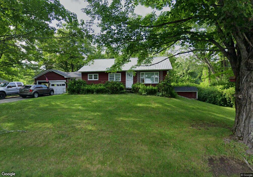
This home is located at 19 General Knox Rd, Weare, NH 03281 and is currently estimated at $396,691, approximately $207 per square foot. 19 General Knox Rd is a home with nearby schools including Center Woods Elementary School, Weare Middle School, and John Stark Regional High School.
Ownership History
Date
Name
Owned For
Owner Type
Purchase Details
Closed on
Jul 26, 2019
Sold by
E M Powers Wilson Ret
Bought by
Brien Nathan A and Swidlehurst Hannah B
Current Estimated Value
Home Financials for this Owner
Home Financials are based on the most recent Mortgage that was taken out on this home.
Original Mortgage
$156,750
Outstanding Balance
$137,621
Interest Rate
3.82%
Mortgage Type
New Conventional
Estimated Equity
$259,070
Purchase Details
Closed on
Apr 2, 2012
Sold by
Hawkes Shawn M
Bought by
Wilson Rodman and Wilson Evangeline P
Create a Home Valuation Report for This Property
The Home Valuation Report is an in-depth analysis detailing your home's value as well as a comparison with similar homes in the area
Home Values in the Area
Average Home Value in this Area
Purchase History
| Date | Buyer | Sale Price | Title Company |
|---|---|---|---|
| Brien Nathan A | $165,000 | -- | |
| Wilson Rodman | -- | -- |
Source: Public Records
Mortgage History
| Date | Status | Borrower | Loan Amount |
|---|---|---|---|
| Open | Brien Nathan A | $156,750 |
Source: Public Records
Tax History Compared to Growth
Tax History
| Year | Tax Paid | Tax Assessment Tax Assessment Total Assessment is a certain percentage of the fair market value that is determined by local assessors to be the total taxable value of land and additions on the property. | Land | Improvement |
|---|---|---|---|---|
| 2024 | $6,021 | $295,300 | $108,000 | $187,300 |
| 2023 | $5,563 | $295,300 | $108,000 | $187,300 |
| 2022 | $5,138 | $295,300 | $108,000 | $187,300 |
| 2021 | $5,079 | $295,300 | $108,000 | $187,300 |
| 2020 | $4,836 | $201,900 | $79,200 | $122,700 |
| 2019 | $4,807 | $202,748 | $80,048 | $122,700 |
| 2018 | $4,670 | $202,782 | $80,082 | $122,700 |
| 2016 | $4,525 | $202,297 | $79,597 | $122,700 |
| 2015 | $4,321 | $192,795 | $72,395 | $120,400 |
| 2014 | $4,360 | $196,314 | $72,414 | $123,900 |
| 2013 | $4,278 | $196,669 | $78,569 | $118,100 |
Source: Public Records
Map
Nearby Homes
- 624 S Stark Hwy
- 103 Renshaw Rd
- 77 Gould Rd
- 196 Deering Center Rd
- 93 Daniels Rd
- 179 Oak Hill Rd
- 238 Old Francestown Rd
- 174 S Stark Hwy Unit 13
- 174 S Stark Hwy Unit 1
- 174 S Stark Hwy Unit 23
- 10 Sap House Rd
- 450 Weare Rd
- 849 River Rd
- 95 Wright Dr
- 0 Huntington Hill Rd Unit 69
- 200 Mountain Rd
- 342 Weare Rd
- 281 Hodgdon Rd
- 194 Buckley Rd Unit 2
- 194 Buckley Rd Unit 44
- 12 General Knox Rd
- 34 General Knox Rd
- 8 Knox Rd
- 684 S Stark Hwy
- 35 General Knox Rd
- 3 General Knox Rd
- 670 S Stark Hwy
- 662 S Stark Hwy
- 683 S Stark Hwy
- 665 S Stark Hwy
- 50 General Knox Rd
- 29 General Knox Rd
- 57 General Knox Rd
- 726 S Stark Hwy Unit 2 Highway
- 726 S Stark Hwy
- lot 110 S Stark Hwy
- 732 S Stark Hwy
- 648 S Stark Hwy
- 49 General Knox Rd
- 719 S Stark Hwy