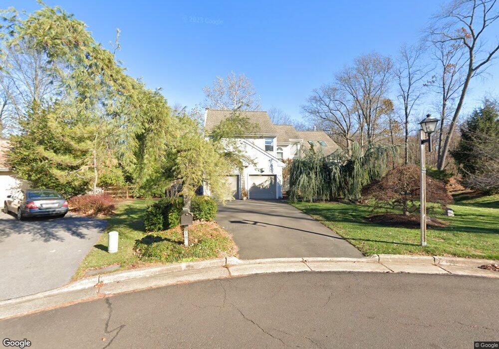
19 Jasmine Ct Newtown, PA 18940
Estimated Value: $764,000 - $877,416
3
Beds
3
Baths
2,990
Sq Ft
$282/Sq Ft
Est. Value
About This Home
This home is located at 19 Jasmine Ct, Newtown, PA 18940 and is currently estimated at $844,604, approximately $282 per square foot. 19 Jasmine Ct is a home located in Bucks County with nearby schools including Newtown Elementary School, Newtown Middle School, and Council Rock High School North.
Ownership History
Date
Name
Owned For
Owner Type
Purchase Details
Closed on
May 28, 2003
Sold by
Alston Cynthia C and Carter Haff Cynthia G
Bought by
Alston Cynthia C
Current Estimated Value
Home Financials for this Owner
Home Financials are based on the most recent Mortgage that was taken out on this home.
Original Mortgage
$186,000
Interest Rate
5.14%
Mortgage Type
Purchase Money Mortgage
Purchase Details
Closed on
Nov 17, 1999
Sold by
Haff Alexander M and Carter Haff Cynthia G
Bought by
Carter Haff Cynthia G
Purchase Details
Closed on
Nov 5, 1996
Sold by
Roth John G and Roth Tracy S
Bought by
Haff Alexander M and Carter Haff Cynthia G
Home Financials for this Owner
Home Financials are based on the most recent Mortgage that was taken out on this home.
Original Mortgage
$200,000
Interest Rate
7.75%
Mortgage Type
Balloon
Create a Home Valuation Report for This Property
The Home Valuation Report is an in-depth analysis detailing your home's value as well as a comparison with similar homes in the area
Home Values in the Area
Average Home Value in this Area
Purchase History
| Date | Buyer | Sale Price | Title Company |
|---|---|---|---|
| Alston Cynthia C | -- | -- | |
| Carter Haff Cynthia G | -- | -- | |
| Haff Alexander M | $276,900 | -- |
Source: Public Records
Mortgage History
| Date | Status | Borrower | Loan Amount |
|---|---|---|---|
| Closed | Alston Cynthia C | $186,000 | |
| Previous Owner | Haff Alexander M | $200,000 |
Source: Public Records
Tax History Compared to Growth
Tax History
| Year | Tax Paid | Tax Assessment Tax Assessment Total Assessment is a certain percentage of the fair market value that is determined by local assessors to be the total taxable value of land and additions on the property. | Land | Improvement |
|---|---|---|---|---|
| 2025 | $8,253 | $46,440 | $12,360 | $34,080 |
| 2024 | $8,253 | $46,440 | $12,360 | $34,080 |
| 2023 | $7,896 | $46,440 | $12,360 | $34,080 |
| 2022 | $7,744 | $46,440 | $12,360 | $34,080 |
| 2021 | $7,623 | $46,440 | $12,360 | $34,080 |
| 2020 | $7,256 | $46,440 | $12,360 | $34,080 |
| 2019 | $7,085 | $46,440 | $12,360 | $34,080 |
| 2018 | $6,950 | $46,440 | $12,360 | $34,080 |
| 2017 | $6,709 | $46,440 | $12,360 | $34,080 |
| 2016 | $6,663 | $46,440 | $12,360 | $34,080 |
| 2015 | -- | $46,440 | $12,360 | $34,080 |
| 2014 | -- | $46,440 | $12,360 | $34,080 |
Source: Public Records
Map
Nearby Homes
- 35 Elfreths Ct
- 95 Rittenhouse Cir Unit 92
- 17 Rittenhouse Cir
- 10 Amy Cir
- 4 Gladiola Cir
- 83 Cypress Place
- 291 Sequoia Dr
- 2204 Society Place Unit B2
- 401 Society Place Unit A1
- Rollins Plan at Lyondale Meadows
- Laney Plan at Lyondale Meadows
- Kingswood Plan at Lyondale Meadows
- Raintree Plan at Lyondale Meadows
- Mayweather Plan at Lyondale Meadows
- Cloverfield Plan at Lyondale Meadows
- 316 Monterey Place
- 0 Augusta Dr Unit LANEY
- 0 Augusta Dr Unit RAINTREE
- 0 Augusta Dr Unit KINGSWOOD
- 0 Augusta Dr Unit MAYWEATHER