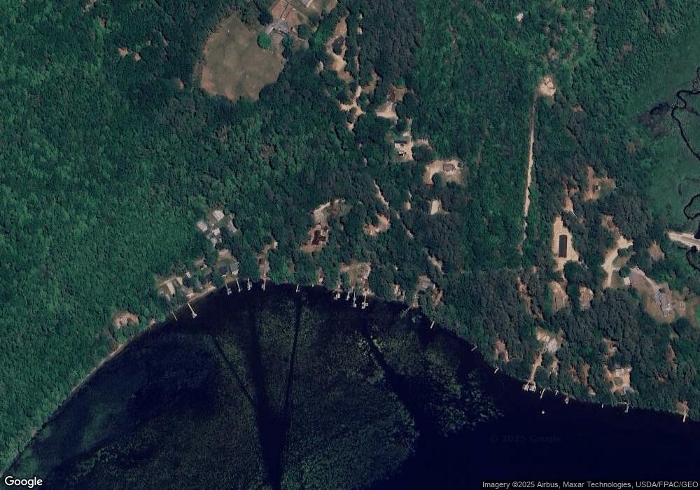
19 Lakeshore Effingham, NH 03882
Estimated Value: $474,000 - $783,000
2
Beds
1
Bath
1,538
Sq Ft
$438/Sq Ft
Est. Value
About This Home
This home is located at 19 Lakeshore, Effingham, NH 03882 and is currently estimated at $673,319, approximately $437 per square foot. 19 Lakeshore is a home located in Carroll County with nearby schools including Effingham Elementary School, Kingswood Regional Middle School, and Kingswood Regional High School.
Ownership History
Date
Name
Owned For
Owner Type
Purchase Details
Closed on
Feb 25, 2013
Sold by
Vye Tucker A and Schuman-Vye Mindy
Bought by
Vye Ft
Current Estimated Value
Purchase Details
Closed on
Sep 28, 2009
Sold by
Connelly Robert J and Connelly Charlotte A
Bought by
Vye Tucker A and Schuman-Vye Mindy
Home Financials for this Owner
Home Financials are based on the most recent Mortgage that was taken out on this home.
Original Mortgage
$140,000
Interest Rate
5.31%
Mortgage Type
Purchase Money Mortgage
Create a Home Valuation Report for This Property
The Home Valuation Report is an in-depth analysis detailing your home's value as well as a comparison with similar homes in the area
Home Values in the Area
Average Home Value in this Area
Purchase History
| Date | Buyer | Sale Price | Title Company |
|---|---|---|---|
| Vye Ft | -- | -- | |
| Vye Tucker A | $279,900 | -- |
Source: Public Records
Mortgage History
| Date | Status | Borrower | Loan Amount |
|---|---|---|---|
| Previous Owner | Vye Tucker A | $135,000 | |
| Previous Owner | Vye Tucker A | $140,000 |
Source: Public Records
Tax History Compared to Growth
Tax History
| Year | Tax Paid | Tax Assessment Tax Assessment Total Assessment is a certain percentage of the fair market value that is determined by local assessors to be the total taxable value of land and additions on the property. | Land | Improvement |
|---|---|---|---|---|
| 2024 | $10,780 | $391,700 | $279,400 | $112,300 |
| 2023 | $9,528 | $385,900 | $280,200 | $105,700 |
| 2022 | $9,096 | $385,900 | $280,200 | $105,700 |
| 2021 | $8,679 | $385,900 | $280,200 | $105,700 |
| 2020 | $8,200 | $385,900 | $280,200 | $105,700 |
| 2019 | $7,061 | $262,500 | $175,300 | $87,200 |
| 2018 | $6,201 | $237,200 | $175,300 | $61,900 |
| 2017 | $5,207 | $238,300 | $175,300 | $63,000 |
| 2016 | $5,433 | $238,300 | $175,300 | $63,000 |
| 2015 | $4,878 | $238,300 | $175,300 | $63,000 |
| 2014 | $5,828 | $287,400 | $225,600 | $61,800 |
| 2013 | $5,512 | $287,400 | $225,600 | $61,800 |
Source: Public Records
Map
Nearby Homes
- 113 Jones Rd
- 118 Champion Hill Rd
- 0 Green Mountain Rd Unit 30
- 0 Green Mountain Rd Unit 13
- 225 Pine River Path
- 156 Elm St
- 375 Pine River Rd
- 110 Elm St
- 32 Rufus Mountain Rd
- 175 Molly Philbrick Rd
- 91 Elm St
- 520 Green Mountain Rd
- 15 Morris Ave
- 45 Effingham Rd
- 45 Morris Ave
- 190 Circuit Rd
- 4 John Terrace
- 6 Abbott Ln
- 55 Pine River Rd
- 5 John Terrace
- 0 Forest View Dr Unit 6 4899657
- 000 Morris Ave Unit 406/40
- 42 Trout Run
- 0 Libby Rd Unit 5012614
- 0 Libby Rd
- lot 71 153
- 0 Rt 25 and Highwatch Rd Unit 2805502
- 562 Town House Rd
- 562 Town House Rd Unit map 412-81-02
- 509 Town House Rd
- 587 Town House Rd
- 589 Town House Rd
- 609 Town House Rd
- 00 Nutter Road and Route 153
- 00 Nutter Rd
- 164 Pine River Rd
- 12 Riverwood Cir
- 94 Blueberry Trail
- 625 Town House Rd
- 645 Town House Rd
