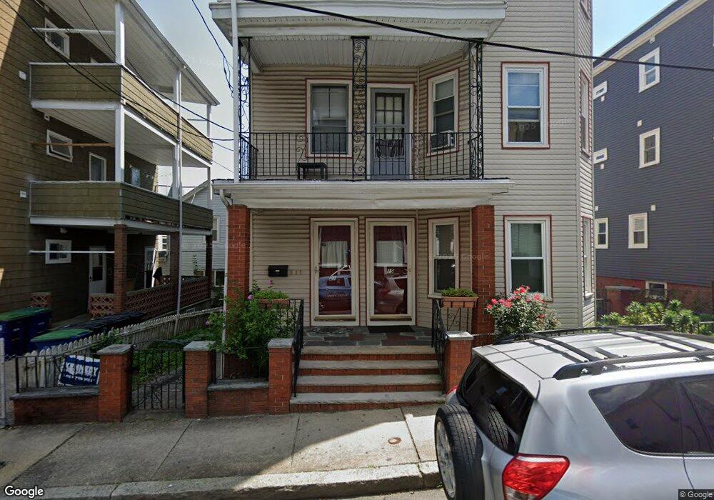
19 Langmaid Ave Unit 1 Somerville, MA 02145
Ten Hills NeighborhoodEstimated Value: $1,241,000 - $1,527,000
2
Beds
1
Bath
1,000
Sq Ft
$1,399/Sq Ft
Est. Value
About This Home
This home is located at 19 Langmaid Ave Unit 1, Somerville, MA 02145 and is currently estimated at $1,398,667, approximately $1,398 per square foot. 19 Langmaid Ave Unit 1 is a home located in Middlesex County with nearby schools including Somerville High School and Bright Future Educare Center.
Ownership History
Date
Name
Owned For
Owner Type
Purchase Details
Closed on
Oct 29, 2008
Sold by
Est Raffa Gildo and Quinci Nicolino S
Bought by
Quinci Nicolino S and Quinci Olga M
Current Estimated Value
Purchase Details
Closed on
Oct 19, 2001
Sold by
Lombardo Salvatore
Bought by
Quinci Nicolino S and Aiello Tina M
Create a Home Valuation Report for This Property
The Home Valuation Report is an in-depth analysis detailing your home's value as well as a comparison with similar homes in the area
Home Values in the Area
Average Home Value in this Area
Purchase History
| Date | Buyer | Sale Price | Title Company |
|---|---|---|---|
| Quinci Nicolino S | -- | -- | |
| Quinci Nicolino S | $90,000 | -- |
Source: Public Records
Tax History Compared to Growth
Tax History
| Year | Tax Paid | Tax Assessment Tax Assessment Total Assessment is a certain percentage of the fair market value that is determined by local assessors to be the total taxable value of land and additions on the property. | Land | Improvement |
|---|---|---|---|---|
| 2025 | $13,160 | $1,206,200 | $337,900 | $868,300 |
| 2024 | $12,288 | $1,168,100 | $337,900 | $830,200 |
| 2023 | $11,981 | $1,158,700 | $337,900 | $820,800 |
| 2022 | $11,470 | $1,126,700 | $321,800 | $804,900 |
| 2021 | $10,890 | $1,068,700 | $292,300 | $776,400 |
| 2020 | $10,670 | $1,057,500 | $281,100 | $776,400 |
| 2019 | $9,876 | $917,800 | $236,500 | $681,300 |
| 2018 | $7,712 | $681,900 | $215,000 | $466,900 |
| 2017 | $7,540 | $646,100 | $202,900 | $443,200 |
| 2016 | $6,876 | $548,800 | $164,700 | $384,100 |
| 2015 | $6,537 | $518,400 | $163,800 | $354,600 |
Source: Public Records
Map
Nearby Homes
- 94 Jaques St Unit B
- 29 Fenwick St
- 19 Fenwick St Unit 4
- 176-182 Broadway
- 59 Dartmouth St Unit A
- 115 Thurston St Unit I
- 115 Thurston St Unit B
- 7 Bond St
- 89 Heath St
- 84 Grant St Unit 7
- 13 Sargent Ave Unit 2
- 7 Jaques St
- 51 Edgar Ave
- 30A Summer
- 77 Wheatland St Unit 2
- 71 Thurston St
- 72 Governor Winthrop Rd Unit 2
- 41 Bailey Rd
- 34 Governor Winthrop Rd Unit 2
- 25 Browning Rd
- 19 Langmaid Ave
- 19 Langmaid Ave Unit 19
- 21 Langmaid Ave Unit 21
- 15 Langmaid Ave Unit 2
- 15 Langmaid Ave Unit 1
- 15 Langmaid Ave Unit 15
- 17 Langmaid Ave Unit 3
- 17 Langmaid Ave Unit 2
- 17 Langmaid Ave Unit 17
- 10 Heath St
- 10 Heath St Unit 2
- 8R Heath St Unit 8R
- 8 Heath St
- 13 Langmaid Ave
- 13 Langmaid Ave Unit 1
- 13 Langmaid Ave Unit 3
- 14 Heath St
- 14 Heath St Unit 1
- 14 Langmaid Ave
- 14 Langmaid Ave Unit 14