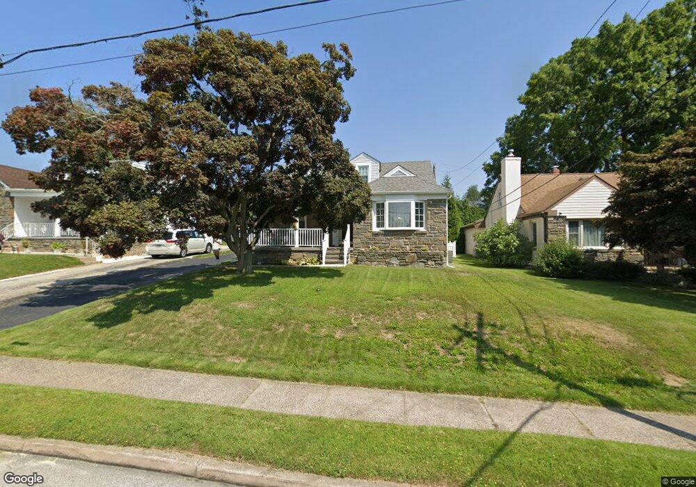
19 Locust Rd Morton, PA 19070
Estimated Value: $433,876 - $480,000
4
Beds
2
Baths
1,654
Sq Ft
$276/Sq Ft
Est. Value
About This Home
This home is located at 19 Locust Rd, Morton, PA 19070 and is currently estimated at $456,219, approximately $275 per square foot. 19 Locust Rd is a home located in Delaware County with nearby schools including Springfield High School, St Francis Of Assisi School, and Our Lady Of Fatima School.
Ownership History
Date
Name
Owned For
Owner Type
Purchase Details
Closed on
Jun 21, 2002
Sold by
Melchior Fred W and Melchior Tonya
Bought by
Lurwick Jeffrey J and Lurwick Jamie L
Current Estimated Value
Home Financials for this Owner
Home Financials are based on the most recent Mortgage that was taken out on this home.
Original Mortgage
$142,000
Outstanding Balance
$60,507
Interest Rate
6.92%
Mortgage Type
Purchase Money Mortgage
Estimated Equity
$395,712
Purchase Details
Closed on
Dec 20, 2001
Sold by
Melchior Fred W and Estate Of Evelyn J Melchior
Bought by
Melchior Fred W
Create a Home Valuation Report for This Property
The Home Valuation Report is an in-depth analysis detailing your home's value as well as a comparison with similar homes in the area
Home Values in the Area
Average Home Value in this Area
Purchase History
| Date | Buyer | Sale Price | Title Company |
|---|---|---|---|
| Lurwick Jeffrey J | $177,500 | -- | |
| Melchior Fred W | -- | -- |
Source: Public Records
Mortgage History
| Date | Status | Borrower | Loan Amount |
|---|---|---|---|
| Open | Lurwick Jeffrey J | $142,000 | |
| Closed | Lurwick Jeffrey J | $26,600 |
Source: Public Records
Tax History
| Year | Tax Paid | Tax Assessment Tax Assessment Total Assessment is a certain percentage of the fair market value that is determined by local assessors to be the total taxable value of land and additions on the property. | Land | Improvement |
|---|---|---|---|---|
| 2025 | $7,781 | $249,480 | $72,980 | $176,500 |
| 2024 | $7,781 | $249,480 | $72,980 | $176,500 |
| 2023 | $5,846 | $249,480 | $72,980 | $176,500 |
| 2022 | $7,447 | $249,480 | $72,980 | $176,500 |
| 2021 | $11,053 | $249,480 | $72,980 | $176,500 |
| 2020 | $6,557 | $128,860 | $49,340 | $79,520 |
| 2019 | $6,431 | $128,860 | $49,340 | $79,520 |
| 2018 | $6,349 | $128,860 | $0 | $0 |
| 2017 | $6,231 | $128,860 | $0 | $0 |
| 2016 | $707 | $128,860 | $0 | $0 |
| 2015 | $707 | $128,860 | $0 | $0 |
| 2014 | $707 | $128,860 | $0 | $0 |
Source: Public Records
Map
Nearby Homes
- 507 School St
- 114 Providence Rd
- 933 Greenbriar Ln
- 7 & 0 Woodland Ave
- 658 E Leamy Ave
- 2 Yale Ave
- 1022 Crozer Ln
- 1015 Mitchell Ave
- 21 Faraday Ct
- 1005 Edwards Dr
- 846 Bobwhite Ln
- 2379 Mole Rd
- 880 Quaint St
- 1907 Pershing Ave
- 720 Evans Rd
- 743 Hickory Rd
- 838 Springhill Rd
- 334 Parham Rd
- 2704 Quaint St
- 1323 Morton Ave
Your Personal Tour Guide
Ask me questions while you tour the home.