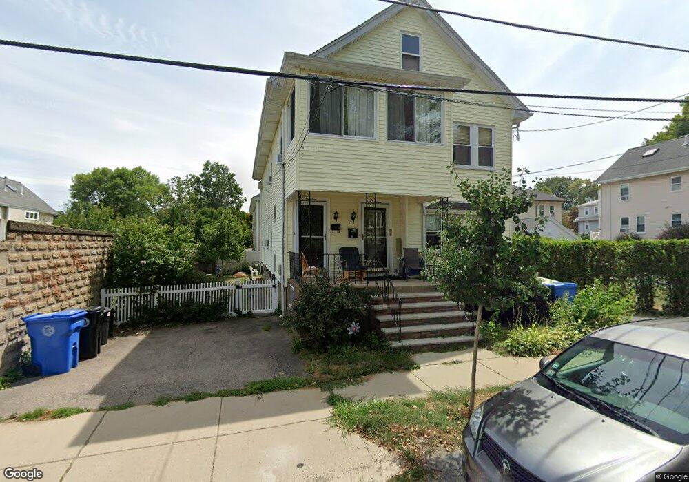
19 Loring St Belmont, MA 02478
Waverley Square NeighborhoodEstimated Value: $827,000 - $910,000
3
Beds
2
Baths
1,404
Sq Ft
$618/Sq Ft
Est. Value
About This Home
This home is located at 19 Loring St, Belmont, MA 02478 and is currently estimated at $867,135, approximately $617 per square foot. 19 Loring St is a home located in Middlesex County with nearby schools including Daniel Butler School, Winthrop L Chenery Middle School, and Belmont High School.
Ownership History
Date
Name
Owned For
Owner Type
Purchase Details
Closed on
Oct 21, 2016
Sold by
Campbell Elreo D and Newash Nidhal S
Bought by
Klinger Mae and Cleary Christopher
Current Estimated Value
Home Financials for this Owner
Home Financials are based on the most recent Mortgage that was taken out on this home.
Original Mortgage
$468,000
Outstanding Balance
$374,952
Interest Rate
3.44%
Mortgage Type
New Conventional
Estimated Equity
$492,183
Purchase Details
Closed on
Apr 1, 2013
Sold by
Drolette Frances A
Bought by
Campbell Elreo D and Newash Nidhal S
Create a Home Valuation Report for This Property
The Home Valuation Report is an in-depth analysis detailing your home's value as well as a comparison with similar homes in the area
Home Values in the Area
Average Home Value in this Area
Purchase History
| Date | Buyer | Sale Price | Title Company |
|---|---|---|---|
| Klinger Mae | $585,000 | -- | |
| Campbell Elreo D | $393,412 | -- |
Source: Public Records
Mortgage History
| Date | Status | Borrower | Loan Amount |
|---|---|---|---|
| Open | Klinger Mae | $468,000 |
Source: Public Records
Tax History Compared to Growth
Tax History
| Year | Tax Paid | Tax Assessment Tax Assessment Total Assessment is a certain percentage of the fair market value that is determined by local assessors to be the total taxable value of land and additions on the property. | Land | Improvement |
|---|---|---|---|---|
| 2025 | $9,021 | $792,000 | $0 | $792,000 |
| 2024 | $8,152 | $772,000 | $0 | $772,000 |
| 2023 | $8,171 | $727,000 | $0 | $727,000 |
| 2022 | $8,497 | $735,000 | $0 | $735,000 |
| 2021 | $8,401 | $728,000 | $0 | $728,000 |
| 2020 | $7,293 | $663,000 | $0 | $663,000 |
| 2019 | $7,854 | $673,000 | $0 | $673,000 |
| 2018 | $6,622 | $545,000 | $0 | $545,000 |
| 2017 | $4,759 | $375,000 | $0 | $375,000 |
| 2016 | $4,660 | $371,000 | $0 | $371,000 |
| 2015 | $4,412 | $342,000 | $0 | $342,000 |
Source: Public Records
Map
Nearby Homes
- 99 Beech St
- 17 Ripley Rd
- 88 Bartlett Ave
- 26 Ridge Rd
- 3 Waverley St Unit 1
- 98 Carroll St Unit 98
- 748 Belmont St
- 289 Waverley Ave Unit 2
- 28 Whitney St
- 52 Hawthorne St Unit 1
- 2 Bartlett Ave Unit 1
- 1 Bridgham Ave
- 914 Belmont St
- 356 Lexington St
- 103 Harnden Ave Unit 103
- 31 Grant Ave Unit 33
- 18 Wilson Ave Unit 2
- 50 Carroll St Unit 50
- 38-40 Wiley Rd
- 30 Duff St
- 17 Loring St
- 19 Loring St Unit 19
- 12 Chestnut St
- 25 Loring St
- 27 Loring St
- 25 Loring St Unit 1
- 27 Loring St Unit 27
- 25 Loring St Unit 25
- 8 Chestnut St
- 8 Chestnut St Unit 2
- 8 Chestnut St Unit 1
- 11 Loring St
- 11 Loring St Unit 2
- 11 Loring St Unit 11
- 14 Loring St
- 16 Loring St Unit 18
- 28 Chestnut St Unit 30
- 28 Chestnut St Unit 1
- 28 Chestnut St Unit 28
- 30 Chestnut St Unit 2