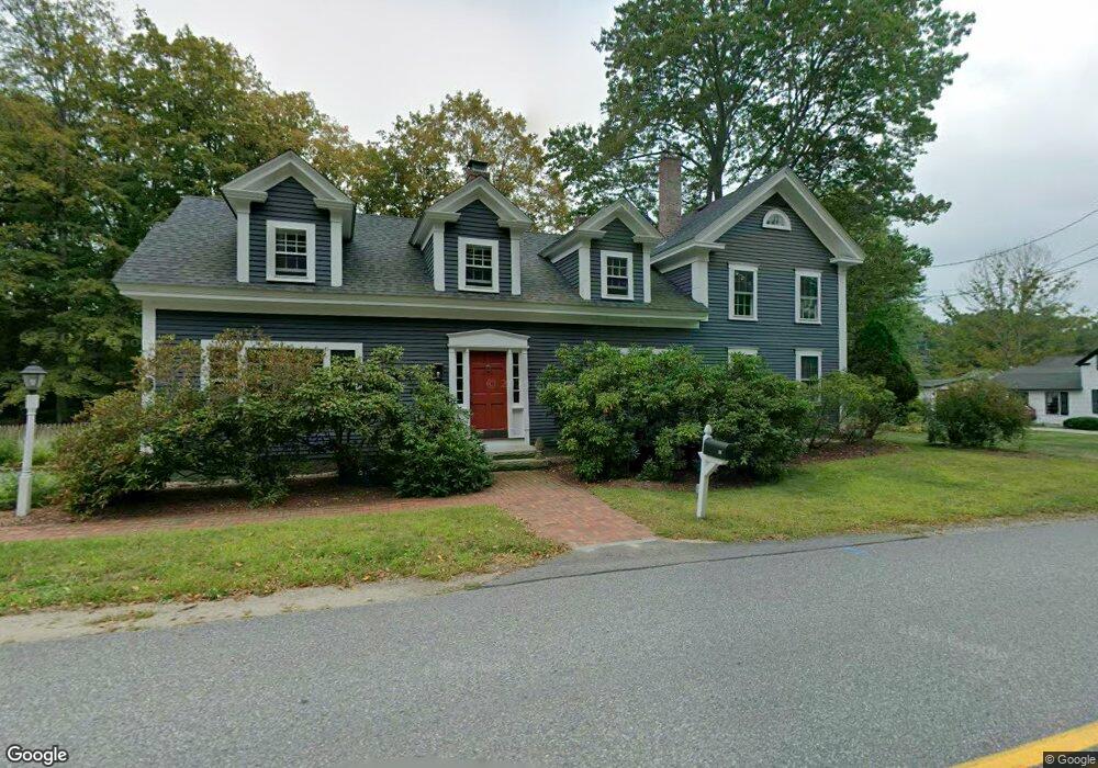
19 Manchester Rd Amherst, NH 03031
Estimated Value: $717,000 - $909,000
5
Beds
3
Baths
3,445
Sq Ft
$239/Sq Ft
Est. Value
About This Home
This home is located at 19 Manchester Rd, Amherst, NH 03031 and is currently estimated at $822,833, approximately $238 per square foot. 19 Manchester Rd is a home with nearby schools including Wilkins Elementary School, Amherst Middle School, and Souhegan Cooperative High School.
Ownership History
Date
Name
Owned For
Owner Type
Purchase Details
Closed on
Jul 6, 2005
Sold by
Beede Alan D and Beede Sondra D
Bought by
Geskos Nicholas and Geskos Katharine
Current Estimated Value
Purchase Details
Closed on
Jan 6, 1998
Sold by
Wheeler Jack F and Wheeler Karen S
Bought by
Beede Frank E and Beede Sondra D
Create a Home Valuation Report for This Property
The Home Valuation Report is an in-depth analysis detailing your home's value as well as a comparison with similar homes in the area
Home Values in the Area
Average Home Value in this Area
Purchase History
| Date | Buyer | Sale Price | Title Company |
|---|---|---|---|
| Geskos Nicholas | $550,000 | -- | |
| Beede Frank E | $237,500 | -- |
Source: Public Records
Mortgage History
| Date | Status | Borrower | Loan Amount |
|---|---|---|---|
| Open | Beede Frank E | $480,000 | |
| Closed | Beede Frank E | $30,000 | |
| Closed | Beede Frank E | $60,000 | |
| Closed | Beede Frank E | $55,000 |
Source: Public Records
Tax History Compared to Growth
Tax History
| Year | Tax Paid | Tax Assessment Tax Assessment Total Assessment is a certain percentage of the fair market value that is determined by local assessors to be the total taxable value of land and additions on the property. | Land | Improvement |
|---|---|---|---|---|
| 2024 | $13,350 | $582,200 | $129,500 | $452,700 |
| 2023 | $12,739 | $582,200 | $129,500 | $452,700 |
| 2022 | $12,302 | $582,200 | $129,500 | $452,700 |
| 2021 | $12,407 | $582,200 | $129,500 | $452,700 |
| 2020 | $7,340 | $425,200 | $103,600 | $321,600 |
| 2019 | $11,463 | $425,200 | $103,600 | $321,600 |
| 2018 | $11,578 | $425,200 | $103,600 | $321,600 |
| 2017 | $7,419 | $425,200 | $103,600 | $321,600 |
| 2016 | $10,673 | $425,200 | $103,600 | $321,600 |
| 2015 | $12,099 | $456,900 | $107,100 | $349,800 |
| 2014 | $12,181 | $456,900 | $107,100 | $349,800 |
| 2013 | $12,085 | $456,900 | $107,100 | $349,800 |
Source: Public Records
Map
Nearby Homes
- 6 Whittemore Ln
- 135 Amherst St Unit 28
- 25 Atherton Ln
- 37 Baboosic Lake Rd
- 7 Miles Rd
- 23 Bloody Brook Rd
- 4 Bloody Brook Rd
- 1A Debbie Ln
- 1B Debbie Ln
- 3 Renee Dr
- 9 Northfield Rd
- 67 Christian Hill Rd
- 18 Storybrook Ln
- 7 Corduroy Rd Unit 20
- 16 Storybrook Ln
- 3 Beechtree Way
- 007-056 MacK Hill Rd
- 4 Tranquility Ln
- 80 Christian Hill Rd
- 0 Claude Rd
- 17 Manchester Rd
- 15 Manchester Rd
- 15 Manchester Rd
- 15 Manchester Rd
- 14 Manchester Rd
- 14 Manchester Rd Unit Lots 8-83-15 and 8-8
- 3 Beaver Brook Cir
- 13 Manchester Rd
- 4 Beaver Brook Cir
- 23 Manchester Rd
- 5 Beaver Brook Cir
- 20 Manchester Rd
- 6 Beaver Brook Cir
- 11 Manchester Rd
- 22 Manchester Rd
- 8 Beaver Brook Cir
- 24 Beaver Brook Cir
- 3 MacK Hill Rd
- 3 Narragansett Rd
- 34 Manchester Rd